Category:St Mary's church, Hanwell
Jump to navigation
Jump to search
| Object location | | View all coordinates using: OpenStreetMap |
|---|
church in Hanwell, London   | |||||
| Upload media | |||||
| Instance of | |||||
|---|---|---|---|---|---|
| Dedicated to | |||||
| Location | Hanwell, London Borough of Ealing, Greater London, London, England | ||||
| Architectural style | |||||
| Diocese | |||||
| Architect | |||||
| Heritage designation |
| ||||
| Religion or worldview | |||||
| official website | |||||
 | |||||
Subcategories
This category has only the following subcategory.
S
Media in category "St Mary's church, Hanwell"
The following 24 files are in this category, out of 24 total.
-
 Church of St Mary - geograph.org.uk - 3495181.jpg 430 × 640; 98 KB
-
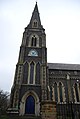 Church of St Mary, Hanwell - geograph.org.uk - 3495185.jpg 430 × 640; 51 KB
-
 Church of St Mary, Hanwell - geograph.org.uk - 3495189.jpg 640 × 430; 79 KB
-
 Clock mech 3445.jpg 1,297 × 864; 806 KB
-
 Hanwell Asylum. Wellcome L0000639.jpg 1,090 × 1,692; 980 KB
-
 Hanwell Church, 1843. Wellcome L0000639 (cropped).jpg 342 × 458; 74 KB
-
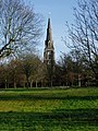
 Spire of St Mary's Church - geograph.org.uk - 3495142.jpg 640 × 430; 86 KB
-
 Spire of St Mary's Church - geograph.org.uk - 5383198.jpg 640 × 426; 51 KB
-
 Spire of St Mary's Church - geograph.org.uk - 5683521.jpg 640 × 425; 52 KB
-
 Spire of St Mary's Church - geograph.org.uk - 5796187.jpg 640 × 443; 47 KB
-
 Spire, Church of St Mary - geograph.org.uk - 3972855.jpg 640 × 312; 27 KB
-
 St mary hanwell 38.jpg 2,579 × 4,758; 8.54 MB
-

-
 St Mary's church, Hanwell - geograph.org.uk - 1066524.jpg 480 × 640; 119 KB
-
 St Mary, Hanwell - Foundation stone - geograph.org.uk - 5054433.jpg 1,000 × 680; 372 KB
-
 St Mary, Hanwell - geograph.org.uk - 5054420.jpg 1,000 × 932; 249 KB
-
 St Mary, Hanwell - geograph.org.uk - 5054429.jpg 1,000 × 799; 459 KB
-
 St. Mary's church - geograph.org.uk - 1165111.jpg 480 × 640; 118 KB
-
 St. Mary's church spire - geograph.org.uk - 1164958.jpg 480 × 640; 72 KB
-
 St. Mary's Church, Hanwell - geograph.org.uk - 1164959.jpg 480 × 640; 124 KB
-
 St. Mary's church, Hanwell - geograph.org.uk - 1186052.jpg 640 × 480; 81 KB
-
 St. Mary's Church, Hanwell - geograph.org.uk - 4973418.jpg 3,672 × 4,896; 6.42 MB
-

-


.jpg)


Categories:
- 1840s churches in London
- 1840s Gothic Revival churches in England
- Anglican churches in Middlesex
- Built in London in 1841
- Buildings by George Gilbert Scott
- Churches in England built in 1841
- Churches in the Archdeaconry of Northolt
- Flint churches in London
- Gothic Revival churches in London
- Grade II* listed churches in the London Borough of Ealing
- Hanwell, London
- London W7
- Saint Mary churches in London
- Saint Mary churches in Middlesex