Category:St Mary's Church, Sandwich
Jump to navigation
Jump to search
| Object location | | View all coordinates using: OpenStreetMap |
|---|
church in the town of Sandwich, Kent, England, UK  | |||||
| Upload media | |||||
| Instance of |
| ||||
|---|---|---|---|---|---|
| Named after | |||||
| Location | Sandwich, Dover, Kent, South East England, England | ||||
| Architectural style | |||||
| Architect |
| ||||
| Heritage designation |
| ||||
| Inception |
| ||||
| Date of official closure |
| ||||
| official website | |||||
 | |||||
This is a category about listed building number 1069541. |
Subcategories
This category has only the following subcategory.
S
Media in category "St Mary's Church, Sandwich"
The following 9 files are in this category, out of 9 total.
-
 Chest Tomb, Church of St Mary 3.jpg 3,024 × 4,032; 3.07 MB
-
 Grave Stones, St Mary's Church, Sandwich - geograph.org.uk - 1479638.jpg 4,000 × 3,000; 4.33 MB
-
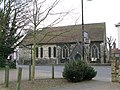 St Mary's church, Sandwich - geograph.org.uk - 1235728.jpg 640 × 480; 157 KB
-
 St Mary's Church - geograph.org.uk - 3029621.jpg 640 × 430; 70 KB
-
 St Mary's Church - geograph.org.uk - 3029622.jpg 640 × 430; 69 KB
-
 St Mary, Sandwich, Kent - geograph.org.uk - 324064.jpg 425 × 640; 123 KB
-
 St Mary, Sandwich, Kent - geograph.org.uk - 324068.jpg 415 × 640; 98 KB
-
 St. Mary's Church, Sandwich - geograph.org.uk - 2211261.jpg 1,105 × 692; 426 KB
-
 The tower, St Mary's Church, Sandwich - geograph.org.uk - 1479636.jpg 3,000 × 4,000; 3.45 MB


