Category:St Mary's Church, Iwerne Minster
Jump to navigation
Jump to search
| Object location | | View all coordinates using: OpenStreetMap |
|---|
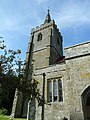
Grade I listed church in Iwerne Minster, Dorset, England, UK  _-_geograph.org.uk_-_3188358.jpg) | |||||
| Upload media | |||||
| Instance of | |||||
|---|---|---|---|---|---|
| Location | Iwerne Minster, Dorset, South West England, England | ||||
| Diocese | |||||
| Heritage designation |
| ||||
| Inception |
| ||||
| Religion or worldview | |||||
| Adjacent building |
| ||||
 | |||||
Subcategories
This category has the following 2 subcategories, out of 2 total.
I
Media in category "St Mary's Church, Iwerne Minster"
The following 19 files are in this category, out of 19 total.
-
 Churchyard wall, St Mary's Church, Iwerne Minster.jpg 4,000 × 3,000; 4.92 MB
-

-

-

-
 Gates, St Mary's Church, Iwerne Minster - geograph.org.uk - 908111.jpg 480 × 640; 121 KB
-

-
 Iwerne Minster Church and the Moon - geograph.org.uk - 118304.jpg 640 × 479; 77 KB
-
 Iwerne Minster parish church 2015.JPG 5,184 × 3,456; 10.44 MB
-
 Iwerne Minster, St Mary - geograph.org.uk - 5473050.jpg 4,608 × 3,456; 5.28 MB
-

-

-

-
 St. Mary, Iwerne Minster, churchyard (a) - geograph.org.uk - 3188322.jpg 640 × 480; 104 KB
-
 St. Mary, Iwerne Minster, churchyard (b) - geograph.org.uk - 3188324.jpg 640 × 480; 105 KB
-

-
 St. Mary, Iwerne Minster, south door - geograph.org.uk - 3188329.jpg 480 × 640; 97 KB
-
 St. Mary, Iwerne Minster, spire - geograph.org.uk - 3188331.jpg 480 × 640; 93 KB
-
 Statue, St Mary's Church, Iwerne Minster - geograph.org.uk - 908275.jpg 480 × 640; 119 KB
-


_-_geograph.org.uk_-_3188322.jpg)
_-_geograph.org.uk_-_3188324.jpg)
_-_geograph.org.uk_-_3188325.jpg)


