Category:St Mary's Church, Almer
Jump to navigation
Jump to search
| Object location | | View all coordinates using: OpenStreetMap |
|---|
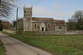
Grade I listed church in Almer, Dorset, England, UK  | |||||
| Upload media | |||||
| Instance of | |||||
|---|---|---|---|---|---|
| Dedicated to | |||||
| Location | Almer, Sturminster Marshall, Dorset, South West England, England | ||||
| Diocese | |||||
| Heritage designation |
| ||||
| Inception |
| ||||
| Religion or worldview | |||||
 | |||||
Subcategories
This category has the following 3 subcategories, out of 3 total.
Media in category "St Mary's Church, Almer"
The following 12 files are in this category, out of 12 total.
-
 Almer - geograph.org.uk - 398.jpg 640 × 427; 41 KB
-
 Almer Parish Church - geograph.org.uk - 2411372.jpg 1,024 × 768; 186 KB
-
 Benchmark on St Mary's Church, Almer - geograph.org.uk - 5129870.jpg 640 × 480; 118 KB
-
 Dreamy days in Dorset 110, Almer - geograph.org.uk - 3127723.jpg 640 × 480; 84 KB
-
 Parish Church of St Mary, Almer - Tower - geograph.org.uk - 456986.jpg 480 × 640; 103 KB
-
 St Mary's Church Almer - geograph.org.uk - 426721.jpg 640 × 480; 88 KB
-
 St Mary's Church entrance - geograph.org.uk - 426723.jpg 640 × 480; 131 KB
-
 St Mary's Church, Almer - geograph.org.uk - 2614434.jpg 640 × 480; 70 KB
-
 St Mary's Church, Almer - geograph.org.uk - 2614458.jpg 480 × 640; 94 KB
-
 St Mary's Church, Almer - geograph.org.uk - 5129860.jpg 640 × 480; 59 KB
-
 The Church of St Mary, Almer - geograph.org.uk - 1691916.jpg 640 × 480; 125 KB
-
 The Parish Church of St Mary, Almer - geograph.org.uk - 456894.jpg 640 × 480; 107 KB


