Category:St Mary's, Little Chart (ruined church)
Jump to navigation
Jump to search
church ruin in Little Chart, Ashford, Kent, England, UK  | |||||
| Upload media | |||||
| Instance of | |||||
|---|---|---|---|---|---|
| Location | Little Chart, Ashford, Kent, South East England, England | ||||
| Heritage designation |
| ||||
 | |||||
Media in category "St Mary's, Little Chart (ruined church)"
The following 15 files are in this category, out of 15 total.
-
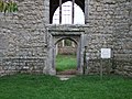 Doorway of St Mary the Virgin, Little Chart - geograph.org.uk - 2158900.jpg 4,000 × 3,000; 2.85 MB
-

-
 Inside the ruined tower of St Mary's Church, Little Chart - geograph.org.uk - 4150872.jpg 3,000 × 4,000; 4.42 MB
-
-
 Ruined church, Little Chart - geograph.org.uk - 4757388.jpg 640 × 480; 165 KB
-
 Ruins of St Mary's Church, Little Chart - geograph.org.uk - 5922232.jpg 1,024 × 768; 264 KB
-
-
 St Mary the Virgin, Little Chart - geograph.org.uk - 2158898.jpg 3,000 × 4,000; 2.78 MB
-
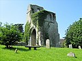
 St Mary's Church, Chart - geograph.org.uk - 4945449.jpg 640 × 480; 335 KB
-
 St Mary, Little Chart, the chancel.JPG 2,030 × 1,512; 1.92 MB
-
 St Mary, Little Chart, the tower.JPG 1,536 × 2,048; 1.53 MB
-
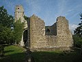
 St Marys Church - Ruin - geograph.org.uk - 59469.jpg 640 × 480; 111 KB
-
 The nave and tower of St Mary's Church, Little Chart - geograph.org.uk - 4150859.jpg 4,000 × 3,000; 4.38 MB
-
 The remains of St Mary's Church, Little Chart - geograph.org.uk - 4150820.jpg 3,000 × 4,000; 4.04 MB
-
 The ruins of St Mary's Church, Little Chart - geograph.org.uk - 4150869.jpg 4,000 × 3,000; 4.11 MB


