Category:St Martin's church, Cheselbourne
Jump to navigation
Jump to search
| Object location | | View all coordinates using: OpenStreetMap |
|---|
Grade I listed church in Cheselbourne, Dorset, England, UK  | |||||
| Upload media | |||||
| Instance of | |||||
|---|---|---|---|---|---|
| Location | Cheselbourne, Dorset, South West England, England | ||||
| Diocese | |||||
| Heritage designation |
| ||||
| Inception |
| ||||
| Religion or worldview | |||||
 | |||||
Subcategories
This category has the following 2 subcategories, out of 2 total.
Media in category "St Martin's church, Cheselbourne"
The following 16 files are in this category, out of 16 total.
-
-

-
 Cheselbourne Church - geograph.org.uk - 2162618.jpg 577 × 640; 121 KB
-
 Cheselbourne Church - geograph.org.uk - 663350.jpg 640 × 480; 69 KB
-
 Cheselbourne, parish church of St. Martin - geograph.org.uk - 473404.jpg 471 × 640; 113 KB
-
 Dreamy days in Dorset 88, Cheselbourne - geograph.org.uk - 3127380.jpg 640 × 480; 105 KB
-

-
 Parish Church of St Martin - Cheselbourne - geograph.org.uk - 887173.jpg 620 × 377; 336 KB
-
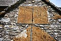
 Scratch dial, St Martin's Church - geograph.org.uk - 1038528.jpg 640 × 480; 151 KB
-

-
 St Martin's Church, Cheselbourne - geograph.org.uk - 1038399.jpg 640 × 480; 140 KB
-
 St Martin's, Cheselbourne - geograph.org.uk - 4990426.jpg 1,600 × 1,065; 747 KB
-

-
 St Martin, Cheselbourne, porch - geograph.org.uk - 3195348.jpg 480 × 640; 120 KB
-

-
 St Martin, Cheselbourne, tower - geograph.org.uk - 3195353.jpg 480 × 640; 75 KB


_-_geograph.org.uk_-_887187.jpg)


_-_geograph.org.uk_-_3195344.jpg)

_-_geograph.org.uk_-_3194690.jpg)
