Category:St Martin's, Isles of Scilly (civil parish)
Jump to navigation
Jump to search
English: St Martin's is a civil parish in the Isles of Scilly district, in the county of Cornwall, England.
civil parish in Isles of Scilly, Cornwall, England  | |||||
| Upload media | |||||
| Instance of | |||||
|---|---|---|---|---|---|
| Location | Isles of Scilly, Cornwall, South West England, England | ||||
| Population |
| ||||
 | |||||
Subcategories
This category has the following 5 subcategories, out of 5 total.
S
W
Media in category "St Martin's, Isles of Scilly (civil parish)"
The following 200 files are in this category, out of 353 total.
(previous page) (next page)-

-
 "Iron maid" - geograph.org.uk - 2376138.jpg 640 × 480; 83 KB
-
 "Swift Lady" - geograph.org.uk - 2376136.jpg 640 × 480; 72 KB
-
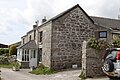
 A barn with a view - geograph.org.uk - 3121703.jpg 640 × 426; 67 KB
-
 A calm sea - geograph.org.uk - 2377861.jpg 640 × 480; 51 KB
-
 A very English view - geograph.org.uk - 3093951.jpg 2,592 × 1,936; 2.38 MB
-
 Abandoned Tractor in a flower field - geograph.org.uk - 4500335.jpg 4,608 × 3,456; 3.33 MB
-
 Adam's Fish and Chips - geograph.org.uk - 6142993.jpg 3,648 × 2,432; 4.53 MB
-
 An advertising scarecrow - geograph.org.uk - 3669215.jpg 480 × 640; 216 KB
-
 Annabel J - geograph.org.uk - 1968862.jpg 640 × 426; 56 KB
-
 Anthony off White Island - geograph.org.uk - 6142920.jpg 3,648 × 2,432; 1.99 MB
-
 Arrivals on St Martin's - geograph.org.uk - 2309739.jpg 640 × 480; 57 KB
-
 Arthur Head - geograph.org.uk - 5446010.jpg 6,048 × 1,322; 1.44 MB
-
 Ashvale Farm - geograph.org.uk - 5446270.jpg 4,000 × 3,000; 3 MB
-
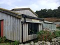
 Barn at St Martin's - geograph.org.uk - 5446860.jpg 4,000 × 3,000; 3.67 MB
-
 Barn on St Martin's - geograph.org.uk - 3311518.jpg 640 × 427; 78 KB
-
 Beach at Great Bay - geograph.org.uk - 5446282.jpg 4,000 × 3,000; 2.24 MB
-
 Beach at Porth Seal - geograph.org.uk - 2377886.jpg 640 × 480; 83 KB
-
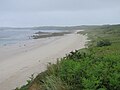
 Beach at west end of St Martin's - geograph.org.uk - 2377863.jpg 640 × 480; 73 KB
-
 Beach in Porth Seal - geograph.org.uk - 6142877.jpg 3,648 × 2,432; 4.98 MB
-
 Black Rock - geograph.org.uk - 2365855.jpg 640 × 480; 55 KB
-
 Bleak House - geograph.org.uk - 6143079.jpg 3,648 × 2,432; 4.28 MB
-
 Boat by Cruther's Point - geograph.org.uk - 5446193.jpg 4,321 × 2,881; 2.82 MB
-
 Boat by Lower Town Quay - geograph.org.uk - 5446310.jpg 5,000 × 3,333; 3.45 MB
-
 Boats at Great Bay - geograph.org.uk - 5446753.jpg 3,147 × 3,147; 3.79 MB
-
 Boats at Lower Town Quay - geograph.org.uk - 5446856.jpg 5,184 × 3,456; 4.11 MB
-
 Boats by Tean - geograph.org.uk - 5446853.jpg 5,184 × 3,456; 4.74 MB
-
 Broken gate - geograph.org.uk - 6142977.jpg 3,648 × 2,432; 4.96 MB
-
 Buildings in Higher Town - geograph.org.uk - 6142990.jpg 3,648 × 2,432; 3.77 MB
-
 Bulbs ^ Blooms - geograph.org.uk - 3093932.jpg 2,592 × 1,936; 2.27 MB
-
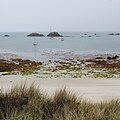
 Bull's Porth - geograph.org.uk - 4697442.jpg 2,048 × 1,536; 583 KB
-
 Bull's Porth - geograph.org.uk - 6142952.jpg 3,648 × 2,432; 3.3 MB
-
 Cable comes ashore here - geograph.org.uk - 3094082.jpg 2,592 × 1,936; 2.32 MB
-
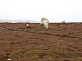
 Cairn on Chapel Down, St Martin's - geograph.org.uk - 3668650.jpg 640 × 480; 146 KB
-
 Cairn on Great Ganilly - geograph.org.uk - 6416072.jpg 1,024 × 811; 263 KB
-
 Carron Farm - geograph.org.uk - 6143055.jpg 3,648 × 2,432; 4.47 MB
-
 Caves beneath Burnt Hill - geograph.org.uk - 3294910.jpg 640 × 427; 86 KB
-
 Chapel Down, St Martin's - geograph.org.uk - 3446391.jpg 2,592 × 1,944; 1.6 MB
-
 Chapel Down, St Martin's, Looking North - geograph.org.uk - 3668622.jpg 640 × 364; 111 KB
-

-
 Church of St Martin's - geograph.org.uk - 6143085.jpg 3,648 × 2,432; 3.22 MB
-
 Churchtown Farm - geograph.org.uk - 6143081.jpg 3,648 × 2,432; 5.09 MB
-
 Cliffs of St Martin's Head - geograph.org.uk - 6142958.jpg 3,648 × 2,432; 2.35 MB
-
 Coast at Pernagie - geograph.org.uk - 6142903.jpg 3,648 × 2,432; 4.43 MB
-
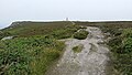
 Coast path - geograph.org.uk - 6142908.jpg 3,648 × 2,432; 4.59 MB
-
 Coast path above Porth Seal - geograph.org.uk - 6142879.jpg 3,648 × 2,432; 5.19 MB
-
 Coast path above Porth Seal - geograph.org.uk - 6142882.jpg 3,648 × 2,432; 4.34 MB
-
 Coast path at Turfy Hill - geograph.org.uk - 6142950.jpg 3,648 × 2,432; 4.41 MB
-
 Coast path in St Martin's Bay - geograph.org.uk - 6142935.jpg 3,648 × 2,432; 5.01 MB
-
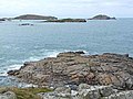
 Coast to South West of St Martin's - geograph.org.uk - 5446201.jpg 5,990 × 1,707; 1.79 MB
-
 Coastline below Top Rock Hill - geograph.org.uk - 6142897.jpg 3,648 × 2,432; 4.49 MB
-
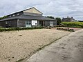
 Community Centre - geograph.org.uk - 3093978.jpg 2,592 × 1,936; 2.07 MB
-
 Community centre - geograph.org.uk - 5395219.jpg 3,264 × 2,448; 3.05 MB
-
 Country lane from the beach - geograph.org.uk - 3094105.jpg 1,936 × 2,592; 2.66 MB
-
 Cows near Porth Seal - geograph.org.uk - 5446697.jpg 5,184 × 3,456; 4.36 MB
-

-
 Cricket pitch on Pool Green - geograph.org.uk - 6143041.jpg 3,648 × 2,432; 5.1 MB
-
 East end of St. Martin's - geograph.org.uk - 3201336.jpg 1,200 × 676; 371 KB
-
 East Porth, Great Ganilly, Scilly - geograph.org.uk - 2603786.jpg 640 × 231; 53 KB
-
 Eastern Isles, Scilly - geograph.org.uk - 3383040.jpg 1,200 × 615; 327 KB
-
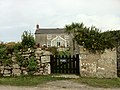
 Entrance to Churchtown Farm - geograph.org.uk - 3094006.jpg 1,936 × 2,592; 2.69 MB
-
 Farmhouse on St. Martin's - geograph.org.uk - 3093982.jpg 2,592 × 1,936; 2.32 MB
-
 Fields in Higher Town - geograph.org.uk - 6142984.jpg 3,648 × 2,432; 5.3 MB
-
 Fields in Higher Town - geograph.org.uk - 6142986.jpg 3,648 × 2,432; 5.26 MB
-
 Fields Middle Town - geograph.org.uk - 5446707.jpg 4,907 × 3,272; 4.29 MB
-
 Fields near Middle Town - geograph.org.uk - 3093956.jpg 2,592 × 1,936; 2.83 MB
-
 Glenmoor House - geograph.org.uk - 6143068.jpg 3,648 × 2,432; 2.5 MB
-
 Gorse on Chapel Down - geograph.org.uk - 6142973.jpg 3,648 × 2,432; 4.73 MB
-
 Granite with horizontal fissures - geograph.org.uk - 3294901.jpg 640 × 427; 98 KB
-
 Grans Cottage - geograph.org.uk - 5446863.jpg 4,000 × 3,000; 3.51 MB
-
 Great and Little Arthur - geograph.org.uk - 3383032.jpg 1,200 × 800; 438 KB
-
 Great and Little Ganinick - geograph.org.uk - 3135662.jpg 1,200 × 1,050; 695 KB
-
 Great Bay - geograph.org.uk - 3663076.jpg 640 × 427; 96 KB
-
 Great Bay - geograph.org.uk - 5446276.jpg 5,184 × 3,456; 4.54 MB
-
 Great Bay - geograph.org.uk - 5446277.jpg 5,184 × 3,456; 4.87 MB
-
 Great Bay - geograph.org.uk - 5446278.jpg 4,000 × 3,000; 2.66 MB
-
 Great Bay - geograph.org.uk - 5446281.jpg 4,000 × 3,000; 3.16 MB
-
 Great Bay - geograph.org.uk - 5446871.jpg 5,882 × 2,193; 2.95 MB
-
 Great Bay - geograph.org.uk - 6142938.jpg 3,648 × 2,432; 4.29 MB
-
 Great Bay ^ Wine Cove - geograph.org.uk - 5446273.jpg 5,184 × 3,456; 4.82 MB
-
 Great Bay ^ Wine Cove - geograph.org.uk - 5446279.jpg 4,000 × 3,000; 2.9 MB
-
 Great Bay, St Martin's - geograph.org.uk - 6444067.jpg 1,600 × 1,080; 515 KB
-
 Great Bay, St Martin's, Scilly - geograph.org.uk - 2603744.jpg 640 × 305; 72 KB
-

-
 Great Ganilly from the West - geograph.org.uk - 3665754.jpg 640 × 110; 34 KB
-

-

-

-
 Great Hill on Tean - geograph.org.uk - 6142867.jpg 3,648 × 2,432; 2.96 MB
-
 Great Innisvouls from the East - geograph.org.uk - 3665802.jpg 640 × 273; 56 KB
-
 Great Merrick Ledge - geograph.org.uk - 2377901.jpg 640 × 480; 54 KB
-
 Great Merrick Ledge - geograph.org.uk - 6142930.jpg 3,648 × 2,432; 2.65 MB
-
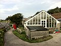
 Green house at Middle Town - geograph.org.uk - 5446844.jpg 4,000 × 2,937; 2.27 MB
-
 Greenhouse on the hill - geograph.org.uk - 6143039.jpg 3,648 × 2,432; 4.74 MB
-
 Guther's Island - geograph.org.uk - 3446536.jpg 2,492 × 1,883; 978 KB
-
 Guther's Island - geograph.org.uk - 5446874.jpg 4,017 × 2,678; 2.18 MB
-
 Guther's Island - geograph.org.uk - 6142789.jpg 3,519 × 2,346; 1.53 MB
-
 Guthers Island between St Marys ^ St Martin, Isles of Scilly - geograph.org.uk - 2923355.jpg 3,072 × 2,304; 2.66 MB
-
 Guthers Island with St Martins in the background - geograph.org.uk - 2923360.jpg 3,072 × 2,304; 2.45 MB
-

-
 Having a rest - geograph.org.uk - 3093995.jpg 2,592 × 1,936; 1.56 MB
-
 Heading toward Higher Town - geograph.org.uk - 3311407.jpg 427 × 640; 88 KB
-
 Heather, gorse and granite - geograph.org.uk - 3311426.jpg 427 × 640; 93 KB
-
 Here comes the boat - geograph.org.uk - 3094129.jpg 2,592 × 1,936; 1.76 MB
-
 Herring gulls at Porth Seal - geograph.org.uk - 2377884.jpg 640 × 480; 73 KB
-
 Higher Town - geograph.org.uk - 6156761.jpg 851 × 1,280; 354 KB
-
 Higher Town Bay - geograph.org.uk - 2309723.jpg 640 × 480; 70 KB
-
 Higher Town Bay - geograph.org.uk - 5446203.jpg 5,876 × 2,534; 2.7 MB
-
 Higher Town Bay - geograph.org.uk - 6143049.jpg 3,648 × 2,432; 4.02 MB
-
 Higher Town Bay, St Martin's - geograph.org.uk - 6703569.jpg 1,600 × 980; 491 KB
-
 Higher Town beach - geograph.org.uk - 3294857.jpg 640 × 427; 57 KB
-
 Higher Town from Higher Town Bay - geograph.org.uk - 3668660.jpg 640 × 428; 106 KB
-
 Higher Town Quay - geograph.org.uk - 5446180.jpg 5,184 × 3,456; 4.04 MB
-
 Higher Town Quay - geograph.org.uk - 5446194.jpg 5,184 × 3,456; 4.71 MB
-
 Higher Town Quay - geograph.org.uk - 6157000.jpg 1,280 × 851; 311 KB
-
 Higher Town Quay, St Martin's - geograph.org.uk - 6415538.jpg 1,600 × 1,048; 399 KB
-
 Higher Town, St Martin's - geograph.org.uk - 3282803.jpg 640 × 419; 91 KB
-
 Higher Town, St Martin's - geograph.org.uk - 3446388.jpg 2,592 × 1,944; 1.73 MB
-
 Hillside House - geograph.org.uk - 6143065.jpg 3,648 × 2,432; 4.43 MB
-
 House on St. Martin's - geograph.org.uk - 3093901.jpg 2,592 × 1,936; 2.39 MB
-
 Houses at Higher Town - geograph.org.uk - 5446212.jpg 3,000 × 4,000; 2.96 MB
-
 Houses on Cruther's Neck - geograph.org.uk - 6143058.jpg 3,648 × 2,432; 4.65 MB
-
 Iron Main Pilot Gig - geograph.org.uk - 6143053.jpg 3,648 × 2,432; 3.02 MB
-
 Jacky's Point - geograph.org.uk - 5446305.jpg 3,000 × 4,000; 3.35 MB
-
 Karma Hotel, St Martin's - geograph.org.uk - 6156620.jpg 1,280 × 851; 528 KB
-
 Karma St Martin's - geograph.org.uk - 5395224.jpg 3,264 × 2,448; 3.24 MB
-
 Karma St. Martin's - geograph.org.uk - 4252359.jpg 4,290 × 2,863; 4.86 MB
-
 Kayaks at Lower Town - geograph.org.uk - 6156596.jpg 1,280 × 851; 330 KB
-
 Landing the Lady's Gig - geograph.org.uk - 2309727.jpg 640 × 480; 63 KB
-
 Lane on Tinkler's Hill - geograph.org.uk - 3094027.jpg 2,592 × 1,936; 2.54 MB
-
 Lane to Higher Town - geograph.org.uk - 3094011.jpg 2,592 × 1,936; 1.86 MB
-
 Lawrence's Bay - geograph.org.uk - 4500316.jpg 4,608 × 3,456; 3.24 MB
-
 Lawrence's Bay - geograph.org.uk - 5446210.jpg 5,184 × 3,456; 3.3 MB
-

-

-
 Little and Great Innisvouls, Scilly - geograph.org.uk - 2603798.jpg 640 × 239; 46 KB
-

-
 Little Bay - geograph.org.uk - 6156646.jpg 1,280 × 851; 405 KB
-
 Little Bay - geograph.org.uk - 6156660.jpg 1,280 × 851; 457 KB
-
 Little Bay and Top Rock - geograph.org.uk - 6156668.jpg 851 × 1,280; 430 KB
-
 Little Ganilly from the West - geograph.org.uk - 3664748.jpg 640 × 381; 59 KB
-

-

-
 Little Innisvouls from the East - geograph.org.uk - 3665796.jpg 640 × 354; 88 KB
-
 Little Merrick Ledge ^ Sheep Ledge - geograph.org.uk - 5446287.jpg 5,972 × 1,934; 2.36 MB
-
 Lobster and crab pots on the beach - geograph.org.uk - 3094115.jpg 2,592 × 1,936; 3.01 MB
-
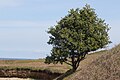 Lone tree on the coast path - geograph.org.uk - 6142881.jpg 3,648 × 2,432; 3.2 MB
-
 Looking towards the Eastern Isles - geograph.org.uk - 5395218.jpg 3,264 × 2,448; 3.6 MB
-
 Looking west towards Tresco - geograph.org.uk - 3093971.jpg 2,592 × 1,936; 2.11 MB
-
 Lower Town Quay, St Martin's - geograph.org.uk - 3446520.jpg 2,592 × 1,944; 1.45 MB
-
 Lower Town Quay, St Martin's, Scilly - geograph.org.uk - 2601269.jpg 640 × 325; 61 KB
-
 Lower Town Quay, St Martins - geograph.org.uk - 5441182.jpg 5,184 × 3,456; 5.59 MB
-
 Lower Town Quay, St Martins - geograph.org.uk - 5441183.jpg 5,710 × 1,309; 1.43 MB
-
 Lower Town, St. Martin's - geograph.org.uk - 3537479.jpg 1,024 × 752; 237 KB
-
 Mackerel Rocks - geograph.org.uk - 6142940.jpg 3,648 × 2,432; 4.49 MB
-
 Maze in Round Bowl - geograph.org.uk - 6142918.jpg 3,648 × 2,432; 6.19 MB
-
 Melinda Cottage - geograph.org.uk - 5446204.jpg 4,000 × 3,000; 3.75 MB
-
 Melinda Cottage - geograph.org.uk - 5446208.jpg 4,000 × 3,000; 3.71 MB
-
 Memorial bench - geograph.org.uk - 3094122.jpg 2,592 × 1,936; 2.71 MB
-
 Menawethan from the East, Scilly - geograph.org.uk - 2603826.jpg 640 × 314; 65 KB
-
 Menawethan from the North - geograph.org.uk - 3665806.jpg 640 × 340; 62 KB
-
 Menawethan in the Eastern Isles - geograph.org.uk - 6140093.jpg 3,496 × 2,331; 1.4 MB
-
 Middle Town - geograph.org.uk - 5446843.jpg 4,000 × 2,667; 2.33 MB
-
 Middle Town - geograph.org.uk - 6156741.jpg 1,280 × 851; 469 KB
-
 Middle Town, St Martin's - geograph.org.uk - 3282834.jpg 640 × 419; 84 KB
-
 Middle Town, St Martin's - geograph.org.uk - 6414513.jpg 1,089 × 1,600; 509 KB
-
 Mullet Pool, St Martin's, Scilly - geograph.org.uk - 2603753.jpg 640 × 480; 143 KB
-
 Murr Rock from Burnt Hill - geograph.org.uk - 3123440.jpg 1,024 × 682; 249 KB
-
 Murr Rock from Turfy Hill - geograph.org.uk - 3446412.jpg 2,592 × 1,944; 1.29 MB
-
 New house at Middle Town - geograph.org.uk - 5446726.jpg 4,000 × 3,000; 3.2 MB
-
 New house in Middle Town - geograph.org.uk - 3093925.jpg 2,592 × 1,936; 2.16 MB
-
 Nornour from the North-east - geograph.org.uk - 2603764.jpg 640 × 261; 60 KB
-
 Nornour from the North-West - geograph.org.uk - 3665765.jpg 640 × 352; 64 KB
-

-
 North end of Little Arthur - geograph.org.uk - 2377910.jpg 640 × 480; 58 KB
-
 North Farm Gallery - geograph.org.uk - 5446209.jpg 4,000 × 3,000; 3.45 MB
-
 North Farm Gallery - geograph.org.uk - 6143075.jpg 3,648 × 2,432; 4.63 MB
-
 North west coast of St Martin's - geograph.org.uk - 6142860.jpg 3,648 × 2,432; 4.44 MB
-
 Old Quay, St Martin's - geograph.org.uk - 6156756.jpg 1,280 × 851; 472 KB
-
 Old Telegraph Station - geograph.org.uk - 6142971.jpg 4,032 × 3,024; 4.61 MB
-
 Overgrown coast path - geograph.org.uk - 6142944.jpg 3,648 × 2,432; 3.11 MB
-
 Overgrown field and overgrown shed - geograph.org.uk - 3293330.jpg 640 × 427; 93 KB
-

-
 Path beside Bread and Cheese Cove - geograph.org.uk - 3184439.jpg 1,600 × 2,400; 1.23 MB
-
 Path from Middle Town - geograph.org.uk - 5446731.jpg 4,000 × 3,000; 4.63 MB
-
 Path round Tinkler's Hill - geograph.org.uk - 3094036.jpg 2,592 × 1,936; 2.34 MB
-
 Path round Top Rock Hill - geograph.org.uk - 6142915.jpg 3,648 × 2,432; 3.55 MB
-
 Path round Turfy Hill - geograph.org.uk - 6142946.jpg 3,648 × 2,432; 5.24 MB
-
 Path through the dunes - geograph.org.uk - 3094095.jpg 2,592 × 1,936; 2.7 MB
-
 Pednbrose - geograph.org.uk - 2365863.jpg 640 × 480; 89 KB
-
 Pednbrose and Round Island - geograph.org.uk - 6142871.jpg 3,648 × 2,432; 3.41 MB
-
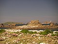 Pernagie and Plumb island - geograph.org.uk - 2109287.jpg 2,816 × 2,112; 2.58 MB
-
 Pernagie Point - geograph.org.uk - 2365883.jpg 640 × 480; 88 KB
-
 Perpitch Bay, St Martin's - geograph.org.uk - 3668655.jpg 640 × 480; 134 KB
-
 Pig's Ledge - geograph.org.uk - 2376129.jpg 640 × 480; 76 KB
-
 Plains on St. Martin's - geograph.org.uk - 3093987.jpg 2,592 × 1,936; 2.46 MB
-
 Plum Island and the view to Round Island - geograph.org.uk - 3409827.jpg 640 × 427; 114 KB
-
 Plumb Island, Pernagie Isle and Lion Rock - geograph.org.uk - 3446488.jpg 2,592 × 1,944; 1.58 MB
-
 Plump Island - geograph.org.uk - 5446311.jpg 5,184 × 3,456; 4.11 MB
-
 Polreath tea rooms - geograph.org.uk - 2376131.jpg 640 × 480; 101 KB


&filefrom=Porth+Morran+-+geograph.org.uk+-+5446307.jpg#mw-category-media)