Category:St Lawrence's church, Bourton-on-the-Hill
Jump to navigation
Jump to search
| Object location | | View all coordinates using: OpenStreetMap |
|---|
church in Bourton-on-the-Hill, Gloucestershire, England, UK  | |||||
| Upload media | |||||
| Instance of | |||||
|---|---|---|---|---|---|
| Dedicated to | |||||
| Location | Bourton-on-the-Hill, Cotswold, Gloucestershire, South West England, England | ||||
| Diocese | |||||
| Heritage designation |
| ||||
| Inception |
| ||||
| Religion or worldview | |||||
 | |||||
Subcategories
This category has only the following subcategory.
Media in category "St Lawrence's church, Bourton-on-the-Hill"
The following 7 files are in this category, out of 7 total.
-
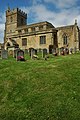 Bourton-on-the-Hill Church - geograph.org.uk - 1448685.jpg 426 × 640; 100 KB
-
 Bourton-on-the-Hill Church - geograph.org.uk - 1448686.jpg 640 × 426; 84 KB
-
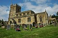
 Church of St. Laurence, Bourton-on-the-Hill - geograph.org.uk - 1918044.jpg 3,648 × 2,736; 3.52 MB
-
 Cotswold stone wall, Bourton-on-the-Hill - geograph.org.uk - 1449002.jpg 426 × 640; 114 KB
-
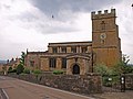
 Parish Church - geograph.org.uk - 34920.jpg 426 × 640; 116 KB
-

-
 Tower of Bourton-on-the-Hill Church - geograph.org.uk - 1448696.jpg 426 × 640; 71 KB


