Category:St Just in Roseland
Jump to navigation
Jump to search
village and civil parish in Cornwall, England in the United Kingdom  | |||||
| Upload media | |||||
| Instance of | |||||
|---|---|---|---|---|---|
| Location | Cornwall, South West England, England | ||||
| Population |
| ||||
| Different from | |||||
 | |||||
English: St Just in Roseland civil parish and village in Cornwall, England, in the United Kingdom: it is known for its picturesque churchyard.
Subcategories
This category has the following 6 subcategories, out of 6 total.
Media in category "St Just in Roseland"
The following 200 files are in this category, out of 296 total.
(previous page) (next page)-

-

-

-
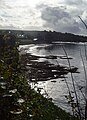
 A3078 at St Just in Roseland - geograph.org.uk - 4978774.jpg 800 × 600; 116 KB
-

-
 Acanthus, St Just in Roseland - geograph.org.uk - 5219936.jpg 1,595 × 1,995; 1.07 MB
-
 Adrian Gilbert ferry off St Mawes Castle - geograph.org.uk - 3937519.jpg 2,048 × 1,360; 779 KB
-
 Amsterdam Point - geograph.org.uk - 5111880.jpg 640 × 428; 72 KB
-
 Artist working at St Just Creek - geograph.org.uk - 4976642.jpg 800 × 643; 178 KB
-
 Beach and rocks by Castle Drive - geograph.org.uk - 5218890.jpg 3,072 × 2,048; 1.28 MB
-
 Beach at Polvarth Point - geograph.org.uk - 5114878.jpg 640 × 428; 76 KB
-
 Beach by Castle Cove - geograph.org.uk - 5458619.jpg 640 × 480; 65 KB
-
 Beach by Castle Drive - geograph.org.uk - 5218907.jpg 2,758 × 2,032; 1.39 MB
-
 Bench (3878852042).jpg 2,535 × 1,675; 4.84 MB
-
 Beside the sea at St Mawes - geograph.org.uk - 2871256.jpg 640 × 480; 65 KB
-
 Boathouse, St Just in Roseland, 1993 - geograph.org.uk - 5219948.jpg 1,763 × 1,170; 443 KB
-
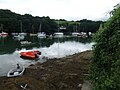
 Boats in St Mawes harbour at low tide - geograph.org.uk - 4139757.jpg 481 × 640; 103 KB
-
 Boatyard at St Just - geograph.org.uk - 561867.jpg 623 × 460; 107 KB
-
 Boundary stone on Messack Point - geograph.org.uk - 1963839.jpg 640 × 427; 61 KB
-
 Bridleway near St Mawes Castle - geograph.org.uk - 5050963.jpg 2,825 × 1,887; 1.18 MB
-
 By Castle Drive - geograph.org.uk - 5218918.jpg 3,072 × 2,048; 1.32 MB
-
 Cannons at St Mawes Castle - geograph.org.uk - 4139771.jpg 640 × 480; 120 KB
-
 Carrick Roads from near Tregear Vean - geograph.org.uk - 232416.jpg 640 × 423; 87 KB
-
 Carricknath Point - geograph.org.uk - 6375963.jpg 1,600 × 1,070; 415 KB
-
 Castle in the distance - geograph.org.uk - 2098006.jpg 640 × 402; 61 KB
-

-

-
 Cattle on Windmill Hill - geograph.org.uk - 5050508.jpg 1,251 × 797; 189 KB
-
 Celtic Cross by the river creek - geograph.org.uk - 2110858.jpg 640 × 451; 101 KB
-

-

-
 Coastal path by Carrick Roads - geograph.org.uk - 5458585.jpg 640 × 480; 96 KB
-
 Coastal path by Carrick Roads - geograph.org.uk - 5458596.jpg 640 × 480; 105 KB
-
 Commerans Farm Lane, St Just in Roseland - geograph.org.uk - 786812.jpg 640 × 558; 135 KB
-
 Commerrans Farm, St Just in Roseland - geograph.org.uk - 780729.jpg 640 × 453; 69 KB
-
 Concrete bases at Turnaware Point - geograph.org.uk - 4742169.jpg 1,600 × 1,200; 601 KB
-
 Concrete farm road to the D-day embarkation site - geograph.org.uk - 6198005.jpg 1,024 × 768; 160 KB
-
 Cornwall , Castle Point - geograph.org.uk - 5375268.jpg 6,000 × 4,000; 7.2 MB
-
 Cottages at St Mawes - geograph.org.uk - 4937093.jpg 1,600 × 1,200; 646 KB
-
 Country lane - geograph.org.uk - 4239053.jpg 640 × 480; 84 KB
-
 Cows near Tregear Vean on the A3078 - geograph.org.uk - 4978739.jpg 800 × 600; 88 KB
-
 Cows on ridge near Tregear Vean - geograph.org.uk - 4976732.jpg 800 × 600; 82 KB
-
 Crossroads at St. Just in Roseland - geograph.org.uk - 5458567.jpg 640 × 480; 73 KB
-
 Curve of The Beach - geograph.org.uk - 6299937.jpg 581 × 800; 115 KB
-
 D-Day remnants on Turnaware Point - geograph.org.uk - 4742175.jpg 4,896 × 3,672; 7.12 MB
-
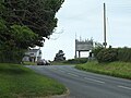
 Direction Sign - Signpost by the B3289 - geograph.org.uk - 6102682.jpg 640 × 480; 192 KB
-

-
-

-
 Fal Estuary, St Just in Roseland - geograph.org.uk - 780630.jpg 640 × 426; 107 KB
-
 Falmouth Docks from St. Mawes Castle car park - geograph.org.uk - 2155385.jpg 3,279 × 2,187; 3.08 MB
-
 Falmouth Harbour from St. Mawes Castle car park - geograph.org.uk - 2155372.jpg 3,281 × 2,187; 4.86 MB
-
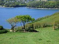
 Field above the Percuil River - geograph.org.uk - 5169155.jpg 480 × 640; 100 KB
-
 Field at Trethem - geograph.org.uk - 5176178.jpg 640 × 480; 79 KB
-
 Field entrance near Penperth - geograph.org.uk - 4993217.jpg 640 × 480; 74 KB
-
 Field near St Just - geograph.org.uk - 5219381.jpg 3,072 × 2,048; 1.27 MB
-
 Field south of Penperth - geograph.org.uk - 6004309.jpg 1,600 × 1,200; 1.03 MB
-
 Field south of St Just - geograph.org.uk - 5219091.jpg 3,072 × 2,048; 1.4 MB
-

-

-

-

-
 Footpath leading to Halwartha - geograph.org.uk - 5168145.jpg 480 × 640; 75 KB
-
 Foreshore at Castle Drive - geograph.org.uk - 5218822.jpg 3,072 × 2,048; 1.28 MB
-

-
 Foreshore, Carrick Roads - geograph.org.uk - 5219049.jpg 3,072 × 2,048; 1.27 MB
-

-
 Garage at Halwartha - geograph.org.uk - 5220044.jpg 3,072 × 2,048; 1.21 MB
-
 Gate (3884397563).jpg 1,546 × 2,357; 3.88 MB
-
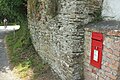
 GR Postbox on Tredenham Road - geograph.org.uk - 4977839.jpg 800 × 600; 167 KB
-
 Graveyard of St Justus Church - geograph.org.uk - 2348171.jpg 3,072 × 2,048; 1.95 MB
-
 Gunnera manicata3.JPG 2,816 × 2,112; 2.5 MB
-
 Harbour at St Mawes - geograph.org.uk - 4938049.jpg 1,600 × 1,200; 567 KB
-
 Heading for the boat yard, St Mawes - geograph.org.uk - 4978058.jpg 800 × 600; 107 KB
-
 High and Dry (3878866604).jpg 2,531 × 1,669; 4.13 MB
-

-
 Hogweed on the Falmouth estuary - geograph.org.uk - 5017029.jpg 640 × 480; 74 KB
-
 House on Castle Drive - geograph.org.uk - 5218836.jpg 3,072 × 2,048; 1.33 MB
-
 House, St Just in Roseland - geograph.org.uk - 5219952.jpg 3,072 × 2,048; 1.36 MB
-
 Houses on Lower Castle Road, St Mawes - geograph.org.uk - 5050891.jpg 2,717 × 1,854; 823 KB
-
 Houses on Lower Castle Road, St Mawes - geograph.org.uk - 5218797.jpg 3,072 × 2,048; 1.3 MB
-
 Hydrangeas near St Mawes Castle - geograph.org.uk - 5458609.jpg 640 × 480; 64 KB
-
 Idle Rocks Hotel, St. Mawes - geograph.org.uk - 2871269.jpg 640 × 480; 62 KB
-
 In St Just - geograph.org.uk - 4180176.jpg 4,000 × 2,664; 4.62 MB
-

-
 Launching boat (3878084359).jpg 2,112 × 1,509; 2.91 MB
-

-
 Lighthouse St Anthony Head - geograph.org.uk - 3008616.jpg 800 × 600; 84 KB
-

-

-

-

-

-
 Looking up the Percuil River - geograph.org.uk - 5169340.jpg 640 × 480; 94 KB
-
 Lower Castle Road - geograph.org.uk - 5017013.jpg 640 × 480; 43 KB
-
 Lower Castle Road St Mawes - geograph.org.uk - 3942110.jpg 2,026 × 1,331; 829 KB
-
 Lower Castle Road, St Mawes - geograph.org.uk - 4607935.jpg 3,264 × 2,448; 2.84 MB
-
 Lower Castle Road, St Mawes, Cornwall - geograph.org.uk - 4977550.jpg 800 × 599; 113 KB
-
 Lych gate, St Just in Roseland - geograph.org.uk - 5050474.jpg 2,126 × 1,658; 817 KB
-
 Marine Parade St Mawes - geograph.org.uk - 5114912.jpg 640 × 428; 61 KB
-
 Marine Parade, St Mawes - geograph.org.uk - 3839405.jpg 640 × 480; 61 KB
-
 Marine Parade, St Mawes - geograph.org.uk - 5050435.jpg 1,960 × 2,710; 707 KB
-
 Muddy field entrance at Trethem - geograph.org.uk - 5176181.jpg 640 × 480; 69 KB
-

-
 Old AA Sign on Kings Road, St Mawes - geograph.org.uk - 6077181.jpg 1,000 × 987; 228 KB
-

-
 Old cross, St Just in Roseland - geograph.org.uk - 2406415.jpg 480 × 640; 89 KB
-

-

-

-
 Old filling station in St. Mawes - geograph.org.uk - 3467287.jpg 640 × 480; 79 KB
-
 Painting at St Just - geograph.org.uk - 4252794.jpg 1,500 × 1,000; 341 KB
-

-
 Pasture, St Just-in-Roseland - geograph.org.uk - 6131908.jpg 640 × 480; 105 KB
-
 Pasture, St Just-in-Roseland - geograph.org.uk - 6131910.jpg 640 × 480; 126 KB
-
 Path junction above St Just in Roseland - geograph.org.uk - 5219964.jpg 3,072 × 2,048; 1.37 MB
-
 Path to St Just - geograph.org.uk - 5218956.jpg 3,072 × 2,048; 1.45 MB
-
 Path to St Just - geograph.org.uk - 5218972.jpg 3,069 × 1,871; 1.52 MB
-
 Path to St Just - geograph.org.uk - 5218994.jpg 3,072 × 2,048; 1.16 MB
-
 Path to St Just - geograph.org.uk - 5219005.jpg 3,072 × 2,048; 1.73 MB
-
 Path to St Just in Roseland - geograph.org.uk - 5219968.jpg 3,072 × 2,048; 1.85 MB
-
 Path to St Mawes - geograph.org.uk - 5218980.jpg 3,072 × 2,048; 1.58 MB
-
 Pendennis Castle - geograph.org.uk - 3008612.jpg 800 × 600; 112 KB
-
 Percuil River - geograph.org.uk - 5016046.jpg 640 × 480; 84 KB
-
 Percuil River - geograph.org.uk - 5016047.jpg 640 × 480; 51 KB
-
 Phone Box on Polvarth Road, St Mawes - geograph.org.uk - 4978062.jpg 800 × 600; 176 KB
-
 Pines on Castle Drive - geograph.org.uk - 5050974.jpg 1,974 × 2,918; 1.26 MB
-
 Place Ferry - geograph.org.uk - 6363308.jpg 1,600 × 1,105; 548 KB
-
 Polvarth Road, St Mawes, Cornwall - geograph.org.uk - 4978049.jpg 800 × 600; 148 KB
-
 Pomery's Garage, Kings Road, St Mawes - geograph.org.uk - 6223602.jpg 8,432 × 3,348; 5.86 MB
-
 Postbox, Halwartha - geograph.org.uk - 5220047.jpg 3,072 × 2,048; 1.35 MB
-
 Postbox, St Mawes - geograph.org.uk - 5218806.jpg 2,864 × 1,918; 1.24 MB
-

-
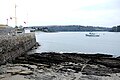 Quay at St Mawes - geograph.org.uk - 5114900.jpg 640 × 428; 74 KB
-
 Rather a steep road^ - geograph.org.uk - 5017026.jpg 640 × 594; 75 KB
-
 Reserved for gigs, St Mawes - geograph.org.uk - 5220055.jpg 3,064 × 1,891; 1,011 KB
-
 Road junction at St Just in Roseland - geograph.org.uk - 2871303.jpg 640 × 480; 62 KB
-
 Road to Carvinack - geograph.org.uk - 6004316.jpg 1,600 × 1,200; 883 KB
-
 Rocks by Lower Castle Road, St Mawes - geograph.org.uk - 5218774.jpg 2,825 × 1,876; 1.37 MB
-
 Rocky foreshore, Carrick Roads - geograph.org.uk - 5219086.jpg 3,072 × 2,048; 1.33 MB
-
 Roseland Peninsula - St Just in Roseland cemetery.jpg 5,317 × 3,550; 7.48 MB
-
 Scrub and woodland above Carrick Road - geograph.org.uk - 5218964.jpg 2,048 × 2,931; 1.53 MB
-
 Seaside cottage, St Mawes - geograph.org.uk - 6169109.jpg 1,600 × 1,071; 389 KB
-

-
 Sheep in pasture at Tredellans - geograph.org.uk - 5172377.jpg 640 × 480; 82 KB
-

-
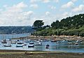
 Skyline of St Mawes - geograph.org.uk - 5094303.jpg 5,472 × 3,648; 6.77 MB
-
 St Just Creek (3890866220).jpg 2,000 × 1,366; 2.15 MB
-
 St Just Creek - geograph.org.uk - 1241356.jpg 628 × 640; 122 KB
-
 St Just Creek - geograph.org.uk - 1963798.jpg 640 × 427; 49 KB
-
 St Just Creek - geograph.org.uk - 4976624.jpg 800 × 600; 146 KB
-
 St Just Creek - geograph.org.uk - 6198008.jpg 1,024 × 768; 175 KB
-
 St Just Creek - geograph.org.uk - 6265602.jpg 1,600 × 1,063; 446 KB
-

-
 St Just Creek, St Just in Roseland - geograph.org.uk - 27414.jpg 640 × 480; 162 KB
-
 St Just Holy Well - geograph.org.uk - 2406407.jpg 480 × 640; 143 KB
-
 St Just in Roseland (3878035063).jpg 2,300 × 1,533; 3.96 MB
-
 St Just in Roseland (3878825674).jpg 2,511 × 1,674; 4.49 MB
-
 St Just in Roseland - geograph.org.uk - 3008481.jpg 800 × 600; 116 KB
-
 St Just in Roseland - geograph.org.uk - 3008482.jpg 800 × 600; 174 KB
-
 St Just in Roseland - geograph.org.uk - 3008484.jpg 800 × 600; 257 KB
-
 St Just in Roseland - geograph.org.uk - 3008487.jpg 600 × 800; 303 KB
-
 St Just in Roseland - geograph.org.uk - 3324204.jpg 1,600 × 1,067; 449 KB
-
 St Just in Roseland - geograph.org.uk - 4976613.jpg 800 × 600; 115 KB
-
 St Just in Roseland - geograph.org.uk - 5094293.jpg 4,996 × 3,331; 5.58 MB
-
 St Just in Roseland - St Just Creek (1) - geograph.org.uk - 3560466.jpg 640 × 427; 293 KB
-
 St Just in Roseland - St Just Creek (2) - geograph.org.uk - 3560471.jpg 640 × 427; 301 KB
-
 St Just in Roseland 1998 - geograph.org.uk - 2905457.jpg 640 × 412; 146 KB
-
 St Just in Roseland Church - geograph.org.uk - 2110862.jpg 490 × 640; 86 KB
-
 St Just in Roseland Church - geograph.org.uk - 4556112.jpg 3,264 × 2,448; 3.48 MB
-
 St Just in Roseland church - geograph.org.uk - 5458499.jpg 640 × 480; 77 KB
-
 St Just in Roseland church - geograph.org.uk - 5762004.jpg 1,600 × 1,075; 852 KB
-
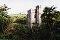
 St Just in Roseland church tower - geograph.org.uk - 2110851.jpg 640 × 443; 73 KB
-
 St Just in Roseland View from church.jpg 2,816 × 2,112; 2.89 MB
-
 St Just in Roseland-church and creek, 1993 - geograph.org.uk - 5219940.jpg 1,768 × 1,183; 447 KB
-
 St Just Pool - geograph.org.uk - 2406410.jpg 640 × 480; 74 KB
-

-
 St Just's church, St Just in Roseland - geograph.org.uk - 3560477.jpg 640 × 427; 477 KB
-
 St Just-in-Roseland church - geograph.org.uk - 1991476.jpg 640 × 426; 84 KB
-
 St Just-in-Roseland Church - geograph.org.uk - 6597964.jpg 1,024 × 636; 981 KB
-
 St Mawe's Castle - geograph.org.uk - 4180197.jpg 4,000 × 2,664; 5.51 MB
-
 St Mawe's castle and Start Point - geograph.org.uk - 4227059.jpg 639 × 434; 30 KB
-
 St Mawe's Harbour - geograph.org.uk - 4180202.jpg 4,000 × 2,664; 2.25 MB
-
 St Mawes - geograph.org.uk - 1977258.jpg 800 × 600; 131 KB
-
 St Mawes - geograph.org.uk - 1977267.jpg 800 × 480; 114 KB
-
 St Mawes - geograph.org.uk - 1977271.jpg 900 × 600; 180 KB
-
 St Mawes - geograph.org.uk - 2007895.jpg 800 × 600; 242 KB
-
 St Mawes - geograph.org.uk - 3012444.jpg 800 × 600; 181 KB
-
 St Mawes - geograph.org.uk - 3012461.jpg 800 × 600; 132 KB
-
 St Mawes - geograph.org.uk - 3012467.jpg 800 × 600; 155 KB
-
 St Mawes - geograph.org.uk - 5094299.jpg 5,472 × 3,648; 7.22 MB
-
 St Mawes - geograph.org.uk - 6365536.jpg 4,032 × 2,808; 3.71 MB
-
 St Mawes Castle - geograph.org.uk - 1965002.jpg 1,112 × 1,675; 450 KB
-
 St Mawes Castle - geograph.org.uk - 1977241.jpg 800 × 600; 139 KB
-
 St Mawes Castle - geograph.org.uk - 2096969.jpg 1,024 × 768; 152 KB
-
 St Mawes Castle - geograph.org.uk - 2518984.jpg 1,770 × 1,196; 530 KB
-
 St Mawes Castle - geograph.org.uk - 3008228.jpg 800 × 600; 133 KB
-
 St Mawes Castle - geograph.org.uk - 3008557.jpg 800 × 600; 196 KB
-
 St Mawes Castle - geograph.org.uk - 3008560.jpg 800 × 595; 184 KB
-
 St Mawes Castle - geograph.org.uk - 3008564.jpg 800 × 600; 256 KB


.jpg)


.jpg)


.jpg)


.jpg)


.jpg)


.jpg)
.jpg)


_-_geograph.org.uk_-_3560466.jpg)
_-_geograph.org.uk_-_3560471.jpg)


