Category:St Juliot
Jump to navigation
Jump to search
village and civil parish in Cornwall, England, UK  | |||||
| Upload media | |||||
| Instance of | |||||
|---|---|---|---|---|---|
| Location | Cornwall, South West England, England | ||||
 | |||||
Subcategories
This category has the following 5 subcategories, out of 5 total.
Media in category "St Juliot"
The following 70 files are in this category, out of 70 total.
-
 "Lane" 2011 - geograph.org.uk - 2434176.jpg 1,067 × 1,600; 519 KB
-
 Across the Valency Valley - geograph.org.uk - 5789889.jpg 1,024 × 768; 266 KB
-
 B3263 at Little Ringford - geograph.org.uk - 5672233.jpg 1,828 × 2,199; 603 KB
-
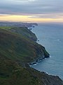
 Buckator and Gull Rock - geograph.org.uk - 2911983.jpg 640 × 480; 76 KB
-
 Byway near Pennycrocker - geograph.org.uk - 5669676.jpg 4,271 × 2,630; 1.53 MB
-
 Cliffs south of Pentargon (4863).jpg 4,187 × 2,848; 6.95 MB
-
 Coastline, St Juliot - geograph.org.uk - 6156060.jpg 1,024 × 768; 205 KB
-
 Confluence of stream with River Valency - geograph.org.uk - 3736682.jpg 1,064 × 1,600; 805 KB
-

-
-
 Elm Cottage, Newmills - geograph.org.uk - 3731357.jpg 1,600 × 1,064; 426 KB
-
 Emma Lavinia Gifford Plaque - geograph.org.uk - 5572223.jpg 640 × 427; 149 KB
-
 Entrance to National Trust property at Newmills - geograph.org.uk - 3731622.jpg 1,600 × 1,064; 685 KB
-
 Entrance to The Old Rectory, St Juliot - geograph.org.uk - 4353311.jpg 800 × 451; 138 KB
-
 Evening on the coastal path near Beeny - geograph.org.uk - 4211585.jpg 640 × 427; 191 KB
-

-
 Field near trig point, Tresparrett Down - geograph.org.uk - 5394282.jpg 2,610 × 1,296; 720 KB
-
 Font and Nave of St Juliots Church - geograph.org.uk - 5572224.jpg 427 × 640; 198 KB
-

-

-
 Footpath crossing stream above the Valency valley - geograph.org.uk - 3731588.jpg 1,600 × 1,064; 606 KB
-
 Former mill stream, Newmills - geograph.org.uk - 3731433.jpg 1,600 × 1,064; 701 KB
-
 Gate by the lane to Pennycrocker - geograph.org.uk - 5722714.jpg 4,288 × 2,848; 1.88 MB
-
 Gloomy weather at Tresparrett, Cornwall - geograph.org.uk - 4594409.jpg 5,647 × 3,520; 3.33 MB
-
 Gull Rock, St Juliot - geograph.org.uk - 6156022.jpg 1,024 × 768; 239 KB
-
 Hay Cutting - geograph.org.uk - 5572231.jpg 640 × 427; 175 KB
-
 House near Newmills, East of Boscastle - geograph.org.uk - 5789912.jpg 1,024 × 770; 384 KB
-
 Junction on Tresparrett Down - geograph.org.uk - 5394295.jpg 3,061 × 1,395; 725 KB
-
 Lane near Newton Farm - geograph.org.uk - 5260876.jpg 1,940 × 1,248; 341 KB
-
 Lane past Little Ringford - geograph.org.uk - 5722722.jpg 4,204 × 2,366; 1.79 MB
-
 Lane to Little Ringford - geograph.org.uk - 5722719.jpg 4,288 × 2,848; 1.95 MB
-
 Lane to Pennycrocker - geograph.org.uk - 5722716.jpg 4,143 × 2,294; 1.1 MB
-
 Level Walking - geograph.org.uk - 1493020.jpg 640 × 426; 92 KB
-
-
 Looking down the Valency valley from St Juliot's church - geograph.org.uk - 3731584.jpg 1,600 × 1,064; 357 KB
-
 Looking to Newton - geograph.org.uk - 3306829.jpg 640 × 480; 77 KB
-
 Looking up the Valency valley from St Juliot's church - geograph.org.uk - 3731577.jpg 1,600 × 1,064; 331 KB
-
 New Mills Ford - geograph.org.uk - 4684302.jpg 6,000 × 4,000; 6.36 MB
-
 Old Boundary Marker - geograph.org.uk - 6428320.jpg 693 × 924; 285 KB
-
 Otterham and St Juliot Hall - geograph.org.uk - 728740.jpg 640 × 428; 56 KB
-
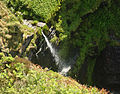 Pentargon waterfall (4870).jpg 2,904 × 2,265; 3.91 MB
-
 Remote house above the Valency valley - geograph.org.uk - 3730824.jpg 1,600 × 1,064; 598 KB
-
 River Valency at Newmills - geograph.org.uk - 3731425.jpg 1,064 × 1,600; 707 KB
-
 River Valency near Newmills - geograph.org.uk - 5789917.jpg 1,024 × 768; 455 KB
-
 Roof of St Juliots Church - geograph.org.uk - 5572226.jpg 427 × 640; 234 KB
-
 Ruin in woodland above Valency valley - geograph.org.uk - 3731640.jpg 1,600 × 1,187; 620 KB
-
 Signs at crossing of footpaths - geograph.org.uk - 3731636.jpg 1,600 × 1,064; 702 KB
-
 South West Coast Path near Rusey Beach - geograph.org.uk - 4211587.jpg 640 × 427; 279 KB
-
 St Juliot Church - geograph.org.uk - 2356131.jpg 1,024 × 768; 340 KB
-
 St Juliot's Church - geograph.org.uk - 4151457.jpg 1,600 × 1,127; 523 KB
-
 St Juliot's church from the south-west - geograph.org.uk - 3731414.jpg 1,600 × 1,064; 410 KB
-
 St Juliot's Church, Hennett - geograph.org.uk - 5789852.jpg 1,024 × 768; 429 KB
-
 St Juliot's Church, Hennett - geograph.org.uk - 5789867.jpg 1,024 × 769; 407 KB
-
 St Juliot, farm buildings at Trevilla - geograph.org.uk - 90474.jpg 640 × 433; 178 KB
-
 St Juliots Church - geograph.org.uk - 5572221.jpg 640 × 427; 218 KB
-
 The A39 at Otterham station - geograph.org.uk - 1883694.jpg 640 × 402; 52 KB
-
 The Interior of St Juliot Church - geograph.org.uk - 2356141.jpg 1,024 × 768; 208 KB
-
 The Thomas Hardy Memorial Window at St Juliot's - geograph.org.uk - 5789876.jpg 1,024 × 768; 289 KB
-
 Towards Ringford Farm - geograph.org.uk - 5394268.jpg 2,150 × 1,213; 569 KB
-
 Track and Footpath at Newmills - geograph.org.uk - 2356118.jpg 768 × 1,024; 344 KB
-
 Track down into the Valency vale at Newmills - geograph.org.uk - 3730046.jpg 1,600 × 1,064; 495 KB
-
 Track down into the Valency vale at Newmills - geograph.org.uk - 3731437.jpg 1,600 × 1,064; 642 KB
-
 Track up the side of the Valency valley - geograph.org.uk - 3731630.jpg 1,064 × 1,600; 630 KB
-
 Tumulus and trig point, Tresparrett Down - geograph.org.uk - 5393860.jpg 3,005 × 1,985; 1.26 MB
-
 Valley above Pentargon waterfall (4867).jpg 4,069 × 2,848; 7.05 MB
-
 View North over Newton Farm - geograph.org.uk - 6238734.jpg 5,472 × 3,648; 3.14 MB
-
 Wayside Cross in St Juliots Churchyard - geograph.org.uk - 5572237.jpg 640 × 427; 311 KB
-
 Wheelhead cross, St Juliot's churchyard - geograph.org.uk - 3731441.jpg 1,064 × 1,600; 564 KB
-
 Winding Road at Newmills, Cornwall - geograph.org.uk - 5789907.jpg 1,024 × 768; 341 KB
-
 Lane - geograph.org.uk - 253465.jpg 640 × 424; 79 KB


.jpg)


.jpg)


.jpg)


