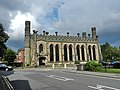
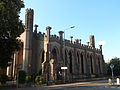
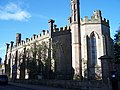
Category:St John the Evangelist's Church, Derby
Jump to navigation
Jump to search
| Object location | | View all coordinates using: OpenStreetMap |
|---|
Grade II* listed church in Derby, United Kingdom .JPG) | |||||
| Upload media | |||||
| Instance of | |||||
|---|---|---|---|---|---|
| Dedicated to | |||||
| Location | City of Derby, Derbyshire, East Midlands, England | ||||
| Diocese | |||||
| Architect | |||||
| Heritage designation |
| ||||
| Inception |
| ||||
| Religion or worldview | |||||
| official website | |||||
 | |||||
Media in category "St John the Evangelist's Church, Derby"
The following 15 files are in this category, out of 15 total.
-
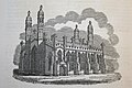 Church of Saint John Derby 1833 or before.jpg 2,667 × 1,778; 3.35 MB
-
 Church of Saint John The Evangelist Derby IMG 3903 cropped and touched.jpg 2,907 × 1,938; 3.44 MB
-
 Derby - panoramio (1).jpg 4,000 × 3,000; 3.9 MB
-
 Derby - panoramio.jpg 4,000 × 3,000; 3.19 MB
-
 SamRaynerStjohnsderby.jpg 584 × 420; 91 KB
-
 St John the Evangelist Church, Derby (1).JPG 4,608 × 3,440; 3.63 MB
-
 St John the Evangelist Church, Derby (2).JPG 4,608 × 3,440; 3.98 MB
-
 St John the Evangelist Church, Derby (3).JPG 4,608 × 3,440; 4.01 MB
-
 St John the Evangelist Church, Derby (4).JPG 4,608 × 3,440; 3.84 MB
-
 St John the Evangelist Church, Derby (5).JPG 4,608 × 3,440; 3.85 MB
-
 St John the Evangelist Church, Derby (6).JPG 4,608 × 3,440; 3.96 MB
-
 St John the Evangelist Church, Derby (7).JPG 4,608 × 3,440; 3.68 MB
-
 St John's Church School, Derby (1).JPG 4,608 × 3,440; 3.99 MB
-
 St John's Church School, Derby (2).JPG 4,608 × 3,440; 3.99 MB
-
 StJohnRH.jpg 2,576 × 1,932; 1.01 MB


.jpg)


.JPG)
.JPG)
.JPG)
.JPG)
.JPG)
.JPG)
.JPG)
.JPG)
