Category:St Helen's church, Great Oxendon
Jump to navigation
Jump to search
| Object location | | View all coordinates using: OpenStreetMap |
|---|
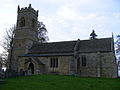
church in Great Oxendon, Northamptonshire, England, UK  | |||||
| Upload media | |||||
| Instance of | |||||
|---|---|---|---|---|---|
| Dedicated to | |||||
| Location | Great Oxendon, West Northamptonshire, Northamptonshire, East Midlands, England | ||||
| Diocese | |||||
| Heritage designation |
| ||||
| Inception |
| ||||
| Religion or worldview | |||||
| official website | |||||
 | |||||
Media in category "St Helen's church, Great Oxendon"
The following 3 files are in this category, out of 3 total.
-

-
 Church of St Helen, Great Oxenden - geograph.org.uk - 2002594.jpg 4,000 × 3,000; 2.95 MB
-
 St Helen, Great Oxendon - geograph.org.uk - 1258888.jpg 640 × 480; 67 KB

