Category:St Gluvias
Jump to navigation
Jump to search
village in Cornwall, England, UK  Eglwys Sant Gluvias, St Gluvias | |||||
| Upload media | |||||
| Instance of | |||||
|---|---|---|---|---|---|
| Location | Penryn, Cornwall, South West England, England | ||||
 | |||||

Subcategories
This category has only the following subcategory.
G
Media in category "St Gluvias"
The following 102 files are in this category, out of 102 total.
-
 A carpet of bluebell - Enys Gardens - geograph.org.uk - 5819432.jpg 640 × 480; 151 KB
-
 A large allotment shed - geograph.org.uk - 5902406.jpg 1,024 × 681; 162 KB
-
 A very narrow and twisting Cornish lane. - geograph.org.uk - 4179194.jpg 4,000 × 2,664; 7.61 MB
-
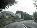
 A39 approaches the Treluswell Roundabout - geograph.org.uk - 3215946.jpg 3,064 × 2,048; 1.11 MB
-

-

-
 A39 Cornwall The Junction For A393 - geograph.org.uk - 5017313.jpg 640 × 480; 57 KB
-

-
 A39 heading north - geograph.org.uk - 4238718.jpg 640 × 480; 85 KB
-
 A39 southwest of Standard Farm - geograph.org.uk - 3215954.jpg 3,182 × 1,989; 1.22 MB
-
 A39 towards Truro - geograph.org.uk - 4238699.jpg 640 × 480; 113 KB
-
 A39 towards Truro - geograph.org.uk - 4238708.jpg 640 × 480; 106 KB
-
 Allotments by the Maritime Line - geograph.org.uk - 5902397.jpg 925 × 1,024; 277 KB
-
 Approaching Ponsanooth - geograph.org.uk - 5462915.jpg 640 × 480; 56 KB
-
 Approaching Treluswell Roundabout - geograph.org.uk - 4238701.jpg 640 × 480; 107 KB
-
 B3292 at Lower Treluswell - geograph.org.uk - 6592747.jpg 640 × 480; 71 KB
-
 Below the Ponsanooth Viaduct - geograph.org.uk - 5905451.jpg 1,024 × 681; 126 KB
-

-

-

-
 Bluebells and young beech leaves - geograph.org.uk - 2412088.jpg 640 × 480; 140 KB
-
 Bluebells at Parc Lye on the Enys Estate - geograph.org.uk - 2411912.jpg 640 × 480; 137 KB
-
 Bluebells at Parc Lye on the Enys estate - geograph.org.uk - 2412082.jpg 640 × 480; 111 KB
-
 Bluebells at Parc Lye on the Enys Estate - geograph.org.uk - 3978232.jpg 640 × 480; 135 KB
-
 Cattle in the parkland at Enys - geograph.org.uk - 2412058.jpg 480 × 640; 83 KB
-
 Clock tower on the Enys Estate - geograph.org.uk - 2412022.jpg 480 × 640; 123 KB
-
 Cornwall , Country Lane - geograph.org.uk - 4597079.jpg 4,288 × 2,848; 5.32 MB
-
 Cornwall , Houses - geograph.org.uk - 4597066.jpg 4,042 × 2,685; 4.98 MB
-
 Cornwall , Railway Line - geograph.org.uk - 5384771.jpg 6,000 × 4,000; 7.69 MB
-
 Cornwall , The A39 - geograph.org.uk - 4611531.jpg 4,288 × 2,848; 7 MB
-
 Cornwall , The A39 - geograph.org.uk - 4611535.jpg 3,764 × 2,500; 6.46 MB
-
 Cornwall , The A39 - geograph.org.uk - 4611536.jpg 4,288 × 2,848; 6.68 MB
-
 Cornwall , The A39 - geograph.org.uk - 4611542.jpg 4,288 × 2,848; 6.65 MB
-
 Cornwall , The A393 - geograph.org.uk - 4597085.jpg 4,288 × 2,848; 6.96 MB
-
 Cornwall , The A393 - geograph.org.uk - 5384769.jpg 6,000 × 4,000; 7.19 MB
-
 Cornwall , The B3292 - geograph.org.uk - 4597061.jpg 4,288 × 2,848; 7.79 MB
-
 Cornwall , The B3292 - geograph.org.uk - 4597062.jpg 3,854 × 2,560; 6.2 MB
-
 Cottage off the A39 - geograph.org.uk - 4238712.jpg 640 × 480; 106 KB
-

-

-
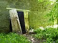 Doorway on the barn at Enys - geograph.org.uk - 3978428.jpg 640 × 480; 122 KB
-
 Enys Gardens - walled garden - geograph.org.uk - 3956188.jpg 640 × 480; 109 KB
-
 Enys Gardens - waterwheel - geograph.org.uk - 3953913.jpg 640 × 480; 165 KB
-
 Enys House - geograph.org.uk - 2411966.jpg 640 × 480; 97 KB
-
 Enys House - geograph.org.uk - 5819447.jpg 640 × 480; 107 KB
-
 Farmland, St Gluvias - geograph.org.uk - 6156655.jpg 1,024 × 751; 307 KB
-
 Farmland, Sunnyside - geograph.org.uk - 4238704.jpg 640 × 424; 56 KB
-
 Field between B3292 and the Maritime Line - geograph.org.uk - 5902393.jpg 1,024 × 681; 157 KB
-

-
 Formal gardens at Enys - geograph.org.uk - 2412064.jpg 640 × 480; 110 KB
-

-
 Gated track into woodland - geograph.org.uk - 4238714.jpg 640 × 480; 158 KB
-
 Harvested field - geograph.org.uk - 5902394.jpg 1,024 × 681; 170 KB
-
 Houses, Ponsanooth - geograph.org.uk - 5462920.jpg 640 × 462; 83 KB
-
 Hydraulic ram at Enys - geograph.org.uk - 2411996.jpg 480 × 640; 139 KB
-
 Industry below the viaduct - geograph.org.uk - 5905454.jpg 1,024 × 681; 119 KB
-
 Lane off the A39 - geograph.org.uk - 4238698.jpg 640 × 435; 127 KB
-
 Medieval cross at Enys - geograph.org.uk - 2412049.jpg 480 × 640; 147 KB
-
 Minor road off the A39 - geograph.org.uk - 4238717.jpg 640 × 404; 94 KB
-
 Minor road towards Ponsanooth - geograph.org.uk - 4238725.jpg 640 × 480; 101 KB
-
 Mown silage field north of Hornywink Wood - geograph.org.uk - 3216078.jpg 3,648 × 2,048; 1.78 MB
-

-
 Oak tree in the parkland at Enys - geograph.org.uk - 2412072.jpg 640 × 480; 72 KB
-

-

-
 Old farm machinery at Enys - geograph.org.uk - 3981582.jpg 640 × 480; 163 KB
-

-

-
 Old Wayside Cross - geograph.org.uk - 6494809.jpg 960 × 720; 230 KB
-
 Penryn River. - geograph.org.uk - 381713.jpg 640 × 480; 119 KB
-
 Ponsanooth , Park Road - geograph.org.uk - 4597095.jpg 4,288 × 2,848; 6.97 MB
-
 Ponsanooth , St Michael's Road A393 - geograph.org.uk - 4597092.jpg 4,288 × 2,848; 7.21 MB
-
 Ponsanooth , The A393 - geograph.org.uk - 4597088.jpg 4,288 × 2,848; 4.92 MB
-
 Railway towards Falmouth - geograph.org.uk - 4238706.jpg 640 × 480; 77 KB
-
 Road junction for Roskrow off A39 - geograph.org.uk - 4708930.jpg 1,600 × 1,202; 1.42 MB
-
 Service station on the A393 - geograph.org.uk - 5462910.jpg 640 × 480; 61 KB
-
 Skull, Crossbones ... and unseasonal primroses (6583014109).jpg 3,000 × 4,000; 7.69 MB
-
 Spring colours at Enys - geograph.org.uk - 3978401.jpg 480 × 640; 177 KB
-
 St Gluvias (2183259811).jpg 2,560 × 1,712; 4.34 MB
-
 St Gluvias (33830601211).jpg 2,925 × 3,757; 9.34 MB
-
 St Gluvias Cemetery 1 (2201881905).jpg 2,560 × 1,712; 2.97 MB
-
 St Gluvias Cemetery 2 (2201878721).jpg 2,560 × 1,712; 2.94 MB
-
 St Gluvias cemetery 3 (2201875589).jpg 2,560 × 1,712; 3.23 MB
-
 St Gluvias cemetery 4 (2202662858).jpg 2,560 × 1,712; 3.02 MB
-
 St Gluvias Cemetery 5 (2201868003).jpg 2,401 × 1,700; 3.16 MB
-
 St Gluvias Churchyard, Penryn (2414495092).jpg 2,560 × 1,712; 4.29 MB
-
 The A39 - geograph.org.uk - 4179177.jpg 3,239 × 2,256; 3.35 MB
-
 The Old Brewery Yard - geograph.org.uk - 5902391.jpg 1,024 × 681; 178 KB
-
 The pond on the Enys Estate - geograph.org.uk - 2412014.jpg 480 × 640; 143 KB
-
 The south elevation of Enys House - geograph.org.uk - 3978419.jpg 640 × 480; 111 KB
-
 Track off the A39 - geograph.org.uk - 4238700.jpg 640 × 480; 98 KB
-
 Turning for Flushing at Barras Moor - geograph.org.uk - 4043010.jpg 640 × 364; 84 KB
-
 Turning for Roskrow from A39 - geograph.org.uk - 4043008.jpg 640 × 412; 69 KB
-
 Unnamed lane in woodland south of Cherry Cottage - geograph.org.uk - 3216057.jpg 2,746 × 2,048; 1.27 MB
-
 Unnamed road junction at Barras Moor - geograph.org.uk - 3216090.jpg 3,648 × 2,048; 2.3 MB
-
 Unnamed road north of Poplar Farm - geograph.org.uk - 3215963.jpg 2,910 × 2,048; 1.19 MB
-
 Unnamed Y-junction south of Horneywink Wood - geograph.org.uk - 3216066.jpg 3,648 × 2,048; 2.3 MB
-
 View from Ponsanooth Viaduct - geograph.org.uk - 5902412.jpg 1,024 × 681; 148 KB
-
 Waterwheel at Enys - geograph.org.uk - 2411991.jpg 640 × 480; 155 KB
-

-
 Woodland, Bracken - geograph.org.uk - 4238723.jpg 478 × 640; 139 KB
-
 Works units and sewage works - geograph.org.uk - 5902409.jpg 1,024 × 681; 159 KB


_and_wild_garlic_(Allium_ursinum)_-_geograph.org.uk_-_2412093.jpg)
_at_Enys_Gardens_-_geograph.org.uk_-_2411494.jpg)


_-_geograph.org.uk_-_2412098.jpg)


.jpg)

.jpg)
.jpg)
.jpg)
.jpg)
.jpg)
.jpg)
.jpg)
.jpg)


