Category:St Giles in the Wood
Jump to navigation
Jump to search
English: St Giles in the Wood is a village and civil parish in the Torridge district of Devon, England.

village in United Kingdom  | |||||
| Upload media | |||||
| Instance of | |||||
|---|---|---|---|---|---|
| Location | Torridge, Devon, South West England, England | ||||
| Population |
| ||||
 | |||||
Subcategories
This category has the following 6 subcategories, out of 6 total.
Media in category "St Giles in the Wood"
The following 200 files are in this category, out of 333 total.
(previous page) (next page)-
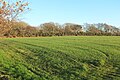
 A3124 approaching Deershill Wood - geograph.org.uk - 4326137.jpg 1,600 × 1,201; 1.57 MB
-
 A3124 heading south east - geograph.org.uk - 5480935.jpg 1,600 × 1,039; 353 KB
-
 A3124 in Deershill Wood - geograph.org.uk - 4326147.jpg 1,600 × 1,200; 1.49 MB
-
 A3124 in Mount Wood - geograph.org.uk - 5800268.jpg 2,848 × 4,288; 2.36 MB
-
 A3124 junction - geograph.org.uk - 5480956.jpg 1,976 × 1,338; 1.72 MB
-
 A3124 near Rosemoor RHS Gardens - geograph.org.uk - 5479887.jpg 1,600 × 1,050; 403 KB
-
 A3124 through Deershill Wood - geograph.org.uk - 5482654.jpg 1,366 × 1,059; 985 KB
-
 Access road to Lower Whitsleigh farm - geograph.org.uk - 4569781.jpg 1,200 × 1,600; 1.53 MB
-
 Approaching Cranford Cross - geograph.org.uk - 6796302.jpg 1,024 × 714; 192 KB
-
 Arable field south of Church Farm - geograph.org.uk - 5308094.jpg 2,175 × 1,180; 690 KB
-
 B3227 near Peagham Barton - geograph.org.uk - 5307750.jpg 2,281 × 1,499; 790 KB
-
 Bales in the barn, Winscott Barton - geograph.org.uk - 5217636.jpg 2,435 × 1,682; 812 KB
-
 Barn, St Giles in The Wood - geograph.org.uk - 5307437.jpg 3,072 × 2,048; 836 KB
-
 Barn, Winscott Barton - geograph.org.uk - 5307031.jpg 3,061 × 2,010; 1.16 MB
-
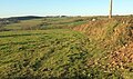
 Beara Moor Plantation - geograph.org.uk - 5307119.jpg 3,056 × 1,781; 1.2 MB
-
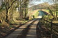
 Bridge in woodland at RHS Rosemoor - geograph.org.uk - 3457088.jpg 768 × 1,024; 271 KB
-
 Bridge over Dodscott Brook - geograph.org.uk - 5307320.jpg 3,072 × 2,048; 1.93 MB
-
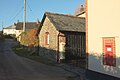
 C19 cottages, St Giles in The Wood - geograph.org.uk - 5217756.jpg 2,411 × 1,600; 767 KB
-
 Catering outlet - RHS Rosemoor - geograph.org.uk - 5473583.jpg 640 × 480; 149 KB
-
 Cattle south-east of Great Torrington, Devon - geograph.org.uk - 4560306.jpg 1,024 × 703; 532 KB
-
 Children's play ship at Rosemoor Gardens - geograph.org.uk - 4718989.jpg 1,200 × 1,600; 1.87 MB
-
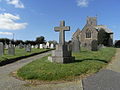
 Church, St Giles in The Wood - geograph.org.uk - 5217842.jpg 3,072 × 2,048; 1.09 MB
-
 Church, St Giles in the Wood - geograph.org.uk - 5307509.jpg 2,601 × 1,657; 611 KB
-
 Corner of wood, Cranford Moor - geograph.org.uk - 5307788.jpg 3,063 × 1,897; 1.08 MB
-
 Cottage by the B3227 - geograph.org.uk - 5307755.jpg 3,064 × 1,769; 1.1 MB
-
 Cottages, Kingscott (geograph 5306789).jpg 3,072 × 2,048; 1.31 MB
-
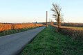
 Country lane - geograph.org.uk - 4309330.jpg 640 × 480; 77 KB
-
 Country lane - geograph.org.uk - 4309332.jpg 640 × 480; 83 KB
-

-
 Cranford Cross - geograph.org.uk - 3450351.jpg 1,024 × 769; 139 KB
-
 Cranford Cross - geograph.org.uk - 5319939.jpg 3,072 × 2,048; 1.19 MB
-
 Cranford Moor - geograph.org.uk - 3450347.jpg 1,024 × 767; 147 KB
-
 Cranford Moor - geograph.org.uk - 5307900.jpg 3,072 × 2,048; 1.54 MB
-
 Daffodils by the stream, RHS Rosemoor - geograph.org.uk - 4886111.jpg 1,200 × 1,600; 779 KB
-
 Deep Moor tip - geograph.org.uk - 658488.jpg 640 × 337; 58 KB
-
 Deepmoor Composting Facility - geograph.org.uk - 5884714.jpg 1,600 × 1,200; 448 KB
-
 Deershill Wood east of Great Torrington - geograph.org.uk - 4326141.jpg 1,600 × 1,200; 1.47 MB
-
 Dodscott Brook - geograph.org.uk - 657425.jpg 640 × 480; 128 KB
-
 Dodscott Brook valley - geograph.org.uk - 5306575.jpg 3,064 × 1,954; 1.19 MB
-
 Dodscott Cross - geograph.org.uk - 5307330.jpg 3,072 × 1,847; 1.2 MB
-
 Dodscott Wood - geograph.org.uk - 656904.jpg 640 × 480; 121 KB
-
 East side of courtyard range, Winscott Barton - geograph.org.uk - 5307067.jpg 2,048 × 3,072; 1.19 MB
-
 Entrance to a field near Whitsley Cross - geograph.org.uk - 4569786.jpg 1,600 × 1,200; 1.41 MB
-
 Entrance to Dodscott Wood - geograph.org.uk - 656874.jpg 640 × 480; 114 KB
-
 Entrance, Cranford Park - geograph.org.uk - 6796307.jpg 1,024 × 768; 317 KB
-
 Eroded lane edge - geograph.org.uk - 656924.jpg 480 × 640; 131 KB
-
 Estate housing at St Giles in the Wood - geograph.org.uk - 5923690.jpg 640 × 480; 101 KB
-
 Farm buildings at Huntshaw Cross - geograph.org.uk - 3450321.jpg 1,024 × 768; 126 KB
-
 Farm buildings, Winscott Barton - geograph.org.uk - 5211832.jpg 2,622 × 1,919; 662 KB
-
 Farm track below High Bullen - geograph.org.uk - 3589309.jpg 3,648 × 2,736; 2.86 MB
-
 Farmland near Hill Farm - geograph.org.uk - 5307305.jpg 3,072 × 2,048; 1.4 MB
-
 Farmland near Peagham Barton - geograph.org.uk - 5307743.jpg 2,978 × 1,821; 933 KB
-
 Farmland south of Church Farm - geograph.org.uk - 5308042.jpg 2,731 × 1,635; 706 KB
-
 Farmland, Dodscott - geograph.org.uk - 5307353.jpg 3,072 × 1,819; 1.32 MB
-
 Farmland, Kingscott - geograph.org.uk - 5306832.jpg 2,637 × 1,597; 966 KB
-
 Farmland, Peagham Barton - geograph.org.uk - 5307715.jpg 3,072 × 1,618; 1.03 MB
-
 Farmland, Way Barton - geograph.org.uk - 5320041.jpg 1,831 × 1,080; 309 KB
-
 Fernhill - geograph.org.uk - 5800288.jpg 4,183 × 2,658; 2.73 MB
-
 Field by the A388 - geograph.org.uk - 5800294.jpg 4,288 × 2,848; 1.75 MB
-
 Field east of Dodscott - geograph.org.uk - 5307261.jpg 2,947 × 1,718; 1.34 MB
-
 Field edge boundary below High Bullen - geograph.org.uk - 3589304.jpg 3,648 × 2,736; 2.45 MB
-
 Fields near Dodscott - geograph.org.uk - 657216.jpg 640 × 480; 102 KB
-
 Fly-tipping near Belle Vue Lodge - geograph.org.uk - 658510.jpg 480 × 640; 148 KB
-
 Foliage and Plantsman's Garden - geograph.org.uk - 6008796.jpg 1,024 × 678; 778 KB
-

-
 Former filling station at High Bullen - geograph.org.uk - 2751866.jpg 800 × 601; 333 KB
-

-
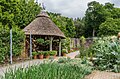
 Fruit and Vegetable Garden - geograph.org.uk - 6008809.jpg 1,024 × 678; 1,012 KB
-
 Fruit and Vegetable Garden - geograph.org.uk - 6008811.jpg 1,024 × 678; 1.02 MB
-
 Fruit and Vegetable Garden - geograph.org.uk - 6008814.jpg 678 × 1,024; 979 KB
-
 Fruit and Vegetable Garden - geograph.org.uk - 6008816.jpg 1,024 × 678; 1.07 MB
-
 Fruit and Vegetable Garden - geograph.org.uk - 6008819.jpg 1,024 × 678; 982 KB
-
 Gate and track beside Deershill Wood - geograph.org.uk - 2750250.jpg 800 × 600; 444 KB
-
 Gateway and woodland track near Great Torrington - geograph.org.uk - 4560350.jpg 1,024 × 768; 682 KB
-
 Gayden's Copse - geograph.org.uk - 5306398.jpg 3,072 × 2,048; 1.47 MB
-
 Grazing south-east of Great Torrington, Devon - geograph.org.uk - 4560303.jpg 1,024 × 683; 486 KB
-
 Great Torrington, from RHS Rosemoor Gardens - geograph.org.uk - 4887106.jpg 1,600 × 1,200; 368 KB
-
 Great Torrington, Orford Mill waterwheel - geograph.org.uk - 5727057.jpg 1,600 × 1,082; 849 KB
-
 Hedgebank in the woodland of RHS Rosemoor - geograph.org.uk - 3457100.jpg 768 × 1,024; 305 KB
-
 Herb, Potager and Cottage Gardens - geograph.org.uk - 6008803.jpg 678 × 1,024; 1.01 MB
-
 Herb, Potager and Cottage Gardens - geograph.org.uk - 6008805.jpg 1,024 × 678; 1.02 MB
-
 Herb, Potager and Cottage Gardens - geograph.org.uk - 6011216.jpg 1,024 × 678; 1.02 MB
-
 High Down on Beara Moor - geograph.org.uk - 3453539.jpg 1,024 × 768; 109 KB
-
 Junction, Woolleigh Mill Bridge - geograph.org.uk - 5217253.jpg 1,848 × 2,413; 1.22 MB
-
 Junction, Woolleigh Mill Bridge - geograph.org.uk - 5306520.jpg 3,072 × 2,048; 1.47 MB
-
 Kingscott Hill (geograph 5306775).jpg 3,072 × 2,048; 967 KB
-
 Kingscott Hill - geograph.org.uk - 5306778.jpg 3,072 × 2,048; 932 KB
-
 Kingscott Hill - geograph.org.uk - 5306798.jpg 3,072 × 2,048; 1.13 MB
-
 Kingscott Hill Bridge - geograph.org.uk - 5217285.jpg 2,986 × 1,958; 1.63 MB
-
 Lake at Rosemoor - geograph.org.uk - 5401340.jpg 1,600 × 899; 389 KB
-
 Lane at Stony Ford - geograph.org.uk - 5306890.jpg 3,072 × 2,048; 1.46 MB
-
 Lane by the Woolleigh Brook - geograph.org.uk - 5306445.jpg 2,672 × 2,021; 1.09 MB
-
 Lane east of Dodscott - geograph.org.uk - 5211844.jpg 3,072 × 2,048; 1.55 MB
-
 Lane from Beara Cross - geograph.org.uk - 5307080.jpg 3,072 × 2,048; 1.16 MB
-
 Lane from Beara Cross - geograph.org.uk - 5307148.jpg 2,048 × 3,072; 1.52 MB
-
 Lane junction west of Kingscott - geograph.org.uk - 648772.jpg 640 × 480; 78 KB
-
 Lane near Dodscott Brook - geograph.org.uk - 658242.jpg 480 × 640; 110 KB
-
 Lane near Dodscott Wood - geograph.org.uk - 656920.jpg 640 × 480; 138 KB
-
 Lane near Dodscott Wood - geograph.org.uk - 656975.jpg 640 × 480; 128 KB
-
 Lane near Dodscott Wood - geograph.org.uk - 656987.jpg 480 × 640; 121 KB
-
 Lane past South Dodscott - geograph.org.uk - 5307339.jpg 3,072 × 2,048; 1.48 MB
-
 Lane to Beara Head - geograph.org.uk - 5307219.jpg 3,072 × 2,048; 1.53 MB
-
 Lane to Deep Moor - geograph.org.uk - 656514.jpg 640 × 412; 63 KB
-
 Lane to Dodscott - geograph.org.uk - 5307223.jpg 3,072 × 2,048; 1.84 MB
-
 Lane to Huntshaw Cross - geograph.org.uk - 5307879.jpg 3,072 × 2,048; 1.14 MB
-
 Lane to Kingscott - geograph.org.uk - 5306572.jpg 3,072 × 2,048; 1.21 MB
-
 Lane to Sherwood Green - geograph.org.uk - 5319973.jpg 2,670 × 1,783; 761 KB
-
 Lane to Sherwood Green - geograph.org.uk - 5320024.jpg 1,994 × 1,054; 480 KB
-
 Lane to St Giles in The Wood - geograph.org.uk - 5307394.jpg 3,072 × 2,048; 1.24 MB
-
 Lane to Whitsleigh Cross - geograph.org.uk - 5306537.jpg 2,048 × 3,072; 1.75 MB
-
 Lane to Winscott Barton - geograph.org.uk - 5217611.jpg 1,545 × 977; 334 KB
-
 Leighty Water - geograph.org.uk - 2751862.jpg 800 × 637; 374 KB
-
 Leighty Water - geograph.org.uk - 649024.jpg 640 × 423; 74 KB
-
 Lichen on seat at RHS Rosemoor - geograph.org.uk - 3457075.jpg 768 × 1,024; 236 KB
-
 Listed houses, St Giles in The Wood - geograph.org.uk - 5307709.jpg 3,072 × 2,048; 1.08 MB
-
 Log piles in old quarry - geograph.org.uk - 655102.jpg 640 × 480; 123 KB
-
 Longwool sheep, Heronslake - geograph.org.uk - 655806.jpg 640 × 480; 103 KB
-
 Lower Woodland walk, RHS Rosemoor, 1 - geograph.org.uk - 4665532.jpg 800 × 498; 278 KB
-
 Lower Woodland walk, RHS Rosemoor, 2 - geograph.org.uk - 4665538.jpg 800 × 451; 229 KB
-
 Lower Woodland walk, RHS Rosemoor, 3 - geograph.org.uk - 4665540.jpg 800 × 451; 262 KB
-
 Lower Woodland walk, RHS Rosemoor, 4 - geograph.org.uk - 4665542.jpg 800 × 448; 271 KB
-
 Lych gate, St Giles in The Wood - geograph.org.uk - 5307503.jpg 1,913 × 2,560; 1.15 MB
-
 Lych gate, St Giles in The Wood - geograph.org.uk - 5307699.jpg 2,048 × 3,072; 994 KB
-
 MarkRolleCrossStGilesInTheWood.jpg 3,648 × 2,736; 2.12 MB
-
 Meanders on the Woolleigh Brook - geograph.org.uk - 648764.jpg 480 × 640; 81 KB
-
 Milestone in Deershaill Wood by A3124 - geograph.org.uk - 2750254.jpg 800 × 600; 455 KB
-
 Milestone south-east of Great Torrington, Devon - geograph.org.uk - 4560312.jpg 768 × 1,024; 679 KB
-
 Minor road by the Woolleigh Brook - geograph.org.uk - 4570283.jpg 1,600 × 1,200; 1.19 MB
-
 Minor road passing Buckgrove Cottages - geograph.org.uk - 2751873.jpg 798 × 800; 390 KB
-
 Minor road to Cranford Cross - geograph.org.uk - 6796272.jpg 1,024 × 792; 247 KB
-
 Minor road to Dodscott - geograph.org.uk - 2751875.jpg 800 × 600; 370 KB
-
 Minor road to Huntishaw Cross - geograph.org.uk - 6796313.jpg 1,024 × 768; 239 KB
-
 Mr. McGregor's garden at RHS Rosemoor - geograph.org.uk - 4665547.jpg 800 × 800; 432 KB
-
 New (2017) meeting hall, Rosemoor RHS Garden - geograph.org.uk - 5477885.jpg 1,600 × 1,200; 768 KB
-
 New Bridge (Torrington) on the river Torridge - geograph.org.uk - 1822951.jpg 1,024 × 768; 217 KB
-
 New houses at St Giles in the Wood - geograph.org.uk - 5923672.jpg 640 × 346; 42 KB
-
 Nine Acre Copse - geograph.org.uk - 5306576.jpg 2,712 × 1,989; 1.18 MB
-
 Northeast of St Giles in The Wood - geograph.org.uk - 5307383.jpg 2,986 × 1,832; 1.21 MB
-
 Ordnance Survey Cut Mark - geograph.org.uk - 4567006.jpg 480 × 640; 125 KB
-
 Ordnance Survey Cut Mark - geograph.org.uk - 4567008.jpg 480 × 640; 133 KB
-
 Ordnance Survey Flush Bracket 1657 - geograph.org.uk - 4741676.jpg 4,000 × 3,000; 3.12 MB
-
 Orford Mill - geograph.org.uk - 3766315.jpg 480 × 640; 101 KB
-
 Orford Mill - Great Torrington - geograph.org.uk - 3766318.jpg 640 × 480; 125 KB
-
 Orford Mill - water wheel - geograph.org.uk - 3766317.jpg 480 × 640; 117 KB
-
 Part of the Deepmoor landfill site - geograph.org.uk - 5202195.jpg 3,988 × 1,580; 4.78 MB
-
 Peagham Barton and beyond - geograph.org.uk - 5870700.jpg 6,000 × 4,000; 5.72 MB
-
 Ploughed field, Cranford - geograph.org.uk - 5217864.jpg 3,072 × 2,048; 1.86 MB
-

-
 Queen Mother's Rose Garden - geograph.org.uk - 6008782.jpg 678 × 1,024; 933 KB
-
 Queen Mother's Rose Garden - geograph.org.uk - 6008785.jpg 1,024 × 678; 1.04 MB
-
 Queen Mother's Rose Garden - geograph.org.uk - 6008791.jpg 678 × 1,024; 1.09 MB
-
 Raised vegetable beds at RHS Rosemoor - geograph.org.uk - 5707783.jpg 640 × 480; 122 KB
-
 RHS Garden Rosemoor - geograph.org.uk - 5059918.jpg 2,171 × 3,256; 2.75 MB
-
 RHS Garden, Rosemoor - geograph.org.uk - 5707751.jpg 640 × 480; 83 KB
-
 RHS Garden, Rosemoor - geograph.org.uk - 5707756.jpg 640 × 480; 74 KB
-
 RHS Gardens Rosemoor - geograph.org.uk - 4284651.jpg 2,888 × 2,941; 6.55 MB
-
 RHS Gardens Rosemoor - geograph.org.uk - 4322853.jpg 3,278 × 2,185; 5.33 MB
-
 RHS Gardens Rosemoor - geograph.org.uk - 4322863.jpg 3,277 × 2,185; 5.81 MB
-
 RHS Gardens Rosemoor - geograph.org.uk - 4322871.jpg 3,278 × 2,185; 6.94 MB
-
 RHS Gardens Rosemoor - geograph.org.uk - 4322877.jpg 3,494 × 2,615; 6.55 MB
-
 RHS Rosemoor - geograph.org.uk - 4151527.jpg 960 × 698; 162 KB
-
 RHS Rosemoor - geograph.org.uk - 4151533.jpg 720 × 960; 134 KB
-
 RHS Rosemoor - geograph.org.uk - 5473567.jpg 640 × 480; 95 KB
-

-
 RHS Rosemoor, 1 - geograph.org.uk - 4665585.jpg 800 × 800; 386 KB
-
 RHS Rosemoor, 10 - geograph.org.uk - 4665657.jpg 800 × 601; 349 KB
-
 RHS Rosemoor, 2 - geograph.org.uk - 4665588.jpg 800 × 451; 248 KB
-
 RHS Rosemoor, 3 - geograph.org.uk - 4665597.jpg 800 × 600; 333 KB
-
 RHS Rosemoor, 4 - geograph.org.uk - 4665607.jpg 800 × 451; 184 KB
-
 RHS Rosemoor, 5 - geograph.org.uk - 4665622.jpg 800 × 800; 425 KB
-
 RHS Rosemoor, 6 - geograph.org.uk - 4665631.jpg 800 × 451; 233 KB
-
 RHS Rosemoor, 7 - geograph.org.uk - 4665644.jpg 800 × 601; 231 KB
-
 RHS Rosemoor, 8 - geograph.org.uk - 4665648.jpg 800 × 450; 197 KB
-
 RHS Rosemoor, 9 - geograph.org.uk - 4665652.jpg 800 × 450; 189 KB
-
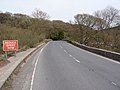
 Road cutting on A3124 - geograph.org.uk - 3457049.jpg 1,024 × 768; 245 KB
-
 Road past Deep Moor - geograph.org.uk - 649193.jpg 480 × 640; 72 KB
-
 Rootball of a fallen tree, RHS Rosemoor - geograph.org.uk - 4886105.jpg 1,200 × 1,600; 558 KB
-
 Rosemoor - geograph.org.uk - 6008828.jpg 1,024 × 678; 823 KB
-

-

-
 Rosemoor, RHS Garden, Apple 'Kidd's orange red' - geograph.org.uk - 5953730.jpg 6,811 × 4,541; 7.42 MB
-
 Rosemoor, RHS Garden, Apple 'Lord Lambourne' - geograph.org.uk - 5953732.jpg 4,669 × 3,112; 3.97 MB
-

-
-
 Rosemoor, RHS Garden, Cider apple 'Tremlett's bitter' - geograph.org.uk - 5953726.jpg 4,343 × 2,896; 3.87 MB
-
 Rosemoor, RHS Garden, Greenhouse housing mainly peppers - geograph.org.uk - 5953738.jpg 7,134 × 4,756; 7.72 MB
-
 Rosemoor, RHS Garden, Greenhouse housing mainly peppers 1 - geograph.org.uk - 5953743.jpg 6,079 × 4,052; 7.48 MB
-

-
 Rosemoor, RHS Garden, Model Garden 1 - geograph.org.uk - 5953750.jpg 5,714 × 3,808; 7.25 MB
-
 Rosemoor, RHS Garden, Model Garden 2 - geograph.org.uk - 5953752.jpg 6,015 × 4,012; 7.07 MB
-
 Rosemoor, RHS Garden, Mr McGregor's Garden 1 - geograph.org.uk - 5953762.jpg 5,826 × 3,884; 6.81 MB
-
 Rosemoor, RHS Garden, Mr McGregor's Garden 2 - geograph.org.uk - 5953765.jpg 6,556 × 4,370; 6.78 MB
-
 Rosemoor, RHS Garden, Mr McGregor's Garden 3 - geograph.org.uk - 5953766.jpg 6,111 × 4,074; 7.39 MB
-
 Rosemoor, RHS Garden, Stream Garden and Rock Gully 1 - geograph.org.uk - 5953753.jpg 6,661 × 4,441; 7.48 MB
-
 Rosemoor, RHS Garden, Stream Garden and Rock Gully 2 - geograph.org.uk - 5953756.jpg 5,567 × 3,712; 7.09 MB
-
 Rosemoor, RHS Garden, Stream Garden and Rock Gully 3 - geograph.org.uk - 5953757.jpg 5,886 × 3,924; 7.41 MB
-
 Rosemoor, RHS Garden, The Melon Tunnel (detail) - geograph.org.uk - 5953747.jpg 6,618 × 4,412; 5.21 MB
-
 Rosemoor, RHS Garden, The Melon Tunnel - geograph.org.uk - 5953746.jpg 6,849 × 4,566; 7.76 MB
-
 Rosemoor, RHS Garden, The Queen Mother's Rose Garden 1 - geograph.org.uk - 5953705.jpg 6,655 × 4,437; 6.22 MB
-
 Rosemoor, RHS Garden, The Queen Mother's Rose Garden 2 - geograph.org.uk - 5953708.jpg 6,624 × 4,416; 7.28 MB


.jpg)


.jpg)


_meeting_hall,_Rosemoor_RHS_Garden_-_geograph.org.uk_-_5477885.jpg)
_on_the_river_Torridge_-_geograph.org.uk_-_1822951.jpg)


_-_geograph.org.uk_-_5953747.jpg)


