Category:St Enoder
Jump to navigation
Jump to search
village in Cornwall, England, UK  Eglwys Sant Enoder, St Enoder | |||||
| Upload media | |||||
| Instance of | |||||
|---|---|---|---|---|---|
| Location | Cornwall, South West England, England | ||||
| Population |
| ||||
 | |||||
English: St. Enoder is a village and parish in mid- Cornwall, United Kingdom. St Enoder was the birthplace of John Trevisa.
Subcategories
This category has the following 12 subcategories, out of 12 total.
B
- Black Cross, Cornwall (2 F)
- Blue Anchor, Cornwall (2 F)
- Brighton, Cornwall (1 F)
C
- Chapel Town, Cornwall (5 F)
F
- Fraddon (14 F)
I
P
- Penhale (4 F)
S
- St Enoder War Memorial (1 F)
T
- Troan (1 F)
Media in category "St Enoder"
The following 200 files are in this category, out of 223 total.
(previous page) (next page)-
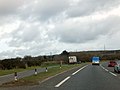
 A30 near Ruthvoes - geograph.org.uk - 4037660.jpg 640 × 408; 44 KB
-
 A30 near St Enoder - geograph.org.uk - 1864968.jpg 640 × 464; 92 KB
-
 A30 south of Polmenna Farm - geograph.org.uk - 3184024.jpg 3,648 × 2,736; 1.22 MB
-

-

-
 A30 Westbound, A39 Sliproad - geograph.org.uk - 3018130.jpg 640 × 480; 57 KB
-

-
 A30 Westbound, Turning For A3058 - geograph.org.uk - 3018139.jpg 532 × 640; 43 KB
-
 A3058 bridge at Summercourt over A30 - geograph.org.uk - 4037677.jpg 640 × 396; 47 KB
-
 A392 near Halloon - geograph.org.uk - 1907791.jpg 640 × 474; 105 KB
-
 A392 near Halloon - geograph.org.uk - 1907808.jpg 640 × 457; 88 KB
-
 An Empty Cattle Feeding Station - geograph.org.uk - 228330.jpg 640 × 427; 93 KB
-
 Approaching exit for services - geograph.org.uk - 4037669.jpg 640 × 346; 40 KB
-

-
 Approaching Halloon Crossing - geograph.org.uk - 1907719.jpg 640 × 432; 76 KB
-
 Approaching St Columb Road - geograph.org.uk - 1907687.jpg 640 × 480; 100 KB
-
 Arriving at St Columb Road station - geograph.org.uk - 3019828.jpg 640 × 429; 100 KB
-
 B3275 - geograph.org.uk - 1865023.jpg 640 × 481; 129 KB
-
 Barton Lane - geograph.org.uk - 1864333.jpg 640 × 480; 145 KB
-
 Barton Lane nr Trevuzza - geograph.org.uk - 3020096.jpg 640 × 427; 96 KB
-
 Barton Lane, Fraddon - geograph.org.uk - 1906981.jpg 640 × 426; 67 KB
-
 Bodanna Farm.jpg 640 × 427; 94 KB
-

-

-

-
 Bridleway near Fraddon - geograph.org.uk - 1864301.jpg 480 × 640; 140 KB
-
 Buildings near Seaview Terrace - geograph.org.uk - 5427618.jpg 3,063 × 1,926; 1.03 MB
-
 Bullocks in Valley-bottom Pasture - geograph.org.uk - 228277.jpg 640 × 426; 99 KB
-
 Burthy china clay quarry and trig point - geograph.org.uk - 3194177.jpg 1,024 × 679; 132 KB
-
 Carnego Lane - geograph.org.uk - 4307525.jpg 800 × 531; 124 KB
-
 Carrick , House - geograph.org.uk - 3381960.jpg 4,058 × 2,444; 2.74 MB
-
 Carrick , Road Junction - geograph.org.uk - 3381957.jpg 4,106 × 2,542; 3.4 MB
-
 Carrick , Seaview Terrace - geograph.org.uk - 3381965.jpg 4,008 × 2,318; 2.61 MB
-
 Carrick , The A30 - geograph.org.uk - 3381952.jpg 4,082 × 2,494; 2.65 MB
-

-
 Cattle Grazing - geograph.org.uk - 229859.jpg 640 × 427; 103 KB
-
 Cattle grazing - geograph.org.uk - 31766.jpg 640 × 480; 128 KB
-
 Cattle, Halloon Farm - geograph.org.uk - 1907795.jpg 640 × 480; 96 KB
-
 China Clay spoil heap near Seaview Terrace - geograph.org.uk - 5268369.jpg 3,072 × 2,048; 1.35 MB
-

-
 Cornish Lane nr Luke Shop - geograph.org.uk - 3020066.jpg 640 × 457; 111 KB
-
 Cornwall , Countryside Scenery - geograph.org.uk - 5387148.jpg 6,000 × 4,000; 7.59 MB
-
 Cornwall , Countryside Scenery - geograph.org.uk - 5387150.jpg 6,000 × 4,000; 7.09 MB
-
 Cornwall , Grassy Field - geograph.org.uk - 5385797.jpg 5,382 × 3,588; 4.73 MB
-
 Cornwall , The A30 - geograph.org.uk - 4612166.jpg 4,288 × 2,848; 4.37 MB
-
 Cornwall , The A30 - geograph.org.uk - 4612170.jpg 4,288 × 2,848; 4.38 MB
-
 Cornwall , The A30 - geograph.org.uk - 4612172.jpg 4,288 × 2,848; 4.87 MB
-
 Cornwall , The A30 - geograph.org.uk - 4612177.jpg 4,288 × 2,848; 4.39 MB
-
 Cornwall , The A30 - geograph.org.uk - 4612184.jpg 4,288 × 2,848; 4.79 MB
-
 Cornwall , The A30 - geograph.org.uk - 4612187.jpg 4,288 × 2,848; 5.32 MB
-
 Cornwall , The A30 - geograph.org.uk - 4612195.jpg 4,288 × 2,848; 5.08 MB
-
 Cornwall , The A30 - geograph.org.uk - 4612198.jpg 4,288 × 2,848; 5.42 MB
-
 Cornwall , The A30 - geograph.org.uk - 4612202.jpg 4,209 × 2,795; 5.24 MB
-
 Cornwall , The A30 - geograph.org.uk - 4612204.jpg 3,809 × 2,530; 4.72 MB
-
 Cornwall , The A30 - geograph.org.uk - 4612206.jpg 4,288 × 2,848; 5.24 MB
-
 Cornwall , The A30 - geograph.org.uk - 4612214.jpg 4,288 × 2,848; 5 MB
-
 Cornwall , The A30 - geograph.org.uk - 4612215.jpg 4,288 × 2,848; 5.42 MB
-
 Cornwall , The A30 - geograph.org.uk - 4612218.jpg 4,288 × 2,848; 4.23 MB
-
 Cornwall , The A30 - geograph.org.uk - 4612221.jpg 4,288 × 2,848; 4.76 MB
-
 Cornwall , The A30 - geograph.org.uk - 4612222.jpg 4,288 × 2,848; 4.79 MB
-
 Cornwall , The A30 - geograph.org.uk - 5385795.jpg 6,000 × 4,000; 7.04 MB
-
 Cornwall , The A30 - geograph.org.uk - 5385796.jpg 5,560 × 3,707; 5.87 MB
-
 Cornwall , The A39 - geograph.org.uk - 4612178.jpg 4,288 × 2,848; 4.55 MB
-

-
 Cottages by the B3275 - geograph.org.uk - 1865037.jpg 640 × 480; 78 KB
-
 Country lane south of Retyn Farm - geograph.org.uk - 2425210.jpg 640 × 480; 121 KB
-
 Country road near Goonabarn - geograph.org.uk - 4307503.jpg 800 × 531; 147 KB
-
 Crossroads in Summercourt - geograph.org.uk - 2618042.jpg 640 × 480; 73 KB
-
 Farm road and pasture, St Enoder - geograph.org.uk - 6144466.jpg 1,024 × 768; 197 KB
-
 Farm road to Benallack - geograph.org.uk - 1865044.jpg 640 × 480; 116 KB
-
 Farm track to Ennis Barton - geograph.org.uk - 1864495.jpg 640 × 365; 51 KB
-
 Farmland at Summercourt - geograph.org.uk - 4303318.jpg 1,024 × 680; 168 KB
-
 Farmland near Goenrounsen Farm - geograph.org.uk - 4307481.jpg 800 × 531; 126 KB
-
 Farmland near Goonabarn - geograph.org.uk - 4307495.jpg 1,024 × 680; 272 KB
-
 Farmland near Mitchell - geograph.org.uk - 4304208.jpg 800 × 531; 140 KB
-
 Field at Troan - geograph.org.uk - 1864716.jpg 640 × 432; 88 KB
-
 Field beside Boswallow Farm - geograph.org.uk - 4303322.jpg 1,024 × 680; 203 KB
-
 Field by the A30 - geograph.org.uk - 1864977.jpg 640 × 480; 112 KB
-
 Field near Troan - geograph.org.uk - 1864734.jpg 640 × 480; 96 KB
-
 Field near Troan - geograph.org.uk - 1864761.jpg 640 × 443; 85 KB
-
 Field south of Troan - geograph.org.uk - 1864902.jpg 640 × 480; 106 KB
-
 Field west of St Enoder - geograph.org.uk - 1864932.jpg 640 × 465; 83 KB
-
 Fields and trees at Penhale - geograph.org.uk - 1863963.jpg 640 × 428; 92 KB
-
 Fields near Carworgie Manor - geograph.org.uk - 1907787.jpg 640 × 433; 90 KB
-
 Fieldside trees, St Enoder - geograph.org.uk - 1864963.jpg 640 × 480; 103 KB
-
 Footbridge over A30 at Fraddon - geograph.org.uk - 3324708.jpg 1,024 × 768; 448 KB
-
-
 Footbridge over A30 near Toldish - geograph.org.uk - 3324722.jpg 1,024 × 768; 449 KB
-
 Footpath at St Columb Road - geograph.org.uk - 1907627.jpg 480 × 640; 94 KB
-
 Fraddon Biogas Plant, Cornwall - geograph.org.uk - 5291756.jpg 1,917 × 1,080; 276 KB
-
 Fraddon Biogas Plant, Cornwall - geograph.org.uk - 5291762.jpg 1,920 × 1,080; 207 KB
-
 Fraddon Millennium Green - geograph.org.uk - 1906944.jpg 640 × 425; 90 KB
-
 Houses at Fraddon - geograph.org.uk - 1907127.jpg 640 × 480; 68 KB
-
 Indian Queens Preaching Pit - geograph.org.uk - 3642332.jpg 1,024 × 683; 1.04 MB
-
 Indian Queens Preaching Pit - geograph.org.uk - 3642340.jpg 1,024 × 683; 964 KB
-
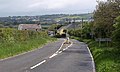
 Junction with the A30 at Summercourt - geograph.org.uk - 2618028.jpg 640 × 480; 67 KB
-
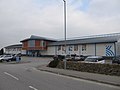
 Kingsley Shopping Village - geograph.org.uk - 1235658.jpg 640 × 480; 59 KB
-
 Kingsley Village - geograph.org.uk - 1906876.jpg 640 × 480; 89 KB
-
 Kingsley Village retail park Penhale, Cornwall - geograph.org.uk - 3616926.jpg 1,024 × 768; 134 KB
-
 Kingsley Village, Penhale - geograph.org.uk - 3394124.jpg 2,816 × 2,112; 1.2 MB
-
 Kingsley Village, Penhale - geograph.org.uk - 5139844.jpg 640 × 480; 48 KB
-
 Lane and field entrance, Troan - geograph.org.uk - 1864843.jpg 640 × 480; 112 KB
-
 Lane near Chytane Wood - geograph.org.uk - 1865019.jpg 640 × 480; 147 KB
-
 Lane, St Enoder - geograph.org.uk - 6144467.jpg 1,024 × 768; 308 KB
-
 Lane, Toldish - geograph.org.uk - 1908137.jpg 498 × 640; 90 KB
-
 Lane, Trefullock Moor - geograph.org.uk - 1865009.jpg 640 × 480; 149 KB
-
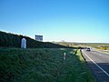
 Lay-by on A30 near Penhale - geograph.org.uk - 3324686.jpg 1,024 × 768; 460 KB
-
 Layby on A30 west near Indian Queens - geograph.org.uk - 3611628.jpg 1,024 × 768; 105 KB
-

-
 Luke's Shop - geograph.org.uk - 2864130.jpg 800 × 600; 363 KB
-
 Meadow, Trevarren - geograph.org.uk - 1907908.jpg 640 × 480; 101 KB
-
 Milestone and vacant site, Toldish - geograph.org.uk - 1908148.jpg 640 × 480; 87 KB
-
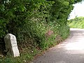
 Milestone by Parka Road - geograph.org.uk - 1907197.jpg 640 × 475; 108 KB
-
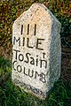
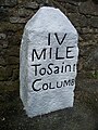
 Milestone, B3275 - geograph.org.uk - 1865032.jpg 480 × 640; 118 KB
-
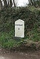
 Milestone, Fraddon - geograph.org.uk - 1906972.jpg 480 × 640; 110 KB
-
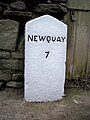
 Milestone, Penhale - geograph.org.uk - 1864062.jpg 480 × 640; 108 KB
-
 Milestone, Trevarren - geograph.org.uk - 1907897.jpg 640 × 480; 126 KB
-
 MilestoneParkaRoad.jpg 3,985 × 5,978; 15.93 MB
-

-
 Newquay Road, St Columb Road - geograph.org.uk - 1907714.jpg 640 × 480; 89 KB
-
 Old A30 - geograph.org.uk - 1864992.jpg 640 × 384; 73 KB
-
 Old Milestone by the A30 - geograph.org.uk - 5623566.jpg 430 × 640; 85 KB
-
-
 Old Milestone by the A3058 - geograph.org.uk - 5623447.jpg 542 × 800; 344 KB
-
-

-

-

-

-

-
 Old Milestone by the former A30, Penhale - geograph.org.uk - 5623563.jpg 480 × 640; 142 KB
-

-
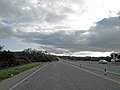
 On the A30 - geograph.org.uk - 4189082.jpg 4,000 × 2,664; 5.88 MB
-
 Orchids, Halloon - geograph.org.uk - 1907860.jpg 640 × 451; 120 KB
-

-
 Parka Mine - geograph.org.uk - 1907426.jpg 640 × 462; 94 KB
-
 Parka Road - geograph.org.uk - 1907368.jpg 640 × 453; 76 KB
-
 Parka Road entering Fraddon - geograph.org.uk - 1907168.jpg 640 × 480; 94 KB
-
-
 Pasture, St Enoder - geograph.org.uk - 6144464.jpg 1,024 × 768; 232 KB
-
 Pasture, St Enoder - geograph.org.uk - 6144465.jpg 1,024 × 768; 249 KB
-
 Penhale Cottages - geograph.org.uk - 1864051.jpg 640 × 387; 56 KB
-
 Potatoes near St Columb Road - geograph.org.uk - 1907730.jpg 640 × 480; 121 KB
-
 Power lines crossing the A30 at Fraddon - geograph.org.uk - 3324700.jpg 1,024 × 768; 465 KB
-
 Preaching Pit - geograph.org.uk - 1592671.jpg 640 × 480; 111 KB
-
 Pylons viewed from Carnego Lane - geograph.org.uk - 4303317.jpg 1,024 × 680; 169 KB
-

-
 Restormel , A39 and Wind Farm - geograph.org.uk - 2494039.jpg 4,274 × 2,826; 3.43 MB
-
 Restormel , A39 Roundabout - geograph.org.uk - 2494014.jpg 4,284 × 2,840; 4.13 MB
-
 Restormel , A39 under the A30 - geograph.org.uk - 2607120.jpg 4,288 × 2,848; 4.54 MB
-
 Restormel , The A30 - geograph.org.uk - 2510994.jpg 4,222 × 2,744; 3.7 MB
-
 Restormel , The A30 - geograph.org.uk - 2607121.jpg 4,288 × 2,848; 4.62 MB
-
 Restormel , The A30 - geograph.org.uk - 2817552.jpg 4,288 × 2,848; 3.98 MB
-
 Restormel , The A30 - geograph.org.uk - 2817553.jpg 4,288 × 2,848; 3.83 MB
-
 Restormel , The A30 - geograph.org.uk - 3381936.jpg 4,288 × 2,848; 4.47 MB
-
 Restormel , The A30 - geograph.org.uk - 3381948.jpg 3,796 × 2,462; 2.5 MB
-
 Restormel , The A39 - geograph.org.uk - 2494018.jpg 4,174 × 2,664; 3.94 MB
-
 Restormel , The A39 - geograph.org.uk - 2607117.jpg 4,288 × 2,848; 4.98 MB
-
 Restormel , The A39 - geograph.org.uk - 2607118.jpg 4,288 × 2,848; 5.03 MB
-
 Retyn Farm - geograph.org.uk - 2425191.jpg 640 × 480; 98 KB
-
 Road from Penhale Roundabout - geograph.org.uk - 1863944.jpg 640 × 480; 72 KB
-
 Road junction ahead - geograph.org.uk - 4179083.jpg 4,000 × 2,664; 5.19 MB
-
 Road junction near Resurrance Farm - geograph.org.uk - 4307515.jpg 800 × 531; 152 KB
-
 Road past Seaview Terrace - geograph.org.uk - 5268345.jpg 3,072 × 2,048; 1.21 MB
-
 Road to Kingsley Village - geograph.org.uk - 5268334.jpg 3,072 × 2,048; 1.33 MB
-
 Road to Trevarren - geograph.org.uk - 1907877.jpg 480 × 640; 108 KB
-
 Road, St Enoder - geograph.org.uk - 6144468.jpg 1,024 × 768; 226 KB
-
 School Road - geograph.org.uk - 1865003.jpg 640 × 480; 98 KB
-
-
 Silage bales in a field - geograph.org.uk - 4303327.jpg 1,024 × 680; 284 KB
-
 Slip road from A30 eastbound at Indian Queens - geograph.org.uk - 3324714.jpg 1,024 × 768; 464 KB
-
 St Austell Street, Summercourt - geograph.org.uk - 5926902.jpg 4,000 × 3,000; 4.71 MB
-
 St Columb Major , A392 - geograph.org.uk - 6305401.jpg 6,000 × 4,000; 6.76 MB
-
 St Columb Major , A392 - geograph.org.uk - 6305402.jpg 6,000 × 4,000; 6.98 MB
-
 St Columb Major , A392 - geograph.org.uk - 6305403.jpg 6,000 × 4,000; 7.34 MB
-
 St Columb Major , A392 - geograph.org.uk - 6305417.jpg 6,000 × 4,000; 6.16 MB
-
 St Columb Road - geograph.org.uk - 1907702.jpg 640 × 410; 57 KB
-
 St Columb Road Railway Station - geograph.org.uk - 5748310.jpg 1,024 × 751; 142 KB
-
 St Columb Road Station - geograph.org.uk - 6203316.jpg 640 × 480; 64 KB
-
 St Dennis Junction - geograph.org.uk - 3256555.jpg 800 × 531; 69 KB
-
 St Dennis Junction again - geograph.org.uk - 3256630.jpg 536 × 800; 76 KB
-
 St Enoder , A30 - geograph.org.uk - 6305394.jpg 6,000 × 4,000; 7.36 MB
-
 St Enoder , A30 - geograph.org.uk - 6305395.jpg 6,000 × 4,000; 5.61 MB
-
 St Enoder , A30 - geograph.org.uk - 6305397.jpg 6,000 × 4,000; 6.91 MB
-
 St Enoder , A392 - geograph.org.uk - 6305399.jpg 6,000 × 4,000; 7.27 MB
-
 St Enoder , Roadside - geograph.org.uk - 6305396.jpg 6,000 × 4,000; 5.77 MB
-
 St Enoder , Track - geograph.org.uk - 6305400.jpg 6,000 × 4,000; 7 MB
-
 St Enoder - geograph.org.uk - 1864953.jpg 640 × 431; 79 KB
-
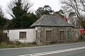 St Enoder Tollhouse, St Austell Road, Brighton (geograph 6076524).jpg 640 × 423; 150 KB
-

-
 St. Columb Road railway station, Cornwall - geograph.org.uk - 5119493.jpg 1,600 × 1,200; 363 KB
-
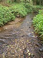
 Stream below Mill Ennis - geograph.org.uk - 1864477.jpg 640 × 480; 148 KB
-
 Stream junction northeast of Troan - geograph.org.uk - 1864507.jpg 480 × 640; 137 KB
-
 Stream near Mill Ennis - geograph.org.uk - 1864432.jpg 480 × 640; 143 KB
-
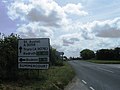 Summercourt entrance sign - geograph.org.uk - 2425232.jpg 640 × 480; 51 KB
-
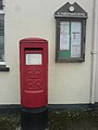 Summercourt Post office box.jpg 1,224 × 1,632; 236 KB
-
 The A30 - geograph.org.uk - 4179092.jpg 3,204 × 1,950; 3.15 MB
-
 The A30 - geograph.org.uk - 4179097.jpg 4,000 × 2,664; 4.26 MB
-
 The A30 - geograph.org.uk - 4179098.jpg 4,000 × 2,664; 5.13 MB
-
 The A30 - geograph.org.uk - 4179101.jpg 4,000 × 2,664; 4.18 MB


_-_geograph.org.uk_-_5090616.jpg)


.jpg)


