Category:St Benet's Level Mill
Jump to navigation
Jump to search
windpump in Horning, North Norfolk, England, UK  | |||||
| Upload media | |||||
| Instance of | |||||
|---|---|---|---|---|---|
| Location | Horning, North Norfolk, Norfolk, East of England, England | ||||
| Heritage designation |
| ||||
 | |||||
This is a category about listed building number 1171700. |
Media in category "St Benet's Level Mill"
The following 12 files are in this category, out of 12 total.
-
 Norfolk broads.jpg 300 × 225; 13 KB
-
 Sailing through Thurne. Norfolk - geograph.org.uk - 274400.jpg 481 × 640; 40 KB
-
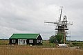
 St Benet's Level Drainage Mill - geograph.org.uk - 194350.jpg 480 × 360; 106 KB
-
 St Benet's Level Drainage Mill - geograph.org.uk - 3973538.jpg 640 × 421; 56 KB
-
 St Benet's Level drainage windpump - geograph.org.uk - 4653094.jpg 640 × 617; 322 KB
-
 St Benet's Level drainage windpump - geograph.org.uk - 4653099.jpg 640 × 602; 409 KB
-
 St Benet's Level drainage windpump - geograph.org.uk - 4653102.jpg 590 × 640; 370 KB
-

-
 St Benet's Level Mill.jpg 419 × 640; 59 KB
-
 St Benets Level Windpump.jpg 1,920 × 1,080; 1.73 MB
-
 St. Benet's level wind driven drainage pump (mill) - geograph.org.uk - 5667596.jpg 2,592 × 3,456; 3.13 MB
-
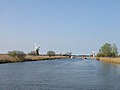 View along the River Thurne - geograph.org.uk - 402682.jpg 640 × 480; 26 KB


_-_geograph.org.uk_-_5667596.jpg)
