Category:St Andrew's church, Melcombe Horsey
Jump to navigation
Jump to search
| Object location | | View all coordinates using: OpenStreetMap |
|---|
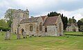
Grade I listed church in Melcombe Horsey, Dorset, England, UK  | |||||
| Upload media | |||||
| Instance of | |||||
|---|---|---|---|---|---|
| Dedicated to | |||||
| Location | Melcombe Horsey, Dorset, South West England, England | ||||
| Diocese | |||||
| Heritage designation |
| ||||
| Inception |
| ||||
| Religion or worldview | |||||
 | |||||
Subcategories
This category has the following 3 subcategories, out of 3 total.
Media in category "St Andrew's church, Melcombe Horsey"
The following 21 files are in this category, out of 21 total.
-

-

-

-
 Bingham's Melcombe Church (St. Andrew) (48643137213).jpg 6,000 × 4,000; 6.46 MB
-
 Bingham's Melcombe Church (St. Andrew) (48643140893).jpg 6,000 × 4,000; 6.5 MB
-
 Bingham's Melcombe Church (St. Andrew) (48643141113).jpg 6,000 × 4,000; 7.04 MB
-
 Bingham's Melcombe Church (St. Andrew) (48643497081).jpg 6,000 × 4,000; 6.61 MB
-
 Bingham's Melcombe Church (St. Andrew) (48643497356).jpg 6,000 × 4,000; 6.77 MB
-
 Church (49277482361).jpg 4,032 × 3,024; 2.91 MB
-

-
 Melcombe Horsey parish church 2015.JPG 5,184 × 3,456; 8.85 MB
-
 St Andrew's Church - geograph.org.uk - 4030253.jpg 640 × 480; 97 KB
-
 St Andrew's Church - geograph.org.uk - 4030260.jpg 640 × 480; 63 KB
-
 St Andrew's church Melcombe Horsey - geograph.org.uk - 2314678.jpg 640 × 416; 399 KB
-
 St Andrew's Church Melcombe Horsey - geograph.org.uk - 366001.jpg 640 × 480; 130 KB
-

-

-

-
 St Andrew's Church, Bingham's Melcombe.jpg 4,128 × 2,506; 8.85 MB
-
 St Andrew's, Melcombe Horsey.JPG 3,648 × 2,736; 2.59 MB
-
 St Andrews Church - geograph.org.uk - 4027675.jpg 640 × 480; 72 KB


_(48643137213).jpg)
_(48643140893).jpg)
_(48643141113).jpg)
_(48643497081).jpg)
_(48643497356).jpg)
.jpg)
,_parish_church_of_St._Andrew_-_geograph.org.uk_-_518498.jpg)


