Category:St. Walburga (Ramsdorf)
Jump to navigation
Jump to search
| Object location | | View all coordinates using: OpenStreetMap |
|---|
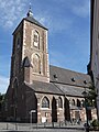
church building in Velen, North Rhine-Westphalia, Germany  | |||||
| Upload media | |||||
| Instance of | |||||
|---|---|---|---|---|---|
| Named after | |||||
| Location | Q2034024, Velen, Borken, Münster Government Region, North Rhine-Westphalia, Germany | ||||
| Architectural style | |||||
| Heritage designation | |||||
 | |||||
Media in category "St. Walburga (Ramsdorf)"
The following 8 files are in this category, out of 8 total.
-
 Altar Kirche St.Walburge Velen-Ramsdorf.jpg 4,896 × 3,672; 2.77 MB
-
 Aussenansicht Kirche St. Walburga Velen-Ramsdorf.jpg 3,672 × 4,896; 3.74 MB
-
 Innenansicht Kirche St. Walburge Velen-Ramsdorf.jpg 3,672 × 4,896; 2.31 MB
-
 Kirche St. Walburga Velen-Ramsdorf.jpg 2,994 × 3,992; 2.26 MB
-
 Ramsdorf (Velen) Lange Str. mit St. Walburga 2018.jpg 2,390 × 3,186; 1.97 MB
-
 Ramsdorf, Velen, Kirche St. Walburga.jpg 2,993 × 3,992; 7.26 MB
-
 St. Walburga Kirche in Ramsdorf.jpg 3,128 × 4,686; 11.41 MB
-
 Velen Ramsdorf Kirche St. Walburga.jpg 800 × 1,068; 279 KB


_Lange_Str._mit_St._Walburga_2018.jpg)


Categories:
- Churches in Velen
- Cultural heritage monuments in Velen
- Ramsdorf
- Saint Walpurga churches in North Rhine-Westphalia
- Churches in Dekanat Borken
- Brick Gothic churches in Kreis Borken
- Pseudobasilicas in Regierungsbezirk Münster
- Brick Gothic churches in Regierungsbezirk Münster
- Gothic churches in Regierungsbezirk Münster