Category:St. Vitus (Willmatshofen)
Jump to navigation
Jump to search
| Object location | | View all coordinates using: OpenStreetMap |
|---|
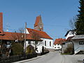
building in Fischach, Swabia, Germany  | |||||
| Upload media | |||||
| Instance of | |||||
|---|---|---|---|---|---|
| Location | Fischach, Augsburg, Swabia, Bavaria, Germany | ||||
| Street address |
| ||||
| Heritage designation | |||||
 | |||||
Bavarian cultural heritage [https://geoportal.bayern.de/denkmalatlas/searchResult.html?koid=112497&objtyp=bau&top=1 D-7-72-141-18
Media in category "St. Vitus (Willmatshofen)"
The following 3 files are in this category, out of 3 total.
-
 Fischach - Willmatshofen - Kirche v SW.JPG 3,264 × 2,448; 3.78 MB
-
 Fischach Willmatshofen03.jpg 4,272 × 2,848; 2.08 MB
-
 Willmatshofen03St. Vitus v. O..jpg 1,134 × 1,762; 1.2 MB

