Category:St. Sigismund und Walpurga (Muotathal)
Jump to navigation
Jump to search
| Object location | | View all coordinates using: OpenStreetMap |
|---|
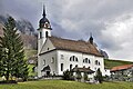
church building in Muotathal in the canton of Schwyz, Switzerland   | |||||
| Upload media | |||||
| Instance of | |||||
|---|---|---|---|---|---|
| Part of | |||||
| Location | Muotathal, Schwyz District, Schwyz, Switzerland | ||||
| Street address |
| ||||
| Heritage designation | |||||
| Inception |
| ||||
 | |||||
Media in category "St. Sigismund und Walpurga (Muotathal)"
The following 6 files are in this category, out of 6 total.
-
 2015-Muotathal-Wil.jpg 1,500 × 1,000; 1.5 MB
-
 Kirche muotathal winter.jpg 4,256 × 2,832; 1.38 MB
-
 Muotathal pfarrkirche3.jpg 719 × 600; 191 KB
-
 Muotathal pfarrkirche4.jpg 737 × 600; 200 KB
-
 Muotathal pfarrkirche5.jpg 903 × 600; 268 KB
-
 Pragel and Druesberg.JPG 3,088 × 2,320; 1.11 MB


