Category:St. Petrus (Langenhettenbach)
Jump to navigation
Jump to search
| Object location | | View all coordinates using: OpenStreetMap |
|---|
church building in Ergoldsbach, Lower Bavaria, Germany  | |||||
| Upload media | |||||
| Instance of | |||||
|---|---|---|---|---|---|
| Location | Ergoldsbach, Landshut, Lower Bavaria, Bavaria, Germany | ||||
| Street address |
| ||||
| Heritage designation | |||||
 | |||||
This is the category of the Bavarian Baudenkmal (cultural heritage monument) with the ID D-2-74-127-19 (Wikidata)
|
Media in category "St. Petrus (Langenhettenbach)"
The following 9 files are in this category, out of 9 total.
-
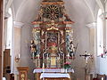 Langenhettenbach Sankt Petrus Chorraum.jpg 2,242 × 1,682; 1.12 MB
-
 Langenhettenbach Sankt Petrus Feldkreuz.jpg 2,304 × 1,728; 1.04 MB
-
 Langenhettenbach Sankt Petrus Hochaltar Auszug.jpg 2,278 × 1,708; 1.04 MB
-
 Langenhettenbach Sankt Petrus Hochaltar.jpg 2,304 × 1,728; 1.11 MB
-
 Langenhettenbach Sankt Petrus Innenraum.jpg 2,304 × 1,728; 1.19 MB
-
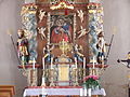
 Langenhettenbach Sankt Petrus linker Seitenaltar.jpg 2,304 × 1,728; 1.13 MB
-
 Langenhettenbach Sankt Petrus mit Dorfweiher.jpg 2,304 × 1,728; 1.64 MB
-
 Langenhettenbach Sankt Petrus rechter Seitenaltar.jpg 2,304 × 1,728; 983 KB
-
 Langenhettenbach-kirche-sankt-petrus.jpg 2,304 × 1,728; 1,008 KB


