Category:St. Niklaus (Oltingen)
Jump to navigation
Jump to search
| Object location | | View all coordinates using: OpenStreetMap |
|---|
church buildings in Oltingen in the canton of Basel-Landschaft, Switzerland  | |||||
| Upload media | |||||
| Instance of | |||||
|---|---|---|---|---|---|
| Part of | |||||
| Location | Oltingen, Sissach District, Basel-Landschaft, Switzerland | ||||
| Street address |
| ||||
| Heritage designation | |||||
 | |||||
Media in category "St. Niklaus (Oltingen)"
The following 12 files are in this category, out of 12 total.
-
 2007-Oltingen-Kirche.jpg 1,920 × 1,280; 2.9 MB
-
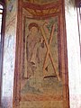 Apostel Andreas in Oltingen.jpg 3,000 × 4,000; 3.4 MB
-
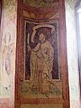 Der Heilige Bartholomäus in Oltingen.jpg 3,000 × 4,000; 2.6 MB
-
 Flucht nach Ägypten in Oltingen.jpg 3,000 × 4,000; 3.85 MB
-
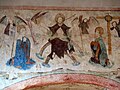 Jüngstes Gericht in Oltingen.jpg 4,000 × 3,000; 3.38 MB
-
 Kirche und Pfarrhaus in Oltingen.jpg 4,000 × 3,000; 3.87 MB
-
 Oltingen-Dorf.jpg 900 × 600; 177 KB
-
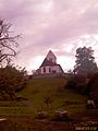
 Oltingen-Kirche.jpg 500 × 333; 77 KB
-
 Oltingen-Peghejo 753.jpg 1,600 × 1,200; 262 KB
-
 Oltingen-Preghejo 752.jpg 1,200 × 1,600; 324 KB
-
 Oltingen-Preghejo 758.jpg 1,200 × 1,600; 326 KB
-
 Reformierte Kirche St. Nikolaus.jpg 3,456 × 2,304; 1.75 MB


