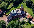
Category:St. Mariä Himmelfahrt (Dyckburg)
Jump to navigation
Jump to search
| Object location | | View all coordinates using: OpenStreetMap |
|---|
church  | |||||
| Upload media | |||||
| Instance of | |||||
|---|---|---|---|---|---|
| Named after | |||||
| Location | Münster, Münster Government Region, North Rhine-Westphalia, Germany | ||||
| Heritage designation | |||||
 | |||||
Media in category "St. Mariä Himmelfahrt (Dyckburg)"
The following 16 files are in this category, out of 16 total.
-
 Interior of Dyckburg Church, Münster 01.jpg 6,000 × 4,000; 5.28 MB
-
 Interior of Dyckburg Church, Münster 02.jpg 6,000 × 4,000; 5.3 MB
-
 Interior of Dyckburg Church, Münster 03.jpg 6,000 × 4,000; 6.29 MB
-
 Interior of Dyckburg Church, Münster 04.jpg 6,000 × 4,000; 6.72 MB
-
 Muenster Dyckburgkirche.jpg 1,728 × 2,304; 1.26 MB
-
 Muenster Dykburg 6349.jpg 3,072 × 2,048; 1.81 MB
-
 Muenster Dykburg 6354.jpg 2,048 × 3,072; 1.7 MB
-
 Muenster Dykburg 6358.jpg 3,072 × 2,048; 2.14 MB
-
 Münster, Dyckburg-Kirche -- 2014 -- 8434.jpg 5,184 × 3,456; 12.49 MB
-
 Münster, Dyckburg-Kirche -- 2014 -- 8435.jpg 5,184 × 3,456; 12.69 MB
-
 Münster, Dyckburg-Kirche -- 2014 -- 8436 -- Ausschnitt.jpg 1,872 × 1,559; 2.52 MB
-
 Münster, Dyckburg-Kirche -- 2014 -- 8436.jpg 5,184 × 3,456; 12.96 MB
-
 Münster, Dyckburg-Kirche -- 2014 -- 8437.jpg 5,184 × 3,456; 11.89 MB
-
 Münster, Dyckburg-Kirche -- 2014 -- 8438.jpg 5,184 × 3,456; 12.47 MB
-
 Münster, Dyckburg-Kirche -- 2019 -- 4243.jpg 6,720 × 4,480; 18.59 MB
-
 Organ of Dyckburg Church, Münster.jpg 5,998 × 3,553; 4.58 MB


