Category:St. Leonhard-Kapelle (Schwaam)
Jump to navigation
Jump to search
| Object location | | View all coordinates using: OpenStreetMap |
|---|
| Upload media | |||||
| Instance of | |||||
|---|---|---|---|---|---|
| Location | Schwaam, Wegberg, Heinsberg, Cologne Government Region, North Rhine-Westphalia, Germany | ||||
| Heritage designation | |||||
 | |||||
Media in category "St. Leonhard-Kapelle (Schwaam)"
The following 13 files are in this category, out of 13 total.
-
 Schwaam Kapelle 1.jpg 1,600 × 2,400; 482 KB
-
 Schwaam Kapelle 2.jpg 1,990 × 2,975; 1,006 KB
-
 Schwaam Kapelle 3.jpg 1,600 × 2,400; 391 KB
-
 Schwaam Kapelle 4.jpg 1,600 × 2,400; 341 KB
-
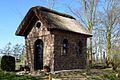
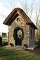 Schwaam Kapelle Ansicht.jpg 800 × 1,200; 167 KB
-
 Schwaam Kapelle Buntfenster.JPG 1,200 × 800; 149 KB
-
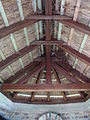 Schwaam Kapelle Dachansicht.JPG 2,304 × 3,072; 1.9 MB
-
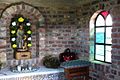
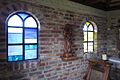 Schwaam Kapelle Innenansicht.JPG 1,200 × 800; 139 KB
-
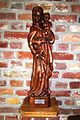
 Schwaam Kapelle Madonna.jpg 800 × 1,200; 205 KB
-
 Schwaam Kapelle Queransicht.JPG 1,200 × 800; 224 KB
-
 Schwaam Kapelle Rundfenster.JPG 800 × 1,200; 84 KB
-
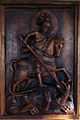
 Schwaam Kapelle St. Leonhard.jpg 800 × 1,200; 131 KB
-
 Schwaam Kapelle Wandtafel.jpg 800 × 1,200; 114 KB


