Category:St. John Lutheran complex (Nemaha County, Nebraska)
Jump to navigation
Jump to search
| Object location | | View all coordinates using: OpenStreetMap |
|---|
_3.JPG) | |||||
| Upload media | |||||
| Instance of | |||||
|---|---|---|---|---|---|
| Location |
| ||||
 | |||||
Subcategories
This category has the following 3 subcategories, out of 3 total.
Media in category "St. John Lutheran complex (Nemaha County, Nebraska)"
The following 7 files are in this category, out of 7 total.
-
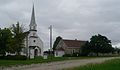 St. John Lutheran cx (Nemaha Co) 1.JPG 2,504 × 1,469; 1.03 MB
-
 St. John Lutheran cx (Nemaha Co) 2.JPG 2,445 × 1,531; 1.71 MB
-
 St. John Lutheran cx (Nemaha Co) 3.JPG 2,560 × 1,804; 1.95 MB
-
 St. John Lutheran cx (Nemaha Co) 4.JPG 2,468 × 1,629; 1.53 MB
-
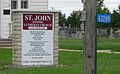 St. John Lutheran cx (Nemaha Co) address.JPG 2,188 × 1,350; 1.14 MB
-
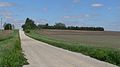 St. John Lutheran cx (Nemaha Co) from W 1.JPG 2,560 × 1,423; 1.48 MB
-
 St. John Lutheran cx (Nemaha Co) from W 2.JPG 2,560 × 1,490; 1.5 MB
_1.JPG)
_2.JPG)
_4.JPG)
_address.JPG)
_from_W_1.JPG)
_from_W_2.JPG)