Category:St. John's, Surrey
Jump to navigation
Jump to search
English: St. Johns is a village in Surrey, England located about 3km west of Woking. Neighbouring villages include Knaphill, Horsell, Goldsworth Park and Hook Heath.
suburb in Woking, Surrey, England, UK  | |||||
| Upload media | |||||
| Instance of | |||||
|---|---|---|---|---|---|
| Location | Woking, Surrey, South East England, England | ||||
| Area |
| ||||
 | |||||
Subcategories
This category has the following 2 subcategories, out of 2 total.
Media in category "St. John's, Surrey"
The following 11 files are in this category, out of 11 total.
-
 Countryliner MCB432 X432 KON and St John's Post Office bus stop.JPG 3,328 × 1,725; 1,009 KB
-
 Countryliner MCB432 X432 KON.JPG 2,567 × 1,524; 628 KB
-
 Firgrove - geograph.org.uk - 1213828.jpg 640 × 480; 112 KB
-
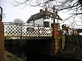 Kiln Bridge, St Johns Woking - geograph.org.uk - 668038.jpg 640 × 479; 107 KB
-
 Pond on Pond Road - geograph.org.uk - 1213888.jpg 640 × 480; 107 KB
-
 St John's - geograph.org.uk - 1213838.jpg 640 × 480; 73 KB
-
 St John's - geograph.org.uk - 1213859.jpg 480 × 640; 116 KB
-
 St John's Village - geograph.org.uk - 1213874.jpg 480 × 640; 91 KB
-
 St John's, Woking - geograph.org.uk - 1213866.jpg 640 × 480; 101 KB
-
 St Johns Lye - geograph.org.uk - 1774339.jpg 640 × 480; 150 KB
-
 St. John's Memorial Hall - geograph.org.uk - 1031667.jpg 640 × 480; 91 KB


