Category:St. Jakobus der Ältere (Rohrberg)
Jump to navigation
Jump to search
| Object location | | View all coordinates using: OpenStreetMap |
|---|
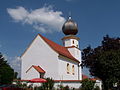
church building in Neufahrn in Niederbayern, Lower Bavaria, Germany   | |||||
| Upload media | |||||
| Instance of | |||||
|---|---|---|---|---|---|
| Location | Rohrberg, Neufahrn in Niederbayern, Landshut, Lower Bavaria, Bavaria, Germany | ||||
| Street address |
| ||||
| Heritage designation | |||||
 | |||||
Media in category "St. Jakobus der Ältere (Rohrberg)"
The following 8 files are in this category, out of 8 total.
-
 Neufahrn in Niederbayern Rohrberg St. Jakobus Empore.jpg 2,288 × 1,716; 899 KB
-
 Neufahrn in Niederbayern Rohrberg St. Jakobus Hochaltar.jpg 2,304 × 1,728; 1.06 MB
-
 Neufahrn in Niederbayern Rohrberg St. Jakobus Innenraum.jpg 2,268 × 1,700; 1.25 MB
-
 Neufahrn in Niederbayern Rohrberg St. Jakobus Kirchenpatron.jpg 2,278 × 1,708; 1.24 MB
-
 Neufahrn in Niederbayern Rohrberg St. Jakobus linker Seitenaltar.jpg 2,304 × 1,728; 1.17 MB
-
 Neufahrn in Niederbayern Rohrberg St. Jakobus rechter Seitenaltar.jpg 2,304 × 1,728; 1.09 MB
-
 Neufahrn in Niederbayern Rohrberg St. Jakobus.jpg 2,288 × 1,716; 930 KB
-
 Neufahrn-in-Niederbayern-Rohrberg-17-Kirche-Sankt-Jakobus.jpg 2,274 × 1,704; 954 KB


Categories:
- Churches in Neufahrn in Niederbayern
- Cultural heritage monuments in Neufahrn in Niederbayern
- Rohrberg (Neufahrn)
- Saint James the Greater churches in Lower Bavaria
- Filial churches in Landkreis Landshut
- Churches in Dekanat Landshut (Diocese of Regensburg)
- Baroque churches in Landkreis Landshut
- Chorturm churches in Landkreis Landshut
- Churches in Bavaria built in 1715