Category:St. Georges, Somerset
Jump to navigation
Jump to search
English: St. Georges is a civil parish and village in the unitary authority of North Somerset, England. Its population in the 2001 census was 1,214.
civil parish and village in North Somerset, England .jpg) | |||||
| Upload media | |||||
| Instance of | |||||
|---|---|---|---|---|---|
| Location | North Somerset, Somerset, South West England, England | ||||
 | |||||
Subcategories
This category has the following 2 subcategories, out of 2 total.
P
- Puxton and Worle level crossing (11 F)
Media in category "St. Georges, Somerset"
The following 57 files are in this category, out of 57 total.
-

-
 A370 underneath power lines - geograph.org.uk - 3046032.jpg 1,024 × 734; 146 KB
-
 Banwell , M5 Motorway - geograph.org.uk - 6283766.jpg 6,000 × 4,000; 4.56 MB
-
 Banwell , M5 Motorway - geograph.org.uk - 6283767.jpg 6,000 × 4,000; 4.19 MB
-

-
 Brimbleworth Farm, St Georges - geograph.org.uk - 1655956.jpg 640 × 480; 93 KB
-
 Bristol Road junction with Queen's Way - geograph.org.uk - 2935041.jpg 800 × 600; 289 KB
-
 Business by the railway line - geograph.org.uk - 5319319.jpg 640 × 426; 60 KB
-
 Cattle grazing - geograph.org.uk - 5319346.jpg 640 × 333; 40 KB
-
 Davan Caravan Ltd, St Georges - geograph.org.uk - 3040695.jpg 640 × 432; 74 KB
-
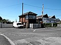 Ex Great Western signal box - geograph.org.uk - 2945587.jpg 2,048 × 1,536; 780 KB
-

-
 Field - geograph.org.uk - 5627254.jpg 640 × 426; 59 KB
-
 Field at St Georges - geograph.org.uk - 3241495.jpg 640 × 198; 20 KB
-
 Field at St Georges - geograph.org.uk - 4476410.jpg 1,920 × 1,135; 370 KB
-
 Field barn - geograph.org.uk - 5627251.jpg 640 × 388; 49 KB
-
 Field barn and cattle - geograph.org.uk - 5319341.jpg 640 × 359; 52 KB
-
 Flat grassland - geograph.org.uk - 5319353.jpg 640 × 284; 24 KB
-
 Golden Arches at St. Georges - geograph.org.uk - 1403517.jpg 640 × 480; 214 KB
-
 Goosey Lane, St Georges - geograph.org.uk - 3040722.jpg 640 × 536; 112 KB
-
 Health Centre, St Georges - geograph.org.uk - 4367624.jpg 640 × 400; 52 KB
-
 Hedgeline - geograph.org.uk - 5627255.jpg 640 × 364; 40 KB
-
 Houses by the railway line - geograph.org.uk - 5319311.jpg 640 × 472; 62 KB
-

-
 Junction 21 ahead M5 south - geograph.org.uk - 4032765.jpg 640 × 362; 31 KB
-
 Level crossing at St Georges - geograph.org.uk - 1655938.jpg 640 × 480; 68 KB
-
 Level crossing, St Georges - geograph.org.uk - 4538870.jpg 1,024 × 768; 148 KB
-
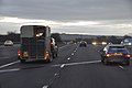
 M5 approaches Junction 20 - geograph.org.uk - 3180202.jpg 3,480 × 2,502; 1.23 MB
-
 M5 Junction 21 - geograph.org.uk - 4676397.jpg 1,928 × 1,248; 702 KB
-
 M5 near Junction 21 - geograph.org.uk - 4676408.jpg 2,256 × 1,496; 892 KB
-
 Milestone, Station Rd, St Georges - geograph.org.uk - 1655926.jpg 640 × 480; 85 KB
-
 North Somerset , Countryside Scenery - geograph.org.uk - 3722837.jpg 4,206 × 2,720; 5.77 MB
-
 North Somerset , M5 Motorway - geograph.org.uk - 5951222.jpg 6,000 × 4,000; 6.35 MB
-
 North Somerset , M5 Motorway Southbound - geograph.org.uk - 2795471.jpg 4,288 × 2,848; 4.42 MB
-
 North Somerset , The M5 Motorway - geograph.org.uk - 2392337.jpg 3,264 × 2,448; 3.19 MB
-

-
 Puxton dairy.jpg 1,366 × 820; 307 KB
-
 Railway line at St Georges - geograph.org.uk - 1655906.jpg 640 × 480; 74 KB
-
 River Banwell.jpg 640 × 480; 95 KB
-
 Riverside Close, St Georges - geograph.org.uk - 4540018.jpg 1,024 × 768; 136 KB
-
 Sliproad onto M5 at Junction 21 - geograph.org.uk - 3806784.jpg 640 × 480; 251 KB
-
 St Georges from the air (geograph 2931943).jpg 640 × 480; 153 KB
-
 The Community Centre, St Georges - geograph.org.uk - 382743.jpg 640 × 480; 113 KB
-
 The River Banwell at St Georges - geograph.org.uk - 1655963.jpg 640 × 480; 66 KB
-

-
 The Woolpack Inn, St Georges - geograph.org.uk - 382731.jpg 640 × 480; 70 KB
-
 The Woolpack Inn, Worle - geograph.org.uk - 2518453.jpg 640 × 397; 64 KB
-

-
 Welcome to Weston-super-Mare - geograph.org.uk - 3040559.jpg 640 × 424; 74 KB
-
 Weston-super-Mare MMB 22 St Georges News.jpg 1,728 × 2,304; 954 KB
-
 Weston-super-Mare MMB 28 Puxton and Worle LC 43XXX.jpg 2,304 × 1,728; 688 KB
-
 Willow Close houses, St Georges - geograph.org.uk - 3040775.jpg 640 × 480; 67 KB
-
 Woolpack Inn, St Georges - geograph.org.uk - 4538864.jpg 1,024 × 812; 167 KB
-

-
 Approaching M5 Junction 21 - geograph.org.uk - 1450727.jpg 640 × 480; 132 KB
-
 Brewery. - geograph.org.uk - 1519959.jpg 640 × 480; 71 KB
-
 Fields from St Georges - geograph.org.uk - 84433.jpg 640 × 480; 86 KB


