Category:St. George, Utah
Jump to navigation
Jump to search
city in Washington County, Utah, United States | |||||
| Upload media | |||||
| Instance of | |||||
|---|---|---|---|---|---|
| Named after | |||||
| Location | Washington County, Utah | ||||
| Located in or next to body of water | |||||
| Head of government |
| ||||
| Inception |
| ||||
| Population |
| ||||
| Area |
| ||||
| Elevation above sea level |
| ||||
| official website | |||||
 | |||||
English: Media related to St. George, Utah, a city located in southern Washington County in the southwestern part of Utah, United States on the Utah-Arizona border, near the tri-state junction of Utah, Nevada and Arizona.
Subcategories
This category has the following 13 subcategories, out of 13 total.
Media in category "St. George, Utah"
The following 153 files are in this category, out of 153 total.
-
1914 D Sugarloaf.jpg 540 × 405; 45 KB
-
1st Gate.JPG 512 × 341; 41 KB
-
2013-09-21 11 19 21 View north along Interstate 15 in Utah near milepost 5.5.JPG 3,264 × 2,448; 2.39 MB
-
2017.05.07 12.11.29 IMG 0619 - Flickr - andrey zharkikh.jpg 5,184 × 3,888; 2.51 MB
-
Airfield, Municipal Airport (St George, Utah).jpg 1,526 × 600; 161 KB
-
Arizona State Route 389 map.svg 1,001 × 586; 89 KB
-
Atop the 'Dixie Sugarloaf' on the outskirts of St. George, Utah - (22392246237).jpg 8,253 × 5,502; 39.83 MB
-
Atop the 'Dixie Sugarloaf' on the outskirts of St. George, Utah - (22392273488).jpg 7,646 × 5,097; 29.35 MB
-
B-DogPractice.jpg 2,816 × 2,112; 2.58 MB
-
BL-15 South and UT-34 West Shields - panoramio.jpg 1,600 × 1,200; 380 KB
-
BL-15-UT-34 Dual Signage - panoramio.jpg 1,600 × 1,200; 585 KB
-
BL-15-UT-34 Signage - panoramio.jpg 1,600 × 1,200; 438 KB
-
BL-15-UT-34, Exit 8 off of I-15 in St. George, UT - panoramio.jpg 1,600 × 1,200; 316 KB
-
Bronze Statue on Main St.jpg 1,280 × 860; 150 KB
-
Brooks the Bison.jpg 4,032 × 3,024; 5.23 MB
-
California Fan Palms, St. George, Utah.jpg 1,280 × 960; 363 KB
-
Canary Palm.jpg 960 × 944; 157 KB
-
City Hall (St George, Utah).jpg 1,533 × 891; 252 KB
-
Classic NMC T-shirt (4708302046).jpg 2,376 × 1,581; 1.17 MB
-
CtyMapWashington.png 936 × 689; 35 KB
-
Date Palm in St. George Utah.jpg 720 × 960; 82 KB
-
DIXIE writtten over 1914.jpg 540 × 405; 61 KB
-
Downtown st george utah.jpg 1,000 × 750; 270 KB
-
Driving Utah, I-15 N near St. George 2014 (29311466936).jpg 2,800 × 1,208; 1.32 MB
-
Dtn st george.jpg 800 × 533; 149 KB
-
East UT-34 - panoramio.jpg 1,600 × 1,200; 469 KB
-
East UT-34 Shield (St. George Blvd.) - panoramio.jpg 1,600 × 1,200; 544 KB
-
Echinocactus grusonii, Red Hills Desert Garden, St. George, UT, USA.jpg 4,752 × 3,168; 6.89 MB
-
EM ME on the mountain at St. George Airport (2190915657).jpg 2,560 × 1,920; 1.66 MB
-
EM ST. GEORGE, UTAH (2624012794).jpg 3,872 × 2,592; 4.42 MB
-
EM St. George, Utah (2820719164).jpg 3,872 × 2,592; 3.26 MB
-
END UT-34 at UT-18, TO I-15 - panoramio.jpg 1,600 × 1,200; 666 KB
-
END UT-34 Shield - panoramio.jpg 1,600 × 1,200; 455 KB
-
END UT-8, UT-18, and TO I-15 Shields - panoramio.jpg 1,600 × 1,200; 530 KB
-
Entrance to St George Narrows dyeclan.com - panoramio.jpg 2,448 × 3,264; 3.64 MB
-
Erastus Snow - Flickr - brewbooks.jpg 3,264 × 2,340; 3.37 MB
-
Eubrontes01.JPG 1,000 × 1,450; 475 KB
-
Evening, St. George, Utah.jpg 15,651 × 7,905; 92.91 MB
-
Fiery Sandstone-2.jpg (11226288466).jpg 2,783 × 1,077; 3.37 MB
-
Fire department (St George, Utah).jpg 1,439 × 771; 192 KB
-
First Westbound UT-34 Shield - panoramio.jpg 1,600 × 1,200; 495 KB
-
George Washington Academy.jpg 2,225 × 1,669; 176 KB
-
Hills by Hwy 18 - panoramio.jpg 1,280 × 960; 334 KB
-
Honeymoon Trail - Flickr - brewbooks.jpg 1,297 × 2,830; 1.58 MB
-
Lane Turnings to I-15 - panoramio.jpg 1,600 × 1,200; 352 KB
-
Larrea tridentata, Red Hills Desert Garden, St. George, UT, USA.jpg 4,752 × 3,168; 5.09 MB
-
Main Street Utah.JPG 800 × 534; 195 KB
-
Matt Keddington climbing the 'D'..jpg 420 × 420; 40 KB
-
Mex fan.jpg 720 × 960; 103 KB
-
Milne Motor Court, St. George, Utah (76715).jpg 3,325 × 2,085; 2.76 MB
-
Mountain Meadows BHoU-p550.png 1,760 × 3,126; 156 KB
-
Municipal Airport Passenger Terminal (St George, Utah).jpg 1,005 × 944; 188 KB
-
My Public Lands Magazine, Spring 2015 (16008925623).jpg 1,140 × 760; 185 KB
-
My Public Lands Magazine, Spring 2015 (16421393557).jpg 1,249 × 803; 58 KB
-
My Public Lands Magazine, Spring 2015 (16602719706).jpg 1,004 × 760; 113 KB
-
My Public Lands Magazine, Spring 2015 (16627591481).jpg 1,245 × 760; 120 KB
-
North UT-18 after UT-34 - panoramio.jpg 1,600 × 1,200; 438 KB
-
Overlook of Main St. St. George.jpg 1,280 × 857; 186 KB
-
Overlook of St. George, Utah.jpg 1,800 × 598; 446 KB
-
Panorama of St.George Utah.jpg 4,336 × 944; 1.2 MB
-
Photo of St.George Utah.jpg 4,128 × 3,096; 1.69 MB
-
Pindo Palm. St. George Utah.jpg 715 × 960; 117 KB
-
Pine Valley Mountains St George banner.jpg 2,100 × 300; 323 KB
-
Pine Valley Mountains.jpg 5,360 × 2,100; 3.73 MB
-
Pioneer Park, St. George Utah.jpg 1,836 × 3,264; 1.72 MB
-
Pioneerhomenearstgeorge.jpg 1,280 × 1,024; 377 KB
-
Police department (St George, Utah).jpg 1,488 × 882; 181 KB
-
Ponte exa.png 160 × 160; 22 KB
-
Punchbowl Dome 1.jpg 2,400 × 1,600; 799 KB
-
Race and ethnicity 2020 St. George, UT.png 2,400 × 2,404; 1.2 MB
-
Rainy Day in St. George.jpg 2,340 × 4,160; 2.43 MB
-
Seal of the City of St. George.png 350 × 97; 9 KB
-
Shinob Kibe seen from St. George, Utah (7054477525).jpg 1,500 × 1,000; 1.3 MB
-
Solar Eclipse Flyer (7176373810).jpg 1,275 × 1,650; 192 KB
-
Souhern Utah Wild Palm.jpg 720 × 960; 104 KB
-
SOUTH UT-18 TO I-15 Shields - panoramio.jpg 1,600 × 1,200; 317 KB
-
Southern Utah map c. 1857, Bancroft p. 550.PNG 332 × 563; 43 KB
-
St George panorama.jpg 10,460 × 1,900; 6.83 MB
-
St George Utah city limits 1.jpg 2,400 × 1,600; 619 KB
-
St George Utah from east 1.jpg 2,400 × 1,600; 638 KB
-
St George Utah River Road area 1.jpg 2,400 × 1,600; 791 KB
-
St George Utah south 1.jpg 2,400 × 1,600; 748 KB
-
St George, Utah in the fall - (11226451934).jpg 2,121 × 1,414; 3.24 MB
-
St George, Utah in the fall - (11226457206).jpg 2,121 × 1,414; 2.46 MB
-
St George, Utah in the fall - (11226580873).jpg 2,121 × 1,414; 3.98 MB
-
St George, Utah in the fall - gorgeous evening light (11226466966).jpg 2,121 × 1,414; 3.65 MB
-
St George, Utah in the fall - gorgeous evening light (11226499526).jpg 1,414 × 2,121; 3.27 MB
-
St George, Utah panorama.jpg 3,008 × 997; 4.01 MB
-
St. george utah pic.JPG 3,264 × 2,448; 1.56 MB
-
St. George - panoramio.jpg 2,048 × 1,536; 1.04 MB
-
St. George BL-15 Turn - panoramio.jpg 1,600 × 1,200; 426 KB
-
St. George Boulevard.jpg 1,367 × 2,048; 276 KB
-
St. George DDI 2 - panoramio.jpg 1,600 × 1,200; 341 KB
-
St. George DDI 3 - panoramio.jpg 1,600 × 1,200; 480 KB
-
St. George DDI 4 - panoramio.jpg 1,600 × 1,200; 345 KB
-
St. George DDI 5 - panoramio.jpg 1,600 × 1,200; 339 KB
-
St. George DDI 7 - panoramio.jpg 1,600 × 1,200; 291 KB
-
St. George DDI 8 - panoramio.jpg 1,600 × 1,200; 293 KB
-
St. George Exit 8 DDI 1 - panoramio.jpg 1,600 × 1,200; 326 KB
-
St. George from United 653 (8396385895).jpg 935 × 1,600; 560 KB
-
St. George Overlook.jpg 1,280 × 832; 228 KB
-
St. George Sunset.jpg 1,280 × 851; 117 KB
-
St. George Utah Orange tree.jpg 720 × 960; 108 KB
-
St. George Utah, Mexican Blue Palm.jpg 720 × 960; 127 KB
-
St. George Utah, Pine Vallet Mt.jpg 720 × 960; 77 KB
-
St. George, UT, I-15N (6003024708).jpg 960 × 1,044; 172 KB
-
St. George, Utah (101362612).jpg 1,600 × 1,200; 695 KB
-
St. George, Utah (67175257).jpg 2,048 × 1,536; 1.16 MB
-
St. George, Utah (68915031).jpg 1,280 × 960; 114 KB
-
St. George, Utah (68915044).jpg 1,280 × 960; 121 KB
-
St. George, Utah (9179233751).jpg 4,000 × 3,000; 2.14 MB
-
St. George, Utah (9179236137).jpg 4,000 × 3,000; 1.97 MB
-
St. George, Utah Afternoon View.jpg 2,150 × 1,613; 730 KB
-
St. George, Utah at Night from Flight from Chicago to Las Vegas, Nevada (7993009835).jpg 1,600 × 1,200; 202 KB
-
St. George, Utah Las Palmas.jpg 960 × 960; 133 KB
-
St. George, Utah Palm Trees.jpg 604 × 373; 55 KB
-
St. George, Utah yucca.jpg 720 × 960; 145 KB
-
St. George, Utah.jpg 3,072 × 2,048; 2.49 MB
-
Stgeorge domestic routes.gif 720 × 360; 7 KB
-
Stgeorgeutah.jpg 741 × 566; 447 KB
-
Sugarloaf Hillside Sign.jpg 4,608 × 3,456; 3.05 MB
-
Temple and Honeymoon Trails - Flickr - brewbooks.jpg 2,986 × 2,384; 2.96 MB
-
Temple Trail - Flickr - brewbooks.jpg 1,140 × 3,158; 1.49 MB
-
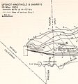
Upshot-knothole-harry-radiation.jpg 607 × 652; 100 KB
-
UT-34 West, TO I-15 in St. George - panoramio.jpg 1,600 × 1,200; 707 KB
-
Utah Desert.JPG 7,069 × 4,724; 3.31 MB
-
UTMap-doton-StGeorge.PNG 238 × 300; 18 KB
-
View from Old Airport - panoramio.jpg 1,600 × 1,200; 487 KB
-
VIRGIN RIVER CANYON - panoramio.jpg 1,785 × 1,136; 472 KB
-
Virgin River Canyon, Utah 5-14a (19401546988).jpg 2,800 × 2,035; 2.53 MB
-
Virgin River Gorge, St. George, UT 5-14 (24424177511).jpg 2,800 × 1,871; 2.41 MB
-
Virgin River in St George 1.jpg 2,400 × 1,600; 619 KB
-
VIRGIN RIVER UTAH - panoramio.jpg 1,785 × 1,136; 503 KB
-
VIRGIN RIVER UTAH TWO - panoramio.jpg 1,785 × 1,136; 509 KB
-
Washingtoncounty ut.png 980 × 663; 35 KB
-
Water Fountain at Tabernacle.jpg 1,023 × 685; 106 KB
-
WorldMark St. George.jpg 2,048 × 1,365; 794 KB
-
Yant Flat Conception Cliffs - Flickr - Bold Frontiers.jpg 1,800 × 1,414; 2.82 MB
-
美國黃石公園25.jpg 3,008 × 2,000; 1.55 MB
-
美國黃石公園26.jpg 3,008 × 2,000; 1.54 MB
Categories:
- Cities in Utah
- Populated places in Washington County, Utah
- County seats in Utah
- University and college towns in the United States
- Big Valley (Arizona-Utah)
- Populated places in the United States named after people
- Cities coinciding a state border within the United States
- Virgin River
- Locations along Interstate 15 in Washington County, Utah
- Locations along U.S. Route 91 in Utah (1926-1974) in Washington County, Utah
- Locations along Utah State Route 7
- Locations along Utah State Route 18 in Washington County, Utah
- Locations along Utah State Route 64 (1931-1969)


