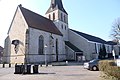
Category:St. Ambrosius (Ostbevern)
Jump to navigation
Jump to search
| Object location | | View all coordinates using: OpenStreetMap |
|---|
church building in Ostbevern, Germany  .jpg) | |||||
| Upload media | |||||
| Instance of | |||||
|---|---|---|---|---|---|
| Named after | |||||
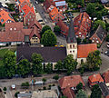
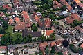
| Location | Ostbevern, Warendorf District, Münster Government Region, North Rhine-Westphalia, Germany | ||||
| Heritage designation | |||||
 | |||||
Subcategories
This category has only the following subcategory.
I
Media in category "St. Ambrosius (Ostbevern)"
The following 27 files are in this category, out of 27 total.
-
 Alte Kirche Ostbevern 1.jpg 2,904 × 3,176; 914 KB
-
 Ambrosius Ostbevern Querschnitt.jpeg 368 × 303; 19 KB
-
 Ambrosius Ostbevern.jpg 1,709 × 1,203; 1.01 MB
-
 Biberkopf Ostbevern.png 334 × 293; 82 KB
-
 Dorfkirche Ostbevern.png 1,280 × 1,104; 1.49 MB
-
 Georg Ostbevern 1928.png 1,782 × 1,225; 1.88 MB
-
 Grundriss Ambrosiuskirche.png 2,432 × 1,225; 2.32 MB
-
 Ostbevern Ambrosius 10.jpg 4,272 × 2,848; 5.33 MB
-
 Ostbevern Ambrosius 11.jpg 4,272 × 2,848; 4.53 MB
-
 Ostbevern Ambrosius 7.jpg 4,272 × 2,848; 4.96 MB
-
 Ostbevern Ambrosius 8.jpg 2,848 × 4,272; 3.6 MB
-
 Ostbevern Ambrosius 9.jpg 2,848 × 4,272; 4.31 MB
-
 Ostbevern Ambrosius Portal.jpg 2,848 × 4,272; 4.85 MB
-
 Ostbevern, St.-Ambrosius-Kirche -- 2014 -- 8492.jpg 5,132 × 3,421; 12.52 MB
-
 Ostbevern, St.-Ambrosius-Kirche -- 2014 -- 8493.jpg 5,070 × 3,380; 12.13 MB
-
 Ostbevern, St.-Ambrosius-Kirche -- 2014 -- 8510.jpg 5,184 × 3,456; 11.42 MB
-
 Ostbevern, St.-Ambrosius-Kirche -- 2014 -- 8511.jpg 5,184 × 3,456; 11.99 MB
-
 Ostbevern, St.-Ambrosius-Kirche -- 2014 -- 8513 -- Ausschnitt.jpg 2,662 × 2,397; 4.53 MB
-
 Ostbevern, St.-Ambrosius-Kirche -- 2014 -- 8513.jpg 5,184 × 3,456; 12.5 MB
-
 Ostbevern, St.-Ambrosius-Kirche -- 2014 -- 8520 -- Ausschnitt.jpg 2,816 × 2,811; 5.56 MB
-
 Ostbevern, St.-Ambrosius-Kirche -- 2014 -- 8520.jpg 5,184 × 3,456; 11.51 MB
-
 Portal-St.Abrosius.jpg 1,200 × 1,600; 914 KB
-
 St Ambrosius Süd.jpg 1,200 × 1,600; 938 KB
-
 St-Ambrosius-Kirche.jpg 1,200 × 1,600; 693 KB
-
 St. Ambrosius2018 (1).JPG 4,896 × 3,264; 5.46 MB
-
 St. Ambrosius2018 (36).JPG 3,264 × 4,896; 4.97 MB
-
 St. Ambrosius2018 (5).JPG 4,896 × 3,264; 3.8 MB


.JPG)
.JPG)
.JPG)