Category:St. Agatha (Dorsten)
Jump to navigation
Jump to search
| Object location | | View all coordinates using: OpenStreetMap |
|---|
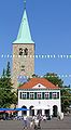
church building in Dorsten, Germany  | |||||
| Upload media | |||||
| Instance of | |||||
|---|---|---|---|---|---|
| Named after | |||||
| Location | Dorsten, Recklinghausen, Münster Government Region, North Rhine-Westphalia, Germany | ||||
| Heritage designation | |||||
 | |||||
This is the category for an architectural monument.
It is on the list of cultural monuments of Dorsten, no. 2.
It is on the list of cultural monuments of Dorsten, no. 2.
Media in category "St. Agatha (Dorsten)"
The following 18 files are in this category, out of 18 total.
-
 Dorsten St. Agatha Innen.jpg 2,304 × 1,728; 314 KB
-
 Dorsten, Sankt Agatha Kirche en Altes Rathaus foto10 2011-04-09 17.05.JPG 3,312 × 4,416; 8.17 MB
-
 Prospekt der Breil-Orgel.jpg 3,024 × 4,032; 3.25 MB
-
 Recklinghausen Dorsten.jpg 2,976 × 3,968; 4.24 MB
-
 St Agatha und Franziskanerkloster Dorsten (Merian).jpg 623 × 471; 162 KB
-
 St. Agatha 2024-03-02 Dorsten-163932.jpg 1,792 × 1,614; 1.08 MB
-
 St. Agatha Chororgel Dorsten-1381.jpg 2,591 × 2,160; 1.49 MB
-
 St. Agatha Chorrosette Dorsten-1372.jpg 2,160 × 2,160; 1.35 MB
-
 St. Agatha Chrorraum Dorsten-1375.jpg 3,240 × 2,160; 1.84 MB
-
 St. Agatha Dorsten 01.jpg 3,968 × 2,240; 2.91 MB
-
 St. Agatha Dorsten 02.jpg 3,968 × 2,976; 3.71 MB
-
 St. Agatha Epitaph Dorsten-1380.jpg 2,255 × 2,160; 930 KB
-
 St. Agatha Epitaph Dorsten-1382.jpg 2,057 × 3,523; 1.67 MB
-
 St. Agatha Epitaph Dorsten-1383.jpg 2,160 × 3,741; 1.82 MB
-
 St. Agatha Hauptorgel Dorsten-1378.jpg 2,160 × 3,240; 1.55 MB
-
 St. Agatha Innenraum 2024-03-02 Dorsten-144340.jpg 2,880 × 2,160; 1.65 MB
-
 St. Agatha Vesperbild Dorsten-1384.jpg 2,160 × 2,312; 1.47 MB
-
 Stadtwaage und St Agatha-Dorsten.jpg 1,124 × 2,036; 406 KB


.jpg)


