Category:Stèle Paul Borde à Rousset
Jump to navigation
Jump to search
| Object location | | View all coordinates using: OpenStreetMap |
|---|
Media in category "Stèle Paul Borde à Rousset"
The following 4 files are in this category, out of 4 total.
-
 Rousset-FR-13-buste Borde-a1.jpg 3,024 × 4,032; 5.82 MB
-
 Rousset-FR-13-buste Borde-a2.jpg 3,024 × 4,032; 6.92 MB
-
 Rousset-FR-13-buste Borde-a3.jpg 3,024 × 4,032; 4.97 MB
-
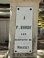
 Rousset-FR-13-stele P Borde-a1.jpg 3,024 × 4,032; 5.3 MB


