Category:Sri Lanka as Taprobana
Jump to navigation
Jump to search
English: Taprobana is an old European name for Ceylon / Sri Lanka, derived from Greek sources. This category collects modern maps where Sri Lanka is labeled "Taprobana". For original maps, see Category:Ptolemaic Taprobane.
Subcategories
This category has the following 4 subcategories, out of 4 total.
Media in category "Sri Lanka as Taprobana"
The following 22 files are in this category, out of 22 total.
-
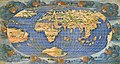
 1490 Ptolemaic world map.jpg 12,926 × 9,070; 14.42 MB
-

-
 1514 Cornelius Aurelius completo alta-res.jpg 5,047 × 3,946; 3.54 MB
-

-
 Map - Special Collections University of Amsterdam - OTM- HB-KZL 31-01-28.tif 7,888 × 6,447; 145.49 MB
-
 A Map of the world 1506.tif 5,137 × 7,652; 112.48 MB
-
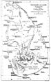
 Asia XII ceylon.jpg 1,600 × 1,200; 387 KB
-
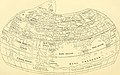
 CeylonPtolemyPliny.jpg 600 × 969; 114 KB
-

-
 Durer Stabiussche Weltkarte World Map 1515.jpg 4,902 × 3,780; 2.32 MB
-
 EB1911 - Map - Fig. 26 - Behaim's Globe, 1492.jpg 1,036 × 529; 432 KB
-
 Orbis vetus juxta Strabonem - (tiré de Cellarius) - btv1b5963496h.jpg 3,568 × 2,568; 1.32 MB
-
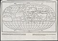
 Periplus World Map.jpg 2,142 × 1,774; 785 KB
-
 PietroCoppo.jpg 2,000 × 1,485; 4.09 MB
-
 PtolemyWorldMap.jpg 1,500 × 1,026; 867 KB
-
-
 Tibetan nomads in the year 60 AD, Periplus World Map (cropped).jpg 620 × 638; 120 KB
-

-

-
 World map (2674845313).jpg 2,000 × 1,436; 2.26 MB
-
 World map RMG C4568 1.jpg 2,712 × 1,449; 2.89 MB
-
 World map RMG C4568 2.tiff 5,248 × 2,704; 40.6 MB


_-_Geographicus_-_Taprobane-mallet-1686.jpg)


_(14595899759).jpg)


_-_btv1b5963496h.jpg)


_(14779948251).jpg)
.jpg)

.jpg)
.jpg)
