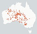
Category:Squamata distribution maps
Jump to navigation
Jump to search
Subcategories
This category has the following 10 subcategories, out of 10 total.
Media in category "Squamata distribution maps"
The following 15 files are in this category, out of 15 total.
-
Angolasaurusdistributionmap.JPG 475 × 605; 14 KB
-
Anniella pulchra.png 999 × 587; 627 KB
-
Bloubergstrand dwarf burrowing skink IUCN range 2021.svg 587 × 454; 30 KB
-
Ctenophorus adelaidensis distribution.png 1,024 × 1,477; 148 KB
-
Ctenophorus rubens distribution.png 1,024 × 1,477; 148 KB
-
Distribution Map from bie.ala.org.au.jpg 988 × 916; 234 KB
-
Gronovi's dwarf burrowing skink IUCN range 2021.svg 578 × 447; 61 KB
-
Lagarto Overo.png 240 × 320; 4 KB
-
Lizard range.png 1,425 × 745; 50 KB
-
Scelotes inornatus distribution.png 1,259 × 944; 1.53 MB
-
Scelotes mossambicus distribution.png 1,259 × 944; 1.64 MB
-
Strophurus distrib ALA.png 630 × 502; 73 KB
-
Teius Suquensis.png 240 × 320; 3 KB
-
World.distribution.sauria.1.png 1,357 × 628; 18 KB
-
תפוצת הבומסלנג.png 594 × 476; 51 KB


