Category:Spurn Point
Jump to navigation
Jump to search
southernmost tip of the Spurn, in East Riding of Yorkshire, England, UK | |||||
| Upload media | |||||
| Instance of | |||||
|---|---|---|---|---|---|
| Location | Easington, East Riding of Yorkshire, Yorkshire and the Humber, England | ||||
 | |||||
Subcategories
This category has the following 6 subcategories, out of 6 total.
H
S
- Spurn Head beach (139 F)
- Spurn Point High Light (109 F)
- Spurn Point jetties (38 F)
- Spurn Point Low Light (43 F)
- Spurn Point pilot station (14 F)
Media in category "Spurn Point"
The following 200 files are in this category, out of 238 total.
(previous page) (next page)-
 A few wading birds, near to high tide , Spurn Point - geograph.org.uk - 2878504.jpg 4,000 × 3,000; 2.53 MB
-

-
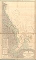
 Admiralty Chart No 1188 River Humber Spurn Point to Immingham Dock, Published 1949.jpg 16,271 × 11,095; 66.61 MB
-
 Admiralty Chart No 1190 Blakeney to Flamborough Head, Published 1951.jpg 11,260 × 18,347; 72.75 MB
-
 Admiralty Chart No 2176 North Foreland to Duncansby Head, Published 1940.jpg 11,308 × 19,692; 67.02 MB
-

-
 Beach at Spurn Warren - geograph.org.uk - 1472478.jpg 640 × 480; 61 KB
-
 Beach defences on Spurn Point - geograph.org.uk - 2877427.jpg 4,000 × 3,000; 2.32 MB
-
 Beach groyne Spurn Head - geograph.org.uk - 819719.jpg 640 × 480; 72 KB
-
 Beach scene at low water Spurn Point - geograph.org.uk - 2068886.jpg 2,816 × 2,112; 2.78 MB
-
 Beach, Spurn Peninsula - geograph.org.uk - 2407588.jpg 1,600 × 1,200; 508 KB
-
 Beneath the jetty, Spurn Point - geograph.org.uk - 3690347.jpg 432 × 640; 198 KB
-
 Between the legs of the jetty, Spurn - geograph.org.uk - 3690348.jpg 426 × 640; 194 KB
-
 Bird ringing at Spurn Head - geograph.org.uk - 3050121.jpg 1,600 × 1,468; 1.02 MB
-
 Bird ringing station near Kilnsea - geograph.org.uk - 1515285.jpg 640 × 480; 60 KB
-
 BirdTrap SpurnPoint.JPG 2,304 × 1,728; 842 KB
-
 Bridleway signs, Spurn Peninsula - geograph.org.uk - 5635544.jpg 1,024 × 768; 203 KB
-
 British Isles rural and coastal Lincolnshire (4452298172).jpg 2,048 × 1,371; 763 KB
-
 Bunker at Spurn Head - geograph.org.uk - 622519.jpg 640 × 427; 88 KB
-
 By Stony Binks, Spurn Head - geograph.org.uk - 4985924.jpg 4,986 × 3,341; 3.43 MB
-
 Catch of the day - geograph.org.uk - 817470.jpg 478 × 640; 84 KB
-
 Chalk Bank hide - geograph.org.uk - 817519.jpg 640 × 480; 61 KB
-
 Chalk Bank, Spurn Point, Holderness - geograph.org.uk - 3848366.jpg 1,200 × 798; 384 KB
-
 Coast at Spurn - geograph.org.uk - 2645336.jpg 2,592 × 1,944; 1.51 MB
-
 Coastal scene, Spurn Head - geograph.org.uk - 2407613.jpg 1,600 × 1,211; 305 KB
-
 Common Darter on Spurn Point - geograph.org.uk - 470596.jpg 640 × 480; 118 KB
-
 Container ship passes Spurn Head - geograph.org.uk - 3848012.jpg 1,200 × 798; 293 KB
-
 Creel on the beach at Spurn Head - geograph.org.uk - 5299354.jpg 1,024 × 682; 186 KB
-
 Crumbling sea walls, Spurn - geograph.org.uk - 3690047.jpg 640 × 426; 189 KB
-
 Damaged groynes on the beach at Spurn - geograph.org.uk - 5552193.jpg 800 × 600; 134 KB
-
 Decaying posts on Spurn - geograph.org.uk - 3690061.jpg 486 × 640; 231 KB
-
 Dunes and pilot boat, Spurn - geograph.org.uk - 2105699.jpg 991 × 1,238; 867 KB
-
 Dunes, Spurn Peninsula - geograph.org.uk - 2407599.jpg 1,600 × 1,200; 295 KB
-

-
 Entering the national nature reserve at Spurn Head - geograph.org.uk - 4985963.jpg 3,569 × 4,616; 3.81 MB
-
 Entrance to Spurn - geograph.org.uk - 2697544.jpg 1,600 × 1,200; 620 KB
-

-
 Entrance to the Spurn National Nature Reserve - geograph.org.uk - 3145293.jpg 2,084 × 1,293; 892 KB
-
 Eroded posts at Spurn - geograph.org.uk - 3690350.jpg 426 × 640; 219 KB
-
 Eroded posts on Spurn - geograph.org.uk - 3690354.jpg 426 × 640; 183 KB
-
 Eroded sea defences at Spurn - geograph.org.uk - 5300037.jpg 1,024 × 682; 138 KB
-
 Eroding coastline, Spurn - geograph.org.uk - 2697567.jpg 1,600 × 1,200; 818 KB
-
 Eroding coastline, Spurn - geograph.org.uk - 2697592.jpg 1,600 × 1,200; 619 KB
-
 Eroding wartime bunker at Spurn Point - geograph.org.uk - 5299391.jpg 1,024 × 682; 158 KB
-
 Erosion at High Bents on the Spurn peninsula - geograph.org.uk - 5298506.jpg 1,024 × 682; 196 KB
-
 Fishing boat - geograph.org.uk - 622552.jpg 640 × 427; 65 KB
-
 Footpath sign at Warren Head, Spurn Point - geograph.org.uk - 3847588.jpg 1,200 × 798; 363 KB
-
 Groyne on Spurn Head - geograph.org.uk - 2567398.jpg 640 × 480; 143 KB
-
 Groynes and Beach at Spurn - geograph.org.uk - 2068866.jpg 2,816 × 2,112; 2.53 MB
-
 Groynes on Spurn - geograph.org.uk - 4569314.jpg 1,000 × 881; 383 KB
-
 Groynes on Spurn Beach - geograph.org.uk - 3847634.jpg 1,200 × 798; 319 KB
-
 Groynes on Spurn Beach - geograph.org.uk - 3847643.jpg 1,200 × 798; 187 KB
-
 Groynes on Spurn Beach - geograph.org.uk - 3847651.jpg 1,200 × 798; 310 KB
-
 Groynes on Spurn Beach - geograph.org.uk - 3847924.jpg 1,200 × 798; 473 KB
-
 Groynes on Spurn Beach - geograph.org.uk - 3847927.jpg 1,200 × 798; 381 KB
-
 Groynes on Spurn Beach - geograph.org.uk - 3847941.jpg 1,200 × 798; 377 KB
-
 Groynes on Spurn Beach - geograph.org.uk - 3847956.jpg 1,200 × 798; 385 KB
-
 Groynes on Spurn Point - geograph.org.uk - 2068831.jpg 2,560 × 1,920; 1.87 MB
-
 Gun emplacement, Spurn Head - geograph.org.uk - 3050175.jpg 1,600 × 1,200; 806 KB
-
 Gun emplacement, Spurn Head - geograph.org.uk - 3050181.jpg 1,600 × 1,200; 915 KB
-
 Haile Sand Fort and Spurn Head - geograph.org.uk - 1205143.jpg 640 × 480; 39 KB
-
 Have a seat - geograph.org.uk - 817543.jpg 640 × 480; 55 KB
-
 Heading south to Spurn - geograph.org.uk - 5796349.jpg 1,600 × 1,200; 456 KB
-
 Heading up the Humber - geograph.org.uk - 5801015.jpg 640 × 480; 57 KB
-
 Heligoland Trap, Spurn Point - geograph.org.uk - 1337627.jpg 640 × 480; 139 KB
-

-
 High Bents - geograph.org.uk - 622644.jpg 640 × 427; 55 KB
-
 High Bents, Spurn Peninsula - geograph.org.uk - 2407584.jpg 1,600 × 1,200; 548 KB
-
 High Bents, Spurn Peninsula - geograph.org.uk - 315875.jpg 640 × 480; 106 KB
-
 Hull and Humber Estuary 2013-03.jpg 1,024 × 679; 146 KB
-
 Humber estuary - geograph.org.uk - 30580.jpg 640 × 480; 86 KB
-
 Humber Extension, Spurn - geograph.org.uk - 373362.jpg 640 × 480; 84 KB
-
 Humber traffic and fort - geograph.org.uk - 2411969.jpg 3,488 × 2,616; 2.2 MB
-
 Incoming vessel rounds Spurn Point into the Humber Estuary - geograph.org.uk - 4559966.jpg 2,107 × 1,230; 1.81 MB
-

-
 Lighthouse at Spurn Beach.jpg 720 × 540; 66 KB
-
 Lighthouse at Spurn Head - geograph.org.uk - 200522.jpg 640 × 367; 75 KB
-
 Lighthouse on Spurn Head - geograph.org.uk - 2034210.jpg 640 × 480; 107 KB
-
 Lighthouses at Spurn Point - geograph.org.uk - 3848090.jpg 1,200 × 798; 228 KB
-
 Lobster pots - geograph.org.uk - 622555.jpg 640 × 427; 99 KB
-

-
 Middle Camp, Spurn Head - geograph.org.uk - 3727197.jpg 1,600 × 1,200; 538 KB
-
 Mv Jipro Isis passes Stony Binks - geograph.org.uk - 1469374.jpg 640 × 480; 55 KB
-
 No animals may be landed - geograph.org.uk - 101296.jpg 527 × 640; 134 KB
-
 Old military building, Spurn Point - geograph.org.uk - 2734474.jpg 1,600 × 1,200; 731 KB
-
 Old Sea Wall, Spurn Point. - geograph.org.uk - 2796291.jpg 1,129 × 1,600; 449 KB
-
 Old temporary road, Spurn Point - geograph.org.uk - 3050075.jpg 1,600 × 1,200; 672 KB
-
 Panoramic view of Spurn Point - geograph.org.uk - 1096081.jpg 640 × 360; 42 KB
-

-
 Post 62, Spurn Head - geograph.org.uk - 3713440.jpg 1,600 × 1,200; 872 KB
-
 Redstart (Phoenicurus phoenicurus) - geograph.org.uk - 1036159.jpg 640 × 480; 82 KB
-
 Road on Spurn Point - geograph.org.uk - 3848729.jpg 1,600 × 1,200; 679 KB
-
 Seat on Spurn Head - geograph.org.uk - 2418011.jpg 3,648 × 2,736; 2.73 MB
-
 Ship at Tetney Monobuoy (2) (geograph 5270560).jpg 640 × 426; 56 KB
-
 Single handed - geograph.org.uk - 1320387.jpg 640 × 480; 51 KB
-
 Spurn 1.jpg 3,072 × 2,304; 2.76 MB
-
 Spurn beach - geograph.org.uk - 2105666.jpg 809 × 1,002; 392 KB
-
 Spurn Beach - geograph.org.uk - 3710604.jpg 1,600 × 1,200; 534 KB
-
 Spurn Beach - geograph.org.uk - 3847962.jpg 1,200 × 798; 179 KB
-
 Spurn beach and lighthouse - geograph.org.uk - 3690105.jpg 640 × 455; 191 KB
-
 Spurn beach jetsam - geograph.org.uk - 2105692.jpg 946 × 1,294; 841 KB
-
 Spurn Boat - geograph.org.uk - 1265695.jpg 640 × 480; 69 KB
-
 Spurn Footpath Stile - geograph.org.uk - 944629.jpg 640 × 480; 108 KB
-
 Spurn from the air - geograph.org.uk - 5912431.jpg 2,709 × 3,703; 2.17 MB
-
 Spurn Head - geograph.org.uk - 1257598.jpg 640 × 428; 99 KB
-
 Spurn Head - geograph.org.uk - 1257610.jpg 640 × 428; 94 KB
-
 Spurn Head - geograph.org.uk - 1257619.jpg 640 × 428; 86 KB
-
 Spurn Head - geograph.org.uk - 1469333.jpg 640 × 480; 52 KB
-
 Spurn Head - geograph.org.uk - 2878567.jpg 4,000 × 3,000; 2.52 MB
-
 Spurn Head - geograph.org.uk - 621872.jpg 640 × 427; 57 KB
-
 Spurn Head and Bull Sand Fort - geograph.org.uk - 587590.jpg 640 × 427; 35 KB
-

-
 Spurn Head entrance sign - geograph.org.uk - 3050165.jpg 1,200 × 1,600; 578 KB
-
 Spurn Head from the River Humber - geograph.org.uk - 3008648.jpg 800 × 600; 62 KB
-
 Spurn Head Settlement.jpg 3,264 × 2,448; 2.31 MB
-
 Spurn in 1979.jpg 512 × 640; 65 KB
-
 Spurn Information Centre - geograph.org.uk - 30576.jpg 640 × 480; 75 KB
-
 Spurn National Nature Reserve - geograph.org.uk - 5047655.jpg 1,280 × 853; 277 KB
-
 Spurn National Nature Reserve - geograph.org.uk - 5047663.jpg 1,280 × 853; 545 KB
-
 Spurn National Nature Reserve - geograph.org.uk - 5047669.jpg 1,280 × 853; 451 KB
-
 Spurn National Nature Reserve - geograph.org.uk - 5047676.jpg 1,280 × 720; 592 KB
-
 Spurn National Nature Reserve - geograph.org.uk - 5047685.jpg 1,280 × 720; 528 KB
-
 Spurn National Nature Reserve - geograph.org.uk - 5047696.jpg 1,280 × 720; 566 KB
-
 Spurn National Nature Reserve - geograph.org.uk - 5047707.jpg 1,280 × 720; 597 KB
-
 Spurn National Nature Reserve - geograph.org.uk - 5047714.jpg 1,280 × 720; 591 KB
-
 Spurn National Nature Reserve - geograph.org.uk - 5047736.jpg 1,280 × 720; 581 KB
-
 Spurn National Nature Reserve - geograph.org.uk - 5047740.jpg 1,280 × 720; 598 KB
-
 Spurn National Nature Reserve - geograph.org.uk - 5047744.jpg 1,280 × 720; 520 KB
-
 Spurn National Nature Reserve - geograph.org.uk - 5047747.jpg 1,280 × 720; 536 KB
-
 Spurn National Nature Reserve - geograph.org.uk - 5047752.jpg 1,280 × 853; 706 KB
-
 Spurn National Nature Reserve - geograph.org.uk - 5047755.jpg 1,280 × 720; 650 KB
-
 Spurn National Nature Reserve - geograph.org.uk - 5047759.jpg 1,280 × 853; 685 KB
-
 Spurn National Nature Reserve - geograph.org.uk - 5047761.jpg 1,280 × 720; 554 KB
-
 Spurn National Nature Reserve - geograph.org.uk - 5047762.jpg 1,280 × 853; 530 KB
-
 Spurn Peninsula - eastern shore - geograph.org.uk - 3203976.jpg 1,024 × 768; 126 KB
-
 Spurn Peninsula - geograph.org.uk - 317.jpg 640 × 480; 55 KB
-

-
 Spurn Peninsula - High Bents - geograph.org.uk - 3124126.jpg 640 × 427; 77 KB
-

-
 Spurn Peninsula at High Bents - geograph.org.uk - 3203966.jpg 1,024 × 768; 176 KB
-
 Spurn Peninsula at TA41711288 - geograph.org.uk - 30581.jpg 640 × 480; 67 KB
-
 Spurn peninsula at the Warren - geograph.org.uk - 5300048.jpg 1,024 × 682; 147 KB
-
 Spurn Peninsula Road - geograph.org.uk - 30577.jpg 640 × 480; 80 KB
-
 Spurn Peninsula Road - geograph.org.uk - 706549.jpg 600 × 400; 96 KB
-
 Spurn peninsula south of High Bents - geograph.org.uk - 5298513.jpg 1,024 × 682; 178 KB
-
 Spurn Peninsula, aerial 2018 - geograph.org.uk - 5718839.jpg 800 × 533; 43 KB
-

-
 Spurn peninsula, dunes and beach (2) - geograph.org.uk - 3203302.jpg 1,024 × 768; 157 KB
-
 Spurn Peninsula, Kilnsea, Humberside - geograph.org.uk - 3853884.jpg 3,959 × 2,147; 1.44 MB
-
 Spurn Peninsula, Kilnsea, Humberside - geograph.org.uk - 3853910.jpg 2,227 × 1,715; 598 KB
-
 Spurn Pilot Jetty (1979) - geograph.org.uk - 860299.jpg 640 × 640; 83 KB
-
 Spurn Point & Holderness coast from the air.jpg 2,268 × 4,032; 647 KB
-
 Spurn Point - east side - geograph.org.uk - 1353004.jpg 640 × 427; 274 KB
-
 Spurn Point - Ebb Tide - geograph.org.uk - 237370.jpg 640 × 480; 83 KB
-
 Spurn Point - geograph.org.uk - 133764.jpg 640 × 429; 83 KB
-
 Spurn Point - geograph.org.uk - 5435753.jpg 5,376 × 3,024; 4.57 MB
-
 Spurn Point - geograph.org.uk - 622516.jpg 640 × 427; 66 KB
-
 Spurn Point - panoramio.jpg 1,200 × 724; 416 KB
-
 Spurn Point 18-11-8 - panoramio.jpg 1,000 × 666; 100 KB
-
 Spurn Point amazing view.jpg 4,608 × 2,592; 5.7 MB
-
 Spurn Point at low tide, aerial 2017 - geograph.org.uk - 5267558.jpg 640 × 427; 30 KB
-
 Spurn Point eroding - geograph.org.uk - 3050037.jpg 1,600 × 1,200; 669 KB
-
 Spurn Point from the air - geograph.org.uk - 3845863.jpg 480 × 640; 62 KB
-
 Spurn Point from the air - geograph.org.uk - 3845870.jpg 640 × 615; 87 KB
-
 Spurn Point from the air - geograph.org.uk - 3845879.jpg 640 × 480; 71 KB
-
 Spurn Point from Winsetts Bank - geograph.org.uk - 290023.jpg 640 × 404; 39 KB
-
 Spurn Point IMG 7906.JPG - panoramio.jpg 1,200 × 801; 399 KB
-
 Spurn Point in September.jpg 4,608 × 2,592; 6.44 MB
-
 Spurn Point jetsam - geograph.org.uk - 2105743.jpg 499 × 640; 74 KB
-
 Spurn Point jetty - geograph.org.uk - 10473.jpg 640 × 480; 55 KB
-

-
 Spurn Point sand.jpg 4,455 × 2,394; 6.4 MB
-

-
 Spurn Point, aerial 2015 (1) - geograph.org.uk - 4581820.jpg 640 × 427; 27 KB
-
 Spurn Point, aerial 2015 (2) - geograph.org.uk - 4581821.jpg 800 × 533; 40 KB
-
 Spurn Point, aerial 2015 (3) - geograph.org.uk - 4581822.jpg 427 × 640; 30 KB
-
 Spurn RNLI Lifeboat - geograph.org.uk - 4292131.jpg 1,062 × 1,600; 499 KB
-
 Spurn RNLI Lifeboat - geograph.org.uk - 4292133.jpg 1,062 × 1,600; 435 KB
-
 Spurn Warren towards Greedy Gut - geograph.org.uk - 1472490.jpg 640 × 480; 39 KB
-
 SpurnPoint Humber.JPG 2,304 × 1,728; 755 KB
-
 SpurnPoint1.JPG 2,304 × 1,728; 837 KB
-
 Stony Binks - geograph.org.uk - 1352992.jpg 640 × 427; 370 KB
-
 Stony Binks - geograph.org.uk - 2699029.jpg 1,600 × 1,200; 601 KB
-
 Stony Binks - geograph.org.uk - 2699033.jpg 1,600 × 1,200; 797 KB
-
 Stony Binks - geograph.org.uk - 30583.jpg 640 × 480; 104 KB
-
 Stony Binks, Spurn Point - geograph.org.uk - 2699037.jpg 1,600 × 1,200; 847 KB
-
 Stony Binks, Spurn Point - geograph.org.uk - 2699041.jpg 1,600 × 1,116; 573 KB
-
 Stony Binks, Spurn Point - geograph.org.uk - 2699055.jpg 1,600 × 1,200; 872 KB
-
 Storm Brewing over Spurn Point - geograph.org.uk - 290074.jpg 640 × 465; 35 KB
-
 Storm Clouds over Spurn Point - geograph.org.uk - 290069.jpg 480 × 640; 44 KB
-
 Sunset at Spurn Point Jetty - geograph.org.uk - 3555356.jpg 3,648 × 2,736; 1.99 MB
-
 Talene V - geograph.org.uk - 622558.jpg 640 × 427; 71 KB
-
 Tangled net and groyne at Spurn Point - geograph.org.uk - 890255.jpg 640 × 480; 101 KB
-
 Tank blocks, Spurn Point - geograph.org.uk - 2734452.jpg 1,600 × 1,200; 772 KB
-

-
-

-

-

-


.jpg)


_-_geograph.org.uk_-_419129.jpg)


_-_geograph.org.uk_-_1036159.jpg)


_(geograph_5270560).jpg)


_(36917176342).jpg)


_-_geograph.org.uk_-_3203302.jpg)


_-_geograph.org.uk_-_860299.jpg)


_-_geograph.org.uk_-_4581820.jpg)
_-_geograph.org.uk_-_4581821.jpg)
_-_geograph.org.uk_-_4581822.jpg)


.jpg)
.jpg)
.jpg)

.jpg)
.jpg)