Category:Springfield, Fife
Jump to navigation
Jump to search
village in Fife, Scotland, UK  | |||||
| Upload media | |||||
| Instance of | |||||
|---|---|---|---|---|---|
| Location |
| ||||
| Population |
| ||||
 | |||||
English: The small village of Springfield (population less than 1000) lies at the edge of the Howe of Fife, to the south of the town of Cupar, Fife, Scotland. The origin of the community is thought to be from the linen industry in the 19th century. The Church of Scotland parish church was built in 1861 (and now shares a minister with nearby Ceres and Kemback). The church garden was originally intended to be a cemetery, but the high water table prevented this. The community is surrounded by fields; agriculture is still an important part of the economy of north east Fife (although few Springfield residents work in agriculture).
Subcategories
This category has the following 4 subcategories, out of 4 total.
C
- Clushgreen Bridge (3 F)
- Crawford Priory (7 F)
- Cults Mill (3 F)
S
- Springfield railway station (2 F)
Media in category "Springfield, Fife"
The following 25 files are in this category, out of 25 total.
-
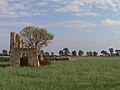 19th Century Race Track Grandstand - geograph.org.uk - 1464305.jpg 640 × 480; 148 KB
-
 A92North to Howe of Fife.jpg 604 × 453; 55 KB
-
 By Springfield hospital - geograph.org.uk - 132189.jpg 640 × 480; 122 KB
-

-
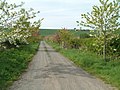 Colourful Farm Road - geograph.org.uk - 169887.jpg 640 × 480; 115 KB
-
 Easter Fernie - geograph.org.uk - 169883.jpg 640 × 480; 60 KB
-
 Elmwood Golf Club - geograph.org.uk - 121823.jpg 640 × 480; 60 KB
-
 Entrance to Tarvit Mill - geograph.org.uk - 1557617.jpg 640 × 480; 77 KB
-
 Farmland and road by Easter Fernie - geograph.org.uk - 132221.jpg 640 × 482; 304 KB
-
 Hedge and field by St Mary's Farm - geograph.org.uk - 132213.jpg 640 × 480; 273 KB
-
 Horselaw by Cupar - geograph.org.uk - 132210.jpg 640 × 480; 275 KB
-
 Hound sanctuary - geograph.org.uk - 121813.jpg 640 × 480; 146 KB
-
 Main line - geograph.org.uk - 121824.jpg 480 × 640; 110 KB
-
 North Scotstarvit - geograph.org.uk - 169893.jpg 640 × 480; 92 KB
-
 Northfield by Springfield - geograph.org.uk - 132197.jpg 640 × 480; 338 KB
-
 Railway between Ladybank and Cupar - geograph.org.uk - 912960.jpg 640 × 480; 70 KB
-
 Railway between Ladybank and Cupar - geograph.org.uk - 912968.jpg 640 × 480; 73 KB
-
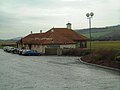
 Russell Mill at Springfield - geograph.org.uk - 912942.jpg 640 × 480; 82 KB
-
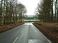
 South East of Springfield - geograph.org.uk - 121821.jpg 640 × 480; 70 KB
-
 Springfield - geograph.org.uk - 121804.jpg 640 × 480; 74 KB
-
 Springfield Church of Scotland November 2008.jpg 938 × 1,062; 466 KB
-
 Stone Pillar - geograph.org.uk - 1464312.jpg 640 × 480; 156 KB
-
 T-junction - geograph.org.uk - 121808.jpg 640 × 480; 128 KB
-
 The River Eden at Springfield - geograph.org.uk - 912949.jpg 640 × 480; 98 KB
-


