Category:Sports venues in the London Borough of Barnet
Jump to navigation
Jump to search
Boroughs of London: City of London · City of Westminster · Barking and Dagenham · Barnet · Bexley · Brent · Bromley · Camden · Croydon · Ealing · Enfield · Greenwich · Hackney · Hammersmith and Fulham · Haringey · Harrow · Havering · Hillingdon · Hounslow · Islington · Kensington and Chelsea · Kingston · Lambeth · Lewisham · Merton · Newham · Redbridge · Richmond · Southwark · Sutton · Tower Hamlets · Waltham Forest · Wandsworth
Subcategories
This category has the following 9 subcategories, out of 9 total.
B
- Barnet Copthall (10 F)
F
- Finchley Lido (2 F)
H
- Hendon Greyhound Stadium (1 F)
O
- Old Fold Manor Golf Club (2 F)
T
- Tudor Sports Ground (6 F)
U
- Underhill Stadium (14 F)
W
Media in category "Sports venues in the London Borough of Barnet"
The following 60 files are in this category, out of 60 total.
-
 Barnet Copthall Golf Course - geograph.org.uk - 1130012.jpg 640 × 427; 128 KB
-
 Barnet Copthall Golf Course - geograph.org.uk - 1130030.jpg 640 × 413; 146 KB
-
 Barnet Copthall Golf Driving Range - geograph.org.uk - 1130020.jpg 640 × 430; 138 KB
-
 Barnet Copthall Leisure Centre - geograph.org.uk - 1130045.jpg 640 × 427; 108 KB
-
 Barnet Powerleague Soccer Centre - geograph.org.uk - 4174374.jpg 640 × 480; 55 KB
-
 Barnet Table Tennis Centre - geograph.org.uk - 2373541.jpg 640 × 430; 88 KB
-
 Bishopswood Bowls Club - geograph.org.uk - 5542246.jpg 640 × 426; 99 KB
-
 Borroughs-Club-tennis-court.jpg 1,139 × 759; 94 KB
-
 Claremont Road Ground Hendon FC.jpg 3,648 × 2,736; 4.04 MB
-
 Conveniences, Cherry Tree Woods - geograph.org.uk - 1068848.jpg 640 × 402; 197 KB
-
 East Barnet, Oak Hill Park - geograph.org.uk - 240926.jpg 640 × 422; 85 KB
-
 Finchley Boxing Club, Leicester Road.JPG 4,000 × 3,000; 4.35 MB
-
 Finchley Manor Club - geograph.org.uk - 871386.jpg 640 × 427; 157 KB
-

-
 Fitness 24-7 - geograph.org.uk - 216146.jpg 640 × 480; 52 KB
-
 Football Practice - geograph.org.uk - 387450.jpg 640 × 480; 110 KB
-
 Football Under Floodlights - geograph.org.uk - 619765.jpg 640 × 427; 128 KB
-
 Gallops of Belmont Farm, Mill Hill - geograph.org.uk - 132277.jpg 640 × 480; 229 KB
-
 Golders Hill Park - geograph.org.uk - 1005721.jpg 640 × 405; 153 KB
-
 Hampstead Golf Club clubhouse, December 2017.jpg 4,032 × 3,024; 2.72 MB
-
 Hampstead Golf Club links, December 2017.jpg 4,032 × 3,024; 3.32 MB
-
 Hampstead Golf Course - geograph.org.uk - 1005657.jpg 640 × 427; 132 KB
-
 Hampstead Golf Course - geograph.org.uk - 1005661.jpg 427 × 640; 217 KB
-
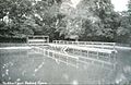 Heddon Court Bathing Place 1912.jpg 661 × 427; 45 KB
-

-

-

-

-

-

-

-

-
 Hendon Golf Course - geograph.org.uk - 458430.jpg 640 × 480; 97 KB
-
 Hollywood Bowl - geograph.org.uk - 1703029.jpg 1,600 × 989; 328 KB
-
 Horse Arena Belmont Stud Farm - geograph.org.uk - 2072651.jpg 640 × 480; 62 KB
-
 Mill Hill Golf Club - geograph.org.uk - 432325.jpg 640 × 420; 91 KB
-
 Nets (4069021305).jpg 3,072 × 1,960; 2.65 MB
-
 Nets - geograph.org.uk - 493814.jpg 640 × 480; 128 KB
-
 Penalty - geograph.org.uk - 236663.jpg 640 × 489; 113 KB
-
 Power Leagues Barnet Centre - geograph.org.uk - 240949.jpg 640 × 480; 77 KB
-
 Powerleague Copthall - geograph.org.uk - 1130369.jpg 640 × 421; 145 KB
-
 Riding School, near Mill Hill - geograph.org.uk - 592163.jpg 640 × 480; 120 KB
-
 Stanley Road - geograph.org.uk - 184979.jpg 640 × 480; 139 KB
-
 Stanley Road Playing Fields - geograph.org.uk - 855597.jpg 640 × 427; 240 KB
-
 Stanley Road Playing Fields - geograph.org.uk - 855602.jpg 640 × 427; 218 KB
-
 Stanley Road Playing Fields - geograph.org.uk - 855610.jpg 427 × 640; 345 KB
-
 Stanley Road Playing Fields - geograph.org.uk - 855616.jpg 640 × 427; 267 KB
-
 Stanley Road Playing Fields - geograph.org.uk - 855680.jpg 640 × 427; 248 KB
-
 Stanley Road Playing Fields - geograph.org.uk - 855686.jpg 427 × 640; 263 KB
-
 Sunset over West Hendon Playing Fields - geograph.org.uk - 4246025.jpg 2,224 × 1,614; 955 KB
-
 Tennis courts in Golders Hill Park - geograph.org.uk - 5502287.jpg 2,304 × 1,728; 1.49 MB
-
 Tennis Courts, Cherry Tree Wood - geograph.org.uk - 5194236.jpg 640 × 426; 71 KB
-

-
 The Jack Fisk Stand - geograph.org.uk - 1197339.jpg 640 × 452; 190 KB
-
 UCS Playing Fields, Ranulf Road NW2 - geograph.org.uk - 2082283.jpg 640 × 480; 56 KB
-

-
 West Hendon Playing Fields - geograph.org.uk - 4246022.jpg 2,304 × 1,728; 876 KB
-
 Wilf Slack Memorial Ground - geograph.org.uk - 870435.jpg 640 × 427; 196 KB
-
 Wilf Slack Memorial Ground - geograph.org.uk - 881057.jpg 640 × 427; 115 KB
-
 Wingate and Finchley FC - geograph.org.uk - 217060.jpg 640 × 480; 102 KB


.jpg)


