Category:Sporle
Jump to navigation
Jump to search
English: Sporle is a village in the civil parish of Sporle with Palgrave, in the Breckland district, in the county of Norfolk, England.
village in Norfolk, England  | |||||
| Upload media | |||||
| Instance of | |||||
|---|---|---|---|---|---|
| Location | Sporle with Palgrave, Breckland, Norfolk, East of England, England | ||||
 | |||||
Subcategories
This category has the following 2 subcategories, out of 2 total.
M
S
- Sporle War Memorial (3 F)
Media in category "Sporle"
The following 33 files are in this category, out of 33 total.
-
 A flint and brick cottage - geograph.org.uk - 1270556.jpg 640 × 480; 83 KB
-
 A sheltered seat on the green - geograph.org.uk - 1270515.jpg 480 × 640; 112 KB
-
 Cottages along The Street - geograph.org.uk - 1270611.jpg 640 × 480; 92 KB
-
 Country Road at Sporle, Norfolk - geograph.org.uk - 1965706.jpg 640 × 480; 95 KB
-
 Crop fields by Sporle - geograph.org.uk - 4890566.jpg 640 × 480; 414 KB
-
 Crop fields south of Sporle - geograph.org.uk - 4890574.jpg 640 × 480; 402 KB
-
 Entering Sporle - geograph.org.uk - 845779.jpg 480 × 640; 132 KB
-
 Forget-me-nots by the stream - geograph.org.uk - 1270520.jpg 630 × 507; 155 KB
-
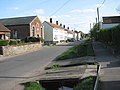
 Houses on The Street - geograph.org.uk - 1270521.jpg 640 × 480; 81 KB
-
 Houses on The Street - geograph.org.uk - 1270531.jpg 640 × 480; 124 KB
-

-
 Modern House on The Street - geograph.org.uk - 1270616.jpg 640 × 480; 74 KB
-
 Part of the A47 near Sporle, Norfolk - geograph.org.uk - 1965624.jpg 640 × 480; 74 KB
-
 Primitive Methodist Church - geograph.org.uk - 1270565.jpg 640 × 480; 84 KB
-
 Priory Place - geograph.org.uk - 1270528.jpg 640 × 480; 73 KB
-
 Sporle Methodist Ebenezer Church - geograph.org.uk - 1270584.jpg 630 × 561; 91 KB
-
 Sporle village sign - geograph.org.uk - 873937.jpg 640 × 480; 132 KB
-
 Sporle village sign - geograph.org.uk - 873938.jpg 480 × 640; 123 KB
-
 Squirrel's Dray, Sporle, 17 March 2009.JPG 2,560 × 1,920; 3.08 MB
-
 Squirrel's Drey - geograph.org.uk - 1270538.jpg 630 × 545; 115 KB
-
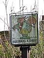 Squirrel's Drey - pub sign - geograph.org.uk - 1270539.jpg 480 × 640; 117 KB
-
 Terraced cottages - geograph.org.uk - 1270551.jpg 480 × 640; 89 KB
-
 Thatched cottages - geograph.org.uk - 1270613.jpg 640 × 518; 89 KB
-
 The old Sporle School - geograph.org.uk - 1270625.jpg 640 × 480; 98 KB
-
 The Peddars Inn at Sporle - geograph.org.uk - 5438213.jpg 800 × 498; 149 KB
-
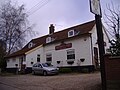
 The Squirrels Dray public house - geograph.org.uk - 1217879.jpg 640 × 480; 81 KB
-
 The Street - geograph.org.uk - 1270536.jpg 480 × 640; 141 KB
-
-
 Track from St Mary's to The Street - geograph.org.uk - 1270645.jpg 480 × 640; 113 KB
-
 Tractor on the A47 near Sporle - geograph.org.uk - 4710343.jpg 640 × 427; 289 KB
-
 View across The Street - geograph.org.uk - 1270552.jpg 480 × 640; 83 KB
-
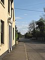
 View north along The Street - geograph.org.uk - 1270514.jpg 640 × 480; 90 KB
-
 View south along The Street - geograph.org.uk - 1270548.jpg 640 × 480; 73 KB


