Category:Speyside Way
Jump to navigation
Jump to search
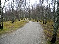
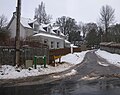
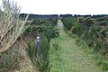
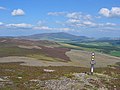
English: The Speyside Way (Strathspey Way; Scottish Gaelic: Slighe Shrath Spe) — a long distance

hiking footpath in Scotland, that follows the River Spey in Moray.
- The 65 miles (105 km) public footpath begins in Aviemore, and ends at Buckpool harbour in Buckie.
- There is a spur leading off the main route, to Tomintoul, bringing the total distance to 80 miles (130 km).
long distance hiking footpath in Scotland, that follows the River Spey in Moray.  | |||||
| Upload media | |||||
| Instance of |
| ||||
|---|---|---|---|---|---|
| Location | Moray, Scotland | ||||
| Length |
| ||||
| Terminus | |||||
| |||||
Subcategories
This category has only the following subcategory.
O
- Old Spey Bridge, Speybridge (7 F)
Media in category "Speyside Way"
The following 53 files are in this category, out of 53 total.
-
 'Rabbit's head' log on Speyside Way - geograph.org.uk - 538987.jpg 640 × 427; 138 KB
-
 001 Speyside Way Sign.jpg 1,750 × 1,167; 1.24 MB
-
 Approaching Imperial Cottages - geograph.org.uk - 1454282.jpg 640 × 481; 117 KB
-
 Cgg tomintoul.jpg 1,840 × 1,232; 1.07 MB
-
 Cycleway Near Aviemore - geograph.org.uk - 764351.jpg 640 × 480; 196 KB
-
 Dailuaine Halt - geograph.org.uk - 6577.jpg 640 × 391; 252 KB
-
 End of the Speyside Way, Kincraig - geograph.org.uk - 4827664.jpg 2,300 × 1,824; 1.64 MB
-

-
 Former Railway Bridge - geograph.org.uk - 851808.jpg 640 × 427; 252 KB
-
 Looking north along the Speyside Way - geograph.org.uk - 324527.jpg 640 × 480; 114 KB
-
 Old Railway Bridge - geograph.org.uk - 1011380.jpg 640 × 428; 127 KB
-

-

-
 Outdoor Iron Artwork on Speyside Way outside Aviemore - panoramio.jpg 1,280 × 960; 617 KB
-

-

-
 Signpost, Speyside Way - geograph.org.uk - 1732822.jpg 427 × 640; 317 KB
-
 Speyside way - geograph.org.uk - 1074377.jpg 640 × 480; 137 KB
-
 Speyside Way - geograph.org.uk - 1132577.jpg 427 × 640; 267 KB
-
 Speyside Way - geograph.org.uk - 1496661.jpg 640 × 480; 105 KB
-
 Speyside Way - geograph.org.uk - 6983.jpg 409 × 640; 229 KB
-
 Speyside Way - geograph.org.uk - 73522.jpg 427 × 640; 175 KB
-
 Speyside Way - geograph.org.uk - 73523.jpg 640 × 427; 169 KB
-
 Speyside Way and Moray Coast Trail - geograph.org.uk - 86361.jpg 640 × 427; 116 KB
-
 Speyside Way and Moray Coast Trail - geograph.org.uk - 86364.jpg 640 × 427; 126 KB
-
 Speyside Way at Auchenreath - geograph.org.uk - 851832.jpg 640 × 427; 283 KB
-
 Speyside Way at Carron - geograph.org.uk - 539263.jpg 640 × 427; 100 KB
-
 Speyside way at Craigellachie - geograph.org.uk - 1048220.jpg 640 × 480; 142 KB
-
 Speyside Way at Gollachy - geograph.org.uk - 851697.jpg 640 × 409; 235 KB
-
 Speyside Way at Spey Bay - geograph.org.uk - 1074404.jpg 640 × 480; 83 KB
-
 Speyside Way crossing Spey Valley Golf Course - panoramio.jpg 1,280 × 960; 658 KB
-

-
 Speyside way heading for the woods - geograph.org.uk - 1074372.jpg 640 × 480; 109 KB
-
 Speyside Way in front of the Museum - geograph.org.uk - 1074390.jpg 640 × 480; 76 KB
-
 Speyside Way in Tom an Uird Wood - geograph.org.uk - 538951.jpg 640 × 427; 115 KB
-
 Speyside Way looking across Spey Bay - geograph.org.uk - 1080975.jpg 640 × 480; 86 KB
-
 Speyside Way near Aberlour - geograph.org.uk - 539008.jpg 427 × 640; 130 KB
-
 Speyside Way near Cromdale - geograph.org.uk - 538608.jpg 640 × 427; 109 KB
-
 Speyside Way near Pitchroy - geograph.org.uk - 6580.jpg 640 × 389; 202 KB
-
 Speyside Way northeast of Delnapot. - geograph.org.uk - 348674.jpg 640 × 426; 169 KB
-
 Speyside Way Path - geograph.org.uk - 1074409.jpg 640 × 480; 92 KB
-
 Speyside Way Path - geograph.org.uk - 1074411.jpg 640 × 480; 110 KB
-

-

-
 The Speyside Way by Delnapot - geograph.org.uk - 599800.jpg 640 × 480; 310 KB
-
 Towards Tom an Uird - geograph.org.uk - 216443.jpg 640 × 424; 88 KB
-

-
 Waymark, Carn Daimh - geograph.org.uk - 430445.jpg 640 × 480; 67 KB
-
 Wester Rynaballoch - geograph.org.uk - 18868.jpg 640 × 416; 43 KB
-
 Woodland on Speyside Way heading north from Aviemore - panoramio.jpg 960 × 1,280; 577 KB
-
 Speyside Way (2) - geograph.org.uk - 236722.jpg 640 × 427; 79 KB
-
 Speyside Way - geograph.org.uk - 236712.jpg 640 × 427; 108 KB
-
 Speyside Way - geograph.org.uk - 236717.jpg 640 × 427; 74 KB


_-_geograph.org.uk_-_236722.jpg)

