Category:Spanish-language SVG maps showing history of Peru
Jump to navigation
Jump to search
Media in category "Spanish-language SVG maps showing history of Peru"
The following 8 files are in this category, out of 8 total.
-
 Capitanía General de Chile, 1775.svg 1,710 × 2,684; 4.53 MB
-
 Capitanía General de Chile, 1776.svg 1,710 × 2,684; 4.77 MB
-
 Capitanía General de Chile, 1810 (Uti possidetis iuris).svg 1,710 × 2,684; 5.8 MB
-
 Chavin-small-es.svg 3,371 × 2,528; 390 KB
-
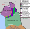
 Cuestión de Tacna y Arica.svg 3,954 × 3,837; 1.03 MB
-
 Departamento de Arica, Chile.svg 3,093 × 2,937; 787 KB
-
 Pérdidas territoriales de iure de la República de Chile.svg 1,800 × 2,808; 3.84 MB
-
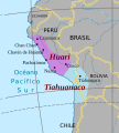 Wari-Tiahuanaco.svg 268 × 297; 398 KB


.svg)


