Category:Southwell Trail
Jump to navigation
Jump to search
multi-user rail trail in the English county of Nottinghamshire  | |||||
| Upload media | |||||
| Instance of | |||||
|---|---|---|---|---|---|
| Location | Newark and Sherwood, Nottinghamshire, East Midlands, England | ||||
| |||||
Subcategories
This category has only the following subcategory.
F
- Flora of the Southwell Trail (11 F)
Media in category "Southwell Trail"
The following 98 files are in this category, out of 98 total.
-

-

-
 Bench on the Southwell Trail - geograph.org.uk - 2449912.jpg 1,024 × 768; 293 KB
-
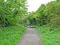
 Bridge ahead on the Southwell Trail - geograph.org.uk - 4678898.jpg 1,024 × 768; 334 KB
-
 Bridge over Southwell trail - geograph.org.uk - 4678893.jpg 1,024 × 768; 315 KB
-
 Bridge over the Southwell Trail - geograph.org.uk - 4785624.jpg 800 × 600; 149 KB
-
 Bridge over the Southwell Trail - geograph.org.uk - 4785632.jpg 800 × 600; 157 KB
-

-
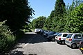
 Car park on the Southwell Trail - geograph.org.uk - 4679593.jpg 1,024 × 768; 231 KB
-
 Control barrier on the Southwell Trail - geograph.org.uk - 4679573.jpg 1,024 × 768; 296 KB
-
 Culvert under the Southwell Trail - geograph.org.uk - 2450097.jpg 1,024 × 768; 445 KB
-
 Entrance to the Southwell Trail - geograph.org.uk - 4966465.jpg 1,600 × 1,065; 743 KB
-
 Farm track crossing the Southwell Trail - geograph.org.uk - 4679582.jpg 1,024 × 768; 255 KB
-
 Farnsfield-Southwell Trail, Kirklington Vicinity - geograph.org.uk - 6224083.jpg 3,001 × 3,391; 4.67 MB
-
 Farnsfield-Southwell Trail, Kirklington Vicinity - geograph.org.uk - 6224408.jpg 3,542 × 2,612; 4.78 MB
-
 Farnsfield-Southwell Trail, Kirklington Vicinity - geograph.org.uk - 6224424.jpg 3,671 × 2,853; 3.64 MB
-
 Farnsfield-Southwell Trail, Kirklington Vicinity - geograph.org.uk - 6224472.jpg 3,389 × 2,577; 3.91 MB
-
 Farnsfield-Southwell Trail, Kirklington Vicinity - geograph.org.uk - 6224480.jpg 3,828 × 2,871; 4.66 MB
-
 Farnsfield-Southwell Trail, Kirklington Vicinity - geograph.org.uk - 6224485.jpg 3,232 × 2,465; 2.76 MB
-
 Footpath crossing - geograph.org.uk - 838507.jpg 426 × 640; 115 KB
-
 Footpath in the Greet Valley - geograph.org.uk - 838505.jpg 640 × 426; 96 KB
-
 Footpath off Kirklington Road - geograph.org.uk - 838485.jpg 640 × 426; 138 KB
-
 Footpath sign on the Southwell Trail - geograph.org.uk - 4905697.jpg 1,024 × 768; 238 KB
-
 Graffiti on the Southwell Trail - geograph.org.uk - 4046377.jpg 1,024 × 683; 300 KB
-

-
 Greet Valley - geograph.org.uk - 838497.jpg 640 × 426; 79 KB
-
 Greet Valley - geograph.org.uk - 838499.jpg 640 × 426; 89 KB
-
 Horse riders on the Southwell Trail - geograph.org.uk - 3881314.jpg 480 × 640; 130 KB
-
 Horse stile on the Southwell Trail - geograph.org.uk - 838510.jpg 640 × 426; 121 KB
-
-
 Junction on the Southwell Trail at Farnsfield - geograph.org.uk - 4679159.jpg 1,024 × 768; 343 KB
-
 Kirklington - geograph-3057836-by-Richard-Croft.jpg 640 × 427; 132 KB
-
 Kirklington - geograph-3881286-by-Oliver-Dixon.jpg 640 × 480; 154 KB
-
 Kirklington Station site (geograph 4046448).jpg 1,024 × 683; 360 KB
-
 Kirklington station, Southwell Trail (geograph 6777574).jpg 1,024 × 768; 242 KB
-
 Mansfield to Southwell line now a trail - geograph.org.uk - 2205845.jpg 640 × 427; 102 KB
-
 Maythorne - geograph.org.uk - 3057514.jpg 640 × 427; 96 KB
-
 Maythorne - geograph.org.uk - 3384811.jpg 640 × 331; 51 KB
-
 Maythorne near Southwell - geograph.org.uk - 3881334.jpg 640 × 480; 85 KB
-
 Maythorne, Southwell, Notts. - geograph.org.uk - 3477215.jpg 2,982 × 3,341; 1.75 MB
-
 Maythorne, Southwell, Notts. - geograph.org.uk - 3477231.jpg 3,640 × 2,346; 1.58 MB
-
 Meeting of the ways off the Southwell Trail - geograph.org.uk - 4679576.jpg 1,024 × 768; 235 KB
-
 Minor road crosses the Southwell Trail - geograph.org.uk - 4679577.jpg 1,024 × 768; 260 KB
-
 NCN645 The Southwell Trail - geograph.org.uk - 4679592.jpg 1,024 × 768; 325 KB
-
 Nearing the end of the Southwell Trail - geograph.org.uk - 4679579.jpg 1,024 × 768; 329 KB
-
 On the Southwell Trail - geograph.org.uk - 4787419.jpg 3,072 × 1,728; 1.66 MB
-
 On the Southwell Trail - geograph.org.uk - 4837211.jpg 3,072 × 1,728; 4.5 MB
-
 On the Southwell Trail - geograph.org.uk - 4838675.jpg 800 × 600; 183 KB
-
 On the Southwell Trail - geograph.org.uk - 4838679.jpg 800 × 600; 230 KB
-
 Power lines alongside the Southwell Trail - geograph.org.uk - 4679586.jpg 1,024 × 768; 265 KB
-

-
 Recreation Ground, Norwood Gardens - geograph.org.uk - 838489.jpg 640 × 426; 134 KB
-
 Road bridge over the Southwell Trail - geograph.org.uk - 4785628.jpg 800 × 600; 102 KB
-
 Robin Hood Way near Easthorpe - geograph.org.uk - 838563.jpg 640 × 426; 95 KB
-
 Southwell Trail - geograph.org.uk - 3057463.jpg 640 × 427; 132 KB
-
 Southwell Trail - geograph.org.uk - 3057585.jpg 640 × 427; 143 KB
-
 Southwell Trail - geograph.org.uk - 3057603.jpg 640 × 427; 162 KB
-
 Southwell Trail - geograph.org.uk - 3057654.jpg 640 × 427; 150 KB
-
 Southwell Trail - geograph.org.uk - 3057838.jpg 640 × 427; 149 KB
-
 Southwell Trail - geograph.org.uk - 3058516.jpg 640 × 427; 149 KB
-
 Southwell Trail - geograph.org.uk - 4046309.jpg 1,024 × 683; 262 KB
-
 Southwell Trail - geograph.org.uk - 4046367.jpg 1,024 × 683; 301 KB
-
 Southwell Trail - geograph.org.uk - 4046378.jpg 1,024 × 683; 305 KB
-
 Southwell Trail - geograph.org.uk - 4046502.jpg 1,024 × 683; 403 KB
-
 Southwell Trail - geograph.org.uk - 4678890.jpg 1,024 × 768; 237 KB
-
 Southwell Trail - geograph.org.uk - 4679583.jpg 1,024 × 768; 306 KB
-
 Southwell Trail - geograph.org.uk - 4790576.jpg 3,072 × 1,728; 3.01 MB
-
 Southwell Trail - geograph.org.uk - 5698415.jpg 4,608 × 3,456; 4.48 MB
-
 Southwell Trail - geograph.org.uk - 5698419.jpg 4,608 × 3,456; 4.83 MB
-
 Southwell Trail - geograph.org.uk - 838492.jpg 426 × 640; 131 KB
-
 Southwell Trail - geograph.org.uk - 838495.jpg 640 × 426; 103 KB
-
 Southwell Trail at Bilsthorpe - geograph.org.uk - 4790582.jpg 3,072 × 1,728; 1.63 MB
-
 Southwell Trail at Broomfield Lane, Farnsfield - geograph.org.uk - 1987980.jpg 1,024 × 768; 239 KB
-
 Southwell Trail at Farnsfield - geograph.org.uk - 2450008.jpg 1,024 × 765; 257 KB
-
 Southwell Trail at Farnsfield - geograph.org.uk - 3880947.jpg 640 × 480; 172 KB
-
 Southwell Trail at Farnsfield - geograph.org.uk - 3880950.jpg 640 × 480; 163 KB
-
 Southwell Trail at Farnsfield - geograph.org.uk - 4785344.jpg 3,072 × 1,728; 1.71 MB
-
 Southwell Trail at Station Road (geograph 6603717).jpg 1,280 × 960; 658 KB
-
 Southwell Trail car park - geograph.org.uk - 838547.jpg 640 × 426; 124 KB
-
 Southwell Trail in the Autumn - geograph.org.uk - 5521653.jpg 4,608 × 3,456; 5.79 MB
-
 Southwell Trail near Farnsfield - geograph.org.uk - 4679575.jpg 1,024 × 768; 315 KB
-
 Southwell trail near Kirklington - geograph.org.uk - 640380.jpg 640 × 480; 124 KB
-
 Southwell Trail near Maythorne - geograph.org.uk - 4679570.jpg 1,024 × 768; 333 KB
-
 Southwell Trail near Maythorne Farm - geograph.org.uk - 2450103.jpg 1,024 × 768; 392 KB
-
 Southwell Trail near Maythorne Farm - geograph.org.uk - 3881312.jpg 640 × 480; 178 KB
-
 Southwell Trail south of Kirklington - geograph.org.uk - 2449571.jpg 1,024 × 768; 422 KB
-
 Speckled Wood basking - geograph.org.uk - 842576.jpg 640 × 426; 60 KB
-
 Station bridge (geograph 4046496).jpg 1,024 × 683; 352 KB
-

-
 The Southwell Trail at Bilsthorpe - geograph.org.uk - 4785636.jpg 800 × 600; 137 KB
-
 The Southwell Trail at Maythorne Mill - geograph.org.uk - 4318283.jpg 800 × 533; 148 KB
-

-
 The start of the Southwell trail at Bilsthorpe - geograph.org.uk - 4678888.jpg 1,024 × 768; 304 KB
-
 View from the Southwell Trail - geograph.org.uk - 4838688.jpg 800 × 600; 162 KB
-
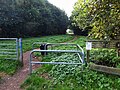
 Access to smallholding - geograph.org.uk - 838513.jpg 640 × 426; 128 KB
-
 Southwell Trail - geograph.org.uk - 34716.jpg 640 × 480; 148 KB
-
 Southwell Trail - geograph.org.uk - 34720.jpg 640 × 480; 119 KB
-
 Southwell Trail - geograph.org.uk - 61767.jpg 640 × 480; 136 KB


.jpg)
.jpg)


.jpg)


.jpg)


