Category:Southern Appalachian spruce-fir forest
Jump to navigation
Jump to search
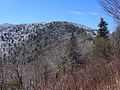
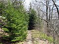
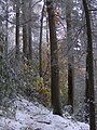
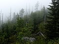
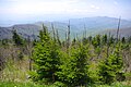
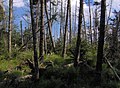
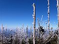
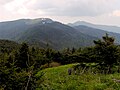
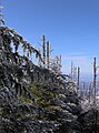
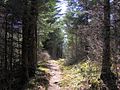
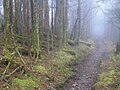
English: Southern Appalachian spruce-fir forest — an ecoregion of the Temperate coniferous forests Biome.
- The ecosystem and plant community is found in the highest elevations of the southern Appalachian Mountain ranges of the Southeastern United States.
ecosystem in North Carolina, Tennessee and Virginia | |||||
| Upload media | |||||
| Location |
| ||||
|---|---|---|---|---|---|
| |||||
Subcategories
This category has the following 4 subcategories, out of 4 total.
Media in category "Southern Appalachian spruce-fir forest"
The following 48 files are in this category, out of 48 total.
-
 Appalachian-spruce-fir-zones.png 390 × 252; 5 KB
-
 Abies fraseri foliage.jpg 2,048 × 1,536; 2.09 MB
-
 Abies fraseri Mitchell.jpg 2,048 × 1,536; 1.43 MB
-
 Appalachian-Trail-Old-Black3.jpg 628 × 460; 254 KB
-
 Appalachian-Trail-OldBlack.jpg 1,198 × 899; 453 KB
-
 Art Loeb Trail.jpg 1,600 × 1,200; 865 KB
-
 At-crossingguyot1.jpg 1,200 × 900; 859 KB
-
 Baxter-creek-old-growth-nc1.jpg 1,536 × 2,048; 1.41 MB
-
 Black mountains dead trees.jpg 480 × 640; 101 KB
-
 Clingmans Dome Appalachian Trail.jpg 3,072 × 2,304; 2.63 MB
-
 Clingmans Dome Appalachian Trail2.jpg 3,072 × 2,304; 2.55 MB
-
 Clingmans Dome-27527-1.jpg 2,000 × 1,500; 1.21 MB
-
 Clingmans-dome-spruce-fir-tn1.jpg 2,573 × 1,709; 2.63 MB
-
 Clingmans-dome-spruce-fir-tn2.jpg 4,288 × 2,848; 8.64 MB
-
 Clingmans-dome-spruce-fir-tn3.jpg 2,648 × 1,758; 2.44 MB
-
 Clingmans-dome-summit-tnnc1.jpg 567 × 417; 99 KB
-
 Forest on Baxter Creek Trail in Great Smoky Mountains National Park.jpg 3,648 × 2,736; 4.37 MB
-
 Guyot-summit1.jpg 1,198 × 898; 333 KB
-
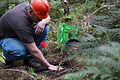
 Haywood Community College student pats the soil around a new planting (10344330916).jpg 6,000 × 4,000; 6.91 MB
-
 Haywood Community College student pats the soil around a new planting (10344338586).jpg 6,000 × 4,000; 7.81 MB
-
 Haywood Community College student places a spruce tree (10344333896).jpg 6,000 × 4,000; 8.59 MB
-

-
 Haywood Community College students planting spruce trees (10344313474).jpg 4,000 × 6,000; 7.35 MB
-
 Haywood Community College students planting spruce trees (10344525523).jpg 6,000 × 4,000; 7.75 MB
-
 Haywood Community College students prepare to plant spruce trees (10344321344).jpg 4,000 × 6,000; 7.24 MB
-
 Inadu-knob-gsmnp1.jpg 1,200 × 900; 593 KB
-
 Leaf-Colors-at-Newfound-Gap-NPS1.jpg 2,203 × 1,454; 605 KB
-
 Luftee-knob-gsmnp-nc2.jpg 1,123 × 776; 406 KB
-
 Mitchell-clingmans-peak-nc1.jpg 1,199 × 899; 270 KB
-
 Mount Craig NC.jpg 288 × 216; 37 KB
-
 Mount-chapman-guyot.jpg 1,199 × 899; 348 KB
-
 Mount-guyot-spruce-fir-tn1.jpg 829 × 1,121; 273 KB
-
 Mount-mitchell-south-nc1.jpg 1,118 × 609; 164 KB
-
 Mount-sequoyah-appalachian-trail.jpg 1,197 × 895; 463 KB
-
 Mount-sterling-summit-spruces-nc1.jpg 2,048 × 1,536; 1.3 MB
-
 Mount-sterling-summit-spruces-nc2.jpg 1,536 × 2,048; 1.3 MB
-
 MountMitchell.jpg 3,072 × 2,048; 1.89 MB
-
 Ob-cocke2.jpg 658 × 491; 147 KB
-
 Old-black-appalachian-trail-tnnc1.jpg 2,045 × 1,529; 824 KB
-
 Old-black-fraser-firs-tn1.jpg 2,041 × 1,529; 386 KB
-
 Old-hyatt-ridge-trail-nc1.jpg 2,041 × 1,529; 1.05 MB
-

-
 Roan-mountain-north-slope-tn1.jpg 1,200 × 693; 260 KB
-
 Roanhighknob-east1.jpg 638 × 478; 93 KB
-
 Seedling rising on the floor of the spruce-fir forest (7651406002).jpg 4,416 × 3,312; 5.92 MB
-
 Waterrock-catawba-rhododendron-nc1.jpg 2,048 × 1,536; 2.32 MB
-
 Waterrock-knob-summit-nc1.jpg 2,041 × 1,533; 783 KB
-
 Waterrock-west-slope-nc1.jpg 2,045 × 1,529; 906 KB


.jpg)
.jpg)
.jpg)
.jpg)
.jpg)
.jpg)
.jpg)


.jpg)


