Category:South Wingfield
Jump to navigation
Jump to search
village and civil parish in Amber Valley district, Derbyshire, England  | |||||
| Upload media | |||||
| Instance of | |||||
|---|---|---|---|---|---|
| Location | Amber Valley, Derbyshire, East Midlands, England | ||||
 | |||||
Subcategories
This category has the following 4 subcategories, out of 4 total.
Media in category "South Wingfield"
The following 200 files are in this category, out of 318 total.
(previous page) (next page)-
 "The Old Yew Tree Inn", South Wingfield - geograph.org.uk - 4841036.jpg 3,778 × 5,007; 5.42 MB
-
 66002 South Wingfield.jpg 2,000 × 1,713; 1.25 MB
-
 222003 , South Wingfield.jpg 3,907 × 2,626; 11.64 MB
-
 222004 , South Wingfield.jpg 2,000 × 1,398; 3.09 MB
-
 31233 South Wingfield.jpg 2,259 × 2,184; 1.31 MB
-
 37423 and inspection saloon Caroline South Wingfield.jpg 2,735 × 2,992; 3.88 MB
-
 37510 & 37688 , South Wingfield.jpg 3,414 × 1,531; 648 KB
-
 43089 and 222005 South Wingfield.jpg 2,458 × 3,212; 4.93 MB
-
 47832 & 47501 , South Wingfield (5673310033).jpg 2,574 × 2,031; 1.6 MB
-
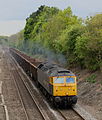
 56301 Shaw Wood Farm.jpg 2,036 × 1,357; 2.53 MB
-
 57006 South Wingfield.jpg 2,284 × 2,680; 2.73 MB
-
 66417 South Wingfield.jpg 2,504 × 2,612; 1.97 MB
-
 66433 , South Wingfield.jpg 3,779 × 2,545; 3.84 MB
-
 A bend in the road, South Wingfield - geograph.org.uk - 3112751.jpg 1,024 × 768; 281 KB
-
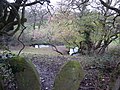
 A drop down to the stream - geograph.org.uk - 5827358.jpg 2,000 × 1,333; 3.31 MB
-
 A farm near South Wingfield - geograph.org.uk - 3408695.jpg 750 × 299; 42 KB
-
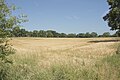 A field of Barley - geograph.org.uk - 5827224.jpg 2,000 × 1,333; 2.87 MB
-
 A gated path - geograph.org.uk - 5827194.jpg 2,000 × 1,333; 3.53 MB
-
 A much extended farmhouse - geograph.org.uk - 5827215.jpg 2,000 × 1,333; 2.6 MB
-
 A road junction - geograph.org.uk - 5827531.jpg 2,000 × 1,333; 2.74 MB
-
 A view of Fritchley Mill - geograph.org.uk - 4841520.jpg 3,725 × 4,836; 4.84 MB
-
 A view of Wingfield Manor - geograph.org.uk - 4841088.jpg 4,935 × 3,434; 4.66 MB
-
 A view of Wingfield Park Farm - geograph.org.uk - 4841513.jpg 5,043 × 3,698; 4.08 MB
-
 A38 north-west of Swanick - geograph.org.uk - 5137352.jpg 640 × 481; 31 KB
-
 A38 turning south - geograph.org.uk - 4045998.jpg 1,600 × 1,065; 230 KB
-
 A615 downhill towards Wessington - geograph.org.uk - 2334023.jpg 1,600 × 1,200; 546 KB
-
 Above the Amber Valley - geograph.org.uk - 1255789.jpg 640 × 455; 89 KB
-
 Across the Amber Valley - geograph.org.uk - 3109654.jpg 768 × 1,024; 144 KB
-
 Across the Amber Valley towards Crich - geograph.org.uk - 3006041.jpg 1,600 × 1,200; 316 KB
-
 Alfreton Brook - geograph.org.uk - 6258276.jpg 3,648 × 2,736; 2.52 MB
-
 Alfreton Golf Course - geograph.org.uk - 2672391.jpg 1,280 × 853; 305 KB
-
 Amber valley east of South Wingfield - geograph.org.uk - 2415873.jpg 1,024 × 768; 304 KB
-
 Amber Valley farmland near South Wingfield - geograph.org.uk - 2415940.jpg 1,024 × 768; 291 KB
-
 Amber Valley Grassland - geograph.org.uk - 2415895.jpg 1,024 × 768; 205 KB
-
 An old stone barn - geograph.org.uk - 5827208.jpg 2,000 × 1,333; 2.96 MB
-
 Another view of Fritchley Mill - geograph.org.uk - 6193957.jpg 3,649 × 4,777; 4.34 MB
-
 Approaching Fourlane Ends - geograph.org.uk - 2172067.jpg 640 × 480; 79 KB
-
 Approaching Tithe Farm - geograph.org.uk - 1255797.jpg 640 × 479; 117 KB
-
 At the east gate, Wingfield Manor - geograph.org.uk - 4841072.jpg 5,184 × 3,888; 6.85 MB
-
 B5035 towards Crich - geograph.org.uk - 2335109.jpg 1,600 × 1,200; 493 KB
-
 B6013 towards Belper - geograph.org.uk - 2333991.jpg 1,600 × 1,200; 325 KB
-
 Baling Straw in the Amber Valley - geograph.org.uk - 3076690.jpg 4,000 × 3,000; 3.57 MB
-
 Barley field near Brook Farm - geograph.org.uk - 2694332.jpg 3,648 × 2,736; 3.47 MB
-
 Birch Lane Methodist Church - geograph.org.uk - 4841022.jpg 3,888 × 5,184; 5.68 MB
-

-
 Boundary marker - geograph.org.uk - 1255876.jpg 640 × 465; 110 KB
-

-
 Brook Farm - geograph.org.uk - 2694316.jpg 3,648 × 2,736; 3.43 MB
-
 Brook Farm - geograph.org.uk - 5055778.jpg 640 × 480; 71 KB
-
 Brook Farm, South Wingfield - geograph.org.uk - 2171291.jpg 640 × 480; 122 KB
-
 Bull Farm, Wingfield Park - geograph.org.uk - 3006077.jpg 1,600 × 1,200; 500 KB
-
 Bus stop - geograph.org.uk - 1564107.jpg 640 × 480; 69 KB
-
 Camouflaged stile - geograph.org.uk - 5591003.jpg 1,702 × 2,269; 1.79 MB
-
 Church of All Saints, South Wingfield - geograph.org.uk - 6447799.jpg 4,896 × 3,264; 3.75 MB
-

-
 Coalburn Hill - geograph.org.uk - 2171342.jpg 640 × 480; 65 KB
-
 Coalburn Hill - geograph.org.uk - 4759413.jpg 640 × 426; 52 KB
-

-
 Corn merchant, Church Lane, South Wingfield - geograph.org.uk - 3109505.jpg 1,024 × 614; 143 KB
-
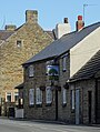
 Country pub - geograph.org.uk - 1564122.jpg 640 × 480; 113 KB
-
 Cows grazing by Moorwoodmoor Lane - geograph.org.uk - 6193761.jpg 4,808 × 3,492; 4.6 MB
-
 Cracked bedding - geograph.org.uk - 1255898.jpg 479 × 640; 122 KB
-
 Crich Stand and Wingfield Manor, fantastic view point - geograph.org.uk - 3006129.jpg 1,600 × 1,200; 405 KB
-
 Crowning clump - geograph.org.uk - 1242706.jpg 640 × 426; 101 KB
-
 Dead Caterpillar - geograph.org.uk - 2171337.jpg 640 × 480; 126 KB
-
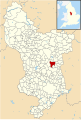 Derbyshire UK parish map highlighting South Wingfield.svg 888 × 1,308; 2.34 MB
-
 Descending to Coalburn Farm - geograph.org.uk - 2171339.jpg 640 × 480; 46 KB
-
 Detail of a gatepost - Wingfield Park - geograph.org.uk - 6194684.jpg 3,888 × 5,184; 5.74 MB
-
 Down the valley up to London - geograph.org.uk - 1255853.jpg 640 × 429; 53 KB
-
 Downhill to Wingfield Park - geograph.org.uk - 1200413.jpg 640 × 480; 121 KB
-
 Drive to Moor House, Moorwood Moor - geograph.org.uk - 5055771.jpg 640 × 480; 108 KB
-
 Driveway to Shrewsbury Cottage - geograph.org.uk - 4841097.jpg 3,501 × 5,010; 4.08 MB
-
 Dung heap near Alfreton Park - geograph.org.uk - 2695419.jpg 3,648 × 2,736; 3.64 MB
-

-
 Entrance road at Wingfield Hall - geograph.org.uk - 2415876.jpg 1,024 × 768; 224 KB
-
 Entrance to Weir Mill Farm - geograph.org.uk - 2415907.jpg 1,024 × 768; 280 KB
-
 Entrance to Wingfield Manor - geograph.org.uk - 2415885.jpg 1,024 × 768; 303 KB
-
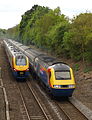
 Express to Sheffield - geograph.org.uk - 1255814.jpg 640 × 378; 45 KB
-
 Farm buildings, South Wingfield - geograph.org.uk - 2171295.jpg 640 × 480; 67 KB
-
 Farm scene, Edge Moor - geograph.org.uk - 3112700.jpg 1,024 × 768; 127 KB
-
 Farm Track and Copse near Alfreton Park - geograph.org.uk - 3145335.jpg 4,000 × 3,000; 2.69 MB
-
 Farm track from Ufton Fields Farm - geograph.org.uk - 2695413.jpg 3,648 × 2,736; 3.96 MB
-
 Farm track to Wild Lane - Hollins Lane - geograph.org.uk - 3112710.jpg 768 × 1,024; 138 KB
-
 Farm track with cautionary sign - geograph.org.uk - 2172254.jpg 640 × 480; 79 KB
-
 Farmland in the Amber Valley - geograph.org.uk - 4759407.jpg 640 × 403; 50 KB
-
 Farmland near Ufton Fields Farm - geograph.org.uk - 2334030.jpg 1,600 × 1,200; 382 KB
-
 Farmland near Wingfield Park - geograph.org.uk - 2117397.jpg 640 × 480; 75 KB
-
 Farmland near Wingfield Park - geograph.org.uk - 2982217.jpg 640 × 261; 29 KB
-
 Farmland off Millstone Lane - geograph.org.uk - 2333979.jpg 640 × 480; 45 KB
-
 Farmland, near Hollybush Farm - geograph.org.uk - 2171285.jpg 640 × 480; 89 KB
-
 Farmyard, Fourlane Ends - geograph.org.uk - 2172204.jpg 640 × 480; 91 KB
-
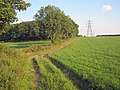
 Field and hedgerow, Brook Farm - geograph.org.uk - 5055776.jpg 640 × 480; 65 KB
-
 Field entrance off Wild Lane - geograph.org.uk - 5055762.jpg 640 × 480; 82 KB
-
 Field of Cut Hay near Fitchley Mill - geograph.org.uk - 3076699.jpg 4,000 × 3,000; 2.17 MB
-
 Field of Hay near Beech Hill Farm - geograph.org.uk - 3076683.jpg 4,000 × 3,000; 3.25 MB
-
 Fields and telegraph poles - geograph.org.uk - 3408709.jpg 750 × 726; 103 KB
-
-
 Fields near Moorwood Moor - geograph.org.uk - 3408685.jpg 750 × 563; 114 KB
-
 Fields near South Wingfield - geograph.org.uk - 3109525.jpg 1,024 × 768; 167 KB
-
 Fields towards South Wingfield - geograph.org.uk - 3408691.jpg 750 × 563; 94 KB
-
 Fishing Lakes and Wingfield Manor - geograph.org.uk - 2911291.jpg 3,288 × 2,460; 1.38 MB
-
 Flooded field north of Park Lane - geograph.org.uk - 4841101.jpg 4,893 × 3,661; 4.63 MB
-
 Footbridge near Shaw Wood - geograph.org.uk - 2172043.jpg 640 × 480; 152 KB
-
 Footbridge over Birches Brook - geograph.org.uk - 2172346.jpg 640 × 480; 131 KB
-
 Footbridge over Lindwaysprings Brook - geograph.org.uk - 2170759.jpg 1,024 × 768; 325 KB
-
 Footbridge over Oakenthorpe Brook - geograph.org.uk - 6201099.jpg 3,888 × 5,184; 6.37 MB
-
 Footbridge over River Amber - geograph.org.uk - 539644.jpg 640 × 480; 170 KB
-
 Footpath between walls - geograph.org.uk - 3109673.jpg 768 × 1,024; 391 KB
-

-
 Footpath Sign near Castle Hill - geograph.org.uk - 4255696.jpg 4,000 × 3,000; 2.36 MB
-
 Footpath south wingfield under railway.jpg 4,912 × 3,264; 2.96 MB
-
 Footpath to Shaw Wood Farm - geograph.org.uk - 6201112.jpg 3,699 × 4,933; 4.41 MB
-
 Footpath to Wingfield Park - geograph.org.uk - 2415882.jpg 1,024 × 768; 256 KB
-
 Footpath with view of Oakerthorpe - geograph.org.uk - 5591011.jpg 1,466 × 1,100; 478 KB
-
 Four Lane Ends - geograph.org.uk - 5590968.jpg 2,272 × 1,704; 1.17 MB
-

-
 Fritchley windmill - geograph.org.uk - 1242712.jpg 640 × 640; 142 KB
-
 Front garden - geograph.org.uk - 1564184.jpg 640 × 480; 108 KB
-
 Garage with decking above - geograph.org.uk - 1564090.jpg 480 × 640; 74 KB
-
 Garner Lane (B5035) towards Crich - geograph.org.uk - 2335115.jpg 1,600 × 1,200; 673 KB
-
 Garner Lane - geograph.org.uk - 5827226.jpg 2,000 × 1,333; 3.44 MB
-
 Garner Lane Farm - geograph.org.uk - 2335113.jpg 1,600 × 1,200; 345 KB
-
 Garner Lane near South Wingfield - geograph.org.uk - 2911429.jpg 3,288 × 2,460; 1.38 MB
-
 Gate post at Wood-End - geograph.org.uk - 2415978.jpg 1,024 × 768; 340 KB
-
 Going Cross-Country - geograph.org.uk - 1255840.jpg 640 × 431; 51 KB
-
 Gospel Hall, South Wingfield - geograph.org.uk - 3112739.jpg 1,024 × 768; 186 KB
-
 Grazing land near Ufton Fields Farm - geograph.org.uk - 2694360.jpg 3,648 × 2,736; 4.53 MB
-
 Grazing land, Amber Valley - geograph.org.uk - 4763922.jpg 640 × 426; 47 KB
-
 High Road in South Wingfield - geograph.org.uk - 2911229.jpg 3,296 × 2,472; 1.07 MB
-
 Hill Top Farm - geograph.org.uk - 4841530.jpg 4,915 × 3,462; 4.33 MB
-
 Hollins Lane - geograph.org.uk - 3145592.jpg 4,000 × 3,000; 3.04 MB
-
 Holly Bush Farm - geograph.org.uk - 3109657.jpg 1,024 × 358; 77 KB
-
 Holme Lane Railway Bridge.jpg 5,472 × 3,648; 2.86 MB
-
 House on Chesterfield Road - geograph.org.uk - 2334019.jpg 1,600 × 1,200; 412 KB
-
 Houses on Church Lane, South Wingfield - geograph.org.uk - 3112767.jpg 1,024 × 569; 141 KB
-
 In the Amber Valley - geograph.org.uk - 1255845.jpg 640 × 479; 93 KB
-
 In Wingfield Park - geograph.org.uk - 1255960.jpg 640 × 479; 105 KB
-
 Inns Lane - geograph.org.uk - 5055774.jpg 640 × 480; 56 KB
-
 Inns Lane near South Wingfield - geograph.org.uk - 3145516.jpg 4,000 × 3,000; 2.41 MB
-
 Inns Lane, Moorwood Moor - geograph.org.uk - 5055940.jpg 640 × 480; 94 KB
-
 Jackson's Lane - geograph.org.uk - 2415930.jpg 1,024 × 768; 252 KB
-
 Leaving South Wingfield - geograph.org.uk - 2172295.jpg 640 × 480; 61 KB
-

-
 Lime Kiln (^) at Park Head - geograph.org.uk - 255705.jpg 640 × 480; 118 KB
-
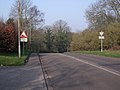
 Listed Bridge - geograph.org.uk - 2305424.jpg 2,048 × 1,536; 2.27 MB
-
 Livestock wagon, and silage - geograph.org.uk - 2172291.jpg 640 × 480; 94 KB
-
 Lodge Hill Farm - geograph.org.uk - 1255937.jpg 640 × 479; 160 KB
-
 Lodge Hill Farm - geograph.org.uk - 1255943.jpg 640 × 479; 114 KB
-
 Lodge Hill Farm drive - geograph.org.uk - 1255881.jpg 479 × 640; 122 KB
-
 Logs and a few chickens - geograph.org.uk - 2172057.jpg 640 × 480; 69 KB
-
 Lots of hay bales - geograph.org.uk - 5827352.jpg 2,000 × 1,333; 2.99 MB
-
 Ludlam's Farm, Wessington - geograph.org.uk - 2170773.jpg 640 × 480; 113 KB
-
 Lynam Road - Junction with Park Lane - geograph.org.uk - 1195015.jpg 640 × 480; 112 KB
-
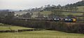
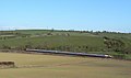
 Main line at South Wingfield - geograph.org.uk - 2415960.jpg 1,024 × 768; 344 KB
-
 Manor Road, South Wingfield - geograph.org.uk - 3109541.jpg 1,024 × 663; 146 KB
-
 Meadows east of Ufton Fields Farm - geograph.org.uk - 2695392.jpg 3,648 × 2,736; 4.37 MB
-
 Methodist Church at Moorwood Moor - geograph.org.uk - 3145581.jpg 4,000 × 3,000; 2.2 MB
-
 Methodist Church, South Wingfield - geograph.org.uk - 2335102.jpg 1,600 × 1,200; 427 KB
-
-
 Millstone lane towards Oakerthorpe - geograph.org.uk - 2333982.jpg 1,600 × 1,200; 626 KB
-
 Mingled Together - geograph.org.uk - 4841064.jpg 5,005 × 3,698; 4.99 MB
-
 Moor House, Moorwood Moor - geograph.org.uk - 5055769.jpg 640 × 480; 83 KB
-

-
 Moorwood Moor - geograph.org.uk - 3145561.jpg 4,000 × 3,000; 2.9 MB
-
 Moorwood Moor Lane - geograph.org.uk - 3408679.jpg 563 × 750; 150 KB
-
 Moorwood Moor Lane - geograph.org.uk - 5055780.jpg 640 × 480; 96 KB
-
 Moorwood Moor Methodist Chapel - geograph.org.uk - 3408675.jpg 750 × 536; 90 KB
-
 Muddy footpath . . . - geograph.org.uk - 5591026.jpg 2,246 × 1,684; 1.12 MB
-
 Nettles round a stile - geograph.org.uk - 1935838.jpg 640 × 480; 63 KB
-
 New life - geograph.org.uk - 5591020.jpg 2,233 × 1,677; 2.1 MB
-
 Oak trees - geograph.org.uk - 1231619.jpg 640 × 640; 123 KB
-
 Oakerthorpe Brook - geograph.org.uk - 2334009.jpg 1,600 × 1,200; 738 KB
-
 Old farm building west of Wingfield Park Hall - geograph.org.uk - 4841385.jpg 3,720 × 4,989; 4.8 MB
-

-
 On Millstone Lane - geograph.org.uk - 6201116.jpg 3,888 × 5,184; 5.65 MB
-
 On the path between Alfreton and Four Lane Ends - geograph.org.uk - 6201095.jpg 5,184 × 3,888; 5.48 MB
-
 On the path south from Hilltop, South Wingfield - geograph.org.uk - 4841548.jpg 5,032 × 3,593; 5.43 MB
-
 On to Scotland - geograph.org.uk - 1255866.jpg 470 × 640; 117 KB
-
 On Wild Lane - geograph.org.uk - 6193785.jpg 4,987 × 3,684; 3.66 MB
-
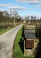
 Overgrown phone box, Moorwood Moor - geograph.org.uk - 5055768.jpg 640 × 480; 70 KB
-
 Park Farm and Coalburn Brook - geograph.org.uk - 4841526.jpg 4,968 × 3,640; 4.69 MB
-
 Park Farm Ford - geograph.org.uk - 4912449.jpg 6,000 × 4,000; 2.5 MB
-

-
 Park Lane - Railway Bridge (SPC8-53 - geograph.org.uk - 1200366.jpg 640 × 480; 107 KB
-

-
 Parks Avenue, South Wingfield - geograph.org.uk - 3109512.jpg 1,024 × 612; 143 KB
-
 Parkside Stables - geograph.org.uk - 5827361.jpg 2,000 × 1,333; 3.26 MB
-
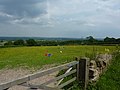
 Pasture near South Wingfield - geograph.org.uk - 2639550.jpg 2,592 × 1,944; 1.5 MB
-
 Pasture overlooking Ufton Fields Farm - geograph.org.uk - 3145356.jpg 4,000 × 3,000; 2.8 MB
-
 Path sign to Alfreton - geograph.org.uk - 2172084.jpg 640 × 480; 87 KB
-
 Pentrich Mill by the River Amber - geograph.org.uk - 3076676.jpg 4,000 × 3,000; 2.73 MB
-
 Post box at road junction - geograph.org.uk - 1564113.jpg 640 × 480; 66 KB
-
 Public footpath near Park Farm - geograph.org.uk - 6193954.jpg 3,802 × 5,089; 6.42 MB
-
 Railway Bridge - geograph.org.uk - 2304517.jpg 2,048 × 1,536; 1.98 MB
-
 Railway bridge at Wingfield Park - geograph.org.uk - 1304525.jpg 470 × 640; 165 KB
-
 Railway bridge Weir Mill - geograph.org.uk - 2335119.jpg 1,600 × 1,200; 707 KB
-
 Railway line at Sawmills - geograph.org.uk - 2117390.jpg 640 × 480; 98 KB
-
 Recently developed pond at Hilltop Farm - geograph.org.uk - 4841562.jpg 4,832 × 3,501; 4.07 MB
-
 River Amber - geograph.org.uk - 2171347.jpg 800 × 600; 146 KB
-
 River Amber - Sawmills - geograph.org.uk - 194522.jpg 640 × 480; 126 KB


.jpg)


_towards_Crich_-_geograph.org.uk_-_2335115.jpg)


_at_Park_Head_-_geograph.org.uk_-_255705.jpg)


