Category:South Petherwin
Jump to navigation
Jump to search
village and civil parish in east Cornwall, England  | |||||
| Upload media | |||||
| Instance of | |||||
|---|---|---|---|---|---|
| Location | Cornwall, South West England, England | ||||
| Located in or next to body of water | |||||
| Population |
| ||||
 | |||||
Subcategories
This category has the following 4 subcategories, out of 4 total.
Media in category "South Petherwin"
The following 122 files are in this category, out of 122 total.
-
 A30 and A395 junction - geograph.org.uk - 3831802.jpg 1,536 × 1,152; 792 KB
-
 A30 at Holyway Cross - geograph.org.uk - 3831793.jpg 1,024 × 768; 90 KB
-
 A30 bridge near Trebursye Manor - geograph.org.uk - 2841875.jpg 800 × 600; 358 KB
-
 A30 by-passing Tregadillett - geograph.org.uk - 5767024.jpg 1,200 × 1,600; 725 KB
-
 A30 north of Treguddick Manor - geograph.org.uk - 3223316.jpg 3,648 × 2,048; 1.53 MB
-
 A30 passes turning to Polyphant - geograph.org.uk - 3183729.jpg 3,551 × 2,680; 1.57 MB
-
 A30 south bound - geograph.org.uk - 3130347.jpg 640 × 480; 52 KB
-
 A30 south of Kennards House - geograph.org.uk - 3223739.jpg 3,375 × 1,932; 758 KB
-
 A30 south of Trebursye Oak - geograph.org.uk - 3223750.jpg 3,648 × 2,048; 1.49 MB
-
 A30 south of Tregadillett - geograph.org.uk - 3223743.jpg 3,648 × 2,048; 778 KB
-
 A30 southwest bound - geograph.org.uk - 3130351.jpg 640 × 480; 44 KB
-
 A30 west bound - geograph.org.uk - 3130299.jpg 640 × 480; 45 KB
-
 A30 west bound - geograph.org.uk - 3130301.jpg 640 × 480; 51 KB
-
 A30 west bound - geograph.org.uk - 3130310.jpg 640 × 480; 43 KB
-
 A30 west bound - geograph.org.uk - 3130326.jpg 640 × 480; 52 KB
-

-

-

-
 A395 at Kennards House - geograph.org.uk - 2836597.jpg 640 × 480; 64 KB
-
 Across the Inny valley - geograph.org.uk - 4435839.jpg 1,920 × 1,392; 511 KB
-

-
 Animal feeders, Brockle - geograph.org.uk - 1732829.jpg 640 × 480; 100 KB
-
 Approaching A30 junction with A395 - geograph.org.uk - 3831812.jpg 1,024 × 768; 73 KB
-
 Bend on A30 at Treguddick - geograph.org.uk - 4036881.jpg 640 × 351; 38 KB
-
 Bridge near Linnick Farm - geograph.org.uk - 1731987.jpg 640 × 480; 133 KB
-
 Bridge over A30 at junction with A395 - geograph.org.uk - 2841892.jpg 800 × 600; 295 KB
-
 Bus shelter in South Petherwin - geograph.org.uk - 3520075.jpg 640 × 480; 89 KB
-
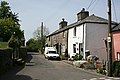
 Cottages in South Petherwin - geograph.org.uk - 3520066.jpg 640 × 480; 97 KB
-
 Dangerous stile - geograph.org.uk - 589873.jpg 480 × 640; 109 KB
-
-
 Farmyard in South Petherwin - geograph.org.uk - 428044.jpg 640 × 427; 100 KB
-
 Field at Linnick Farm - geograph.org.uk - 3520047.jpg 640 × 480; 90 KB
-
 Field near Trecrogo - geograph.org.uk - 4431657.jpg 1,920 × 1,289; 576 KB
-
 Ford at Higher Tregada - geograph.org.uk - 4676180.jpg 6,000 × 4,000; 6.49 MB
-
 Hillside, Brockle Ford - geograph.org.uk - 1731477.jpg 640 × 429; 102 KB
-
 Holyway Cross - geograph.org.uk - 3831787.jpg 1,536 × 1,152; 1.17 MB
-
 House at Trevosper - geograph.org.uk - 4700738.jpg 2,199 × 1,682; 681 KB
-
 Joining the A30 - geograph.org.uk - 2836580.jpg 640 × 454; 43 KB
-
 Lane to South Petherwin - geograph.org.uk - 1732874.jpg 640 × 480; 97 KB
-
 Lane, Brockle Ford - geograph.org.uk - 1732999.jpg 640 × 445; 129 KB
-
 Lane, Brockle Ford - geograph.org.uk - 1733109.jpg 640 × 458; 131 KB
-
 Launceston Industrial Park - geograph.org.uk - 37885.jpg 640 × 480; 100 KB
-
 Launceston Turnpike Trust milestone.jpg 3,096 × 4,128; 5.72 MB
-
 Lay-by on A30 near Tregadillett - geograph.org.uk - 2841885.jpg 800 × 600; 284 KB
-

-
 Minor road junction at Brockle Ford - geograph.org.uk - 3519275.jpg 640 × 480; 115 KB
-
 North Cornwall , Small Roundabout - geograph.org.uk - 3862289.jpg 4,166 × 2,652; 3.22 MB
-
 North Cornwall , The A30 - geograph.org.uk - 3862287.jpg 4,288 × 2,848; 4.75 MB
-
 North Cornwall , The A30 - geograph.org.uk - 3862290.jpg 4,288 × 2,848; 4.09 MB
-
 North Cornwall , The A30 - geograph.org.uk - 3862291.jpg 4,288 × 2,848; 4.78 MB
-
 North Cornwall , The A30 - geograph.org.uk - 3862294.jpg 4,288 × 2,848; 4.27 MB
-
 North Cornwall , The A30 - geograph.org.uk - 3862296.jpg 4,288 × 2,848; 5.35 MB
-
 North Cornwall , The A30 - geograph.org.uk - 3862300.jpg 2,848 × 4,288; 5.17 MB
-
 North Cornwall , The A30 Dual Carriageway - geograph.org.uk - 2491179.jpg 4,276 × 2,830; 5.16 MB
-
 Oak above Landlake Road - geograph.org.uk - 1732083.jpg 480 × 640; 102 KB
-
 Oak by the road - geograph.org.uk - 1730122.jpg 640 × 480; 126 KB
-
 Old Milestone - geograph.org.uk - 6045129.jpg 567 × 800; 110 KB
-

-
-
 Old Wayside Cross on the A30 at Holyway Cross - geograph.org.uk - 6083816.jpg 698 × 1,024; 389 KB
-
 Parapet, Brockle Ford - geograph.org.uk - 1731497.jpg 640 × 491; 131 KB
-
 Pennygillam Way - geograph.org.uk - 3704106.jpg 1,024 × 645; 85 KB
-
 Pollinnick Farm - geograph.org.uk - 589525.jpg 640 × 416; 113 KB
-
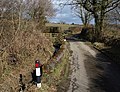
 Postbox at Landlake Cross - geograph.org.uk - 428928.jpg 427 × 640; 151 KB
-
 River Inny below Trekelland Bridge - geograph.org.uk - 589539.jpg 640 × 480; 159 KB
-
 Road at Brockle Ford - geograph.org.uk - 428034.jpg 640 × 427; 106 KB
-
 Road to Treguddick, Two Bridges, Cornwall - geograph.org.uk - 1754107.jpg 1,024 × 768; 177 KB
-
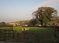 Sheep at South Petherwin - geograph.org.uk - 2836587.jpg 640 × 470; 57 KB
-
 Sheep near Botathan - geograph.org.uk - 2836591.jpg 640 × 328; 21 KB
-
 South Petherwin , The A30 - geograph.org.uk - 6337720.jpg 6,000 × 4,000; 7.4 MB
-
 South Petherwin, near Botathan - geograph.org.uk - 511657.jpg 640 × 427; 217 KB
-
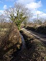 Stream by the lane, Brockle Ford - geograph.org.uk - 1733138.jpg 480 × 640; 106 KB
-
 Stream near Brockle Ford - geograph.org.uk - 1733166.jpg 640 × 480; 148 KB
-
 The A30 from the A395 - geograph.org.uk - 3527145.jpg 1,024 × 768; 227 KB
-
 The A30 westbound - geograph.org.uk - 3521170.jpg 1,024 × 768; 221 KB
-
 The A30 westbound - geograph.org.uk - 3521180.jpg 1,024 × 768; 199 KB
-
 The A30 westbound - geograph.org.uk - 3521187.jpg 1,024 × 768; 189 KB
-
 The A30 westbound at the A395 - geograph.org.uk - 3521203.jpg 1,024 × 768; 194 KB
-
 The A30 westbound near Lower Tresmarrow - geograph.org.uk - 3521168.jpg 1,024 × 768; 216 KB
-
 The A30 westbound near Trebursye - geograph.org.uk - 3521177.jpg 1,024 × 768; 237 KB
-
 The A395 at the road to Hidden Valley - geograph.org.uk - 3527169.jpg 1,024 × 768; 218 KB
-
 The A395 near Kennards House - geograph.org.uk - 3527153.jpg 1,024 × 768; 186 KB
-
 The A395 towards Pipers Pool - geograph.org.uk - 3527167.jpg 1,024 × 768; 213 KB
-
 The Church of St Paternus at South Petherwin - geograph.org.uk - 4732008.jpg 4,000 × 3,000; 2.7 MB
-
 The Village Pump - geograph.org.uk - 428118.jpg 640 × 427; 75 KB
-
 Towards Trehurdon - geograph.org.uk - 2836592.jpg 640 × 442; 64 KB
-
 Trebursye House, near Launceston.jpg 3,096 × 4,128; 2.05 MB
-
 Trecongdon - geograph.org.uk - 2836594.jpg 640 × 379; 41 KB
-
 Trevozah Barton - geograph.org.uk - 1732167.jpg 640 × 429; 82 KB
-
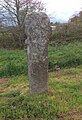
 Trevozah Cross - geograph.org.uk - 1731067.jpg 640 × 430; 64 KB
-
-

-
 Valley at Brockle Ford - geograph.org.uk - 1731347.jpg 640 × 336; 58 KB
-
 Valley at Petherwin Water - geograph.org.uk - 2836586.jpg 640 × 388; 49 KB
-
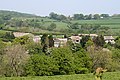
 Valley near South Petherwin - geograph.org.uk - 587562.jpg 640 × 480; 101 KB
-
 View near Strand - geograph.org.uk - 587811.jpg 640 × 480; 137 KB
-
 Wind turbine west of Trethorne - geograph.org.uk - 5767016.jpg 1,600 × 1,598; 746 KB
-
 Woodfield Park - geograph.org.uk - 1732603.jpg 640 × 459; 77 KB
-
 A Green Landscape - geograph.org.uk - 423750.jpg 640 × 427; 108 KB
-
 Beech, path and Trebursye Manor - geograph.org.uk - 587659.jpg 640 × 480; 155 KB
-
 Cottage in Shadow - geograph.org.uk - 321058.jpg 640 × 427; 90 KB
-
 Cottages in South Petherwin - geograph.org.uk - 428108.jpg 640 × 427; 88 KB
-
 Derelict Barn - geograph.org.uk - 428959.jpg 640 × 427; 104 KB
-
 Footpath at Trebursye - geograph.org.uk - 589868.jpg 640 × 480; 139 KB
-
 Houses at New Mills Farm - geograph.org.uk - 321054.jpg 640 × 427; 101 KB
-
 Landlake Road - geograph.org.uk - 428935.jpg 640 × 427; 127 KB
-
 Landlake Road Hillside - geograph.org.uk - 424329.jpg 640 × 426; 104 KB
-
 Landlake Wood - geograph.org.uk - 428973.jpg 640 × 427; 117 KB
-
 Larrick - geograph.org.uk - 428021.jpg 640 × 427; 112 KB
-
 Linnick Farm - geograph.org.uk - 428028.jpg 640 × 426; 112 KB
-
 Looking towards Trelinnoe - geograph.org.uk - 428039.jpg 640 × 427; 107 KB
-
 Lowley Brook - geograph.org.uk - 428964.jpg 427 × 640; 155 KB
-
 Lowley Brook valley - geograph.org.uk - 589870.jpg 640 × 460; 117 KB
-
 Newton Wood - geograph.org.uk - 587808.jpg 640 × 480; 115 KB
-
 Northeast of South Petherwin - geograph.org.uk - 428135.jpg 640 × 427; 92 KB
-
 Pasture Land east of South Petherwin - geograph.org.uk - 423780.jpg 640 × 427; 92 KB
-
 St Stephen by Launceston, New Mills - geograph.org.uk - 62187.jpg 640 × 432; 132 KB
-
 The Eastern Road - geograph.org.uk - 428142.jpg 640 × 427; 102 KB
-
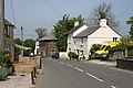 The main road through South Petherwin - geograph.org.uk - 428090.jpg 640 × 427; 92 KB
-
 Trevozah Cross - geograph.org.uk - 421992.jpg 640 × 427; 78 KB
-
 Valley near Brockle - geograph.org.uk - 423773.jpg 640 × 427; 120 KB
-
 Woodland on the valley side - geograph.org.uk - 320769.jpg 640 × 427; 105 KB


