Category:South Milford
Jump to navigation
Jump to search
village in United Kingdom  | |||||
| Upload media | |||||
| Instance of | |||||
|---|---|---|---|---|---|
| Location | Selby, North Yorkshire, Yorkshire and the Humber, England | ||||
| Population |
| ||||
 | |||||
Subcategories
This category has the following 6 subcategories, out of 6 total.
Media in category "South Milford"
The following 200 files are in this category, out of 282 total.
(previous page) (next page)-
 A first class view of Milford Sidings - geograph.org.uk - 5787357.jpg 800 × 600; 113 KB
-
 A pair of Tits - geograph.org.uk - 2721666.jpg 1,600 × 1,117; 544 KB
-
 A1 Cabbage Field - geograph.org.uk - 243036.jpg 640 × 480; 40 KB
-
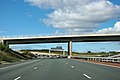 A1(M) - B1222 bridge - geograph.org.uk - 2646728.jpg 640 × 428; 73 KB
-

-
 A1(M) approaching J42 - geograph.org.uk - 4806176.jpg 640 × 426; 26 KB
-
 A1(M) junction 42 - geograph.org.uk - 2646540.jpg 640 × 428; 65 KB
-
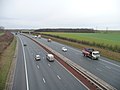
 A1(M) north - geograph.org.uk - 2040777.jpg 640 × 480; 62 KB
-
 A1(M) northbound - geograph.org.uk - 2646715.jpg 640 × 428; 68 KB
-
 A1(M) northbound - geograph.org.uk - 3035236.jpg 640 × 430; 34 KB
-
 A1(M), southbound - geograph.org.uk - 4806171.jpg 640 × 394; 24 KB
-
 A162 heading north - geograph.org.uk - 2628812.jpg 1,600 × 1,200; 346 KB
-
 A63 crosses the A1(M) - geograph.org.uk - 2040770.jpg 640 × 480; 47 KB
-
 A63 towards Selby - geograph.org.uk - 2628684.jpg 1,600 × 1,200; 522 KB
-
 A63 towards Selby - geograph.org.uk - 2755004.jpg 640 × 480; 67 KB
-
 Advertising banners - geograph.org.uk - 6395327.jpg 6,252 × 4,164; 7.24 MB
-
 Agricultural ditch, Milford Common - geograph.org.uk - 94768.jpg 426 × 640; 157 KB
-
 Another view of the disused Maltings - geograph.org.uk - 3352103.jpg 800 × 533; 140 KB
-
 Approach to railway bridge - geograph.org.uk - 5336572.jpg 800 × 600; 163 KB
-
 B1222 Bridge - geograph.org.uk - 4793133.jpg 640 × 426; 33 KB
-
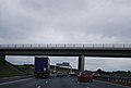 B1222 bridge over the A1(M) - geograph.org.uk - 2515464.jpg 640 × 430; 30 KB
-
 B1222 Bridge, A1(M) - geograph.org.uk - 3035240.jpg 640 × 430; 38 KB
-
 B1222, Squires cafe - geograph.org.uk - 4614824.jpg 640 × 426; 42 KB
-
 Barn construction @ South Milford - geograph.org.uk - 3511353.jpg 4,288 × 3,216; 2.25 MB
-
 Barn, Scat House Farm - geograph.org.uk - 2755006.jpg 640 × 480; 55 KB
-
 Bench mark, Church of St Mary, South Milford - geograph.org.uk - 6345465.jpg 1,280 × 1,280; 536 KB
-
 Bends on Whitecote Lane - geograph.org.uk - 2736546.jpg 1,024 × 768; 113 KB
-
 Black Bull, South Milford (closed) (8043995300).jpg 2,771 × 3,060; 4.3 MB
-
 Blocked field entrance near Steeton - geograph.org.uk - 2736593.jpg 1,024 × 768; 140 KB
-
 Bridge Garth, South Milford - geograph.org.uk - 5025191.jpg 1,200 × 799; 331 KB
-
 Bridleway bridge over the A63 at Selby Fork - geograph.org.uk - 3724983.jpg 1,600 × 1,200; 460 KB
-
 Buildings at Gascoigne Wood Mine - geograph.org.uk - 2637680.jpg 800 × 600; 245 KB
-
 Car park exit onto the B1222 - geograph.org.uk - 2736318.jpg 1,024 × 768; 110 KB
-
 Cass Lane - geograph.org.uk - 956927.jpg 640 × 326; 29 KB
-
 Church of St Mary, South Milford - geograph.org.uk - 6345461.jpg 1,280 × 926; 295 KB
-
 Church of St Mary, South Milford - geograph.org.uk - 6345463.jpg 1,280 × 1,280; 454 KB
-
 Church of St Mary, South Milford - geograph.org.uk - 6345469.jpg 927 × 1,280; 347 KB
-
 Church of St Mary, South Milford - geograph.org.uk - 6345474.jpg 960 × 1,280; 339 KB
-
 Church of St Mary, South Milford - geograph.org.uk - 6345476.jpg 1,280 × 912; 251 KB
-

-
 Coal train passing Gascoigne Wood - geograph.org.uk - 2502842.jpg 1,600 × 1,015; 239 KB
-
 Coal Train Passing under Common Lane bridge at South Milford - geograph.org.uk - 2757170.jpg 3,455 × 2,559; 1.51 MB
-
 Coal train returning to collect another load - geograph.org.uk - 2502851.jpg 1,600 × 1,120; 226 KB
-
 Coal trains at Milford Junction - 1993 (1) - geograph.org.uk - 4124019.jpg 1,024 × 768; 528 KB
-
 Coal trains at Milford Junction - 1993 (2) - geograph.org.uk - 4129118.jpg 1,024 × 768; 359 KB
-
 Coal trains at Milford Junction - 1993 (3) - geograph.org.uk - 4129124.jpg 1,024 × 768; 491 KB
-
 Coal trains at Milford Junction - 1993 (4) - geograph.org.uk - 4129128.jpg 1,024 × 768; 431 KB
-
 Coming round the curve - geograph.org.uk - 3798646.jpg 1,280 × 960; 410 KB
-
 Common Lane at Burley Close, South Milford - geograph.org.uk - 5604491.jpg 1,600 × 1,064; 359 KB
-
 Common Lane Bridge, South Milford - geograph.org.uk - 6345478.jpg 1,280 × 861; 449 KB
-
 Common Lane Bridge, South Milford - geograph.org.uk - 6345480.jpg 1,280 × 906; 417 KB
-
 Common Lane towards Gascoigne Wood - geograph.org.uk - 5604501.jpg 1,600 × 1,064; 643 KB
-
 Common Lane towards Gascolgne Wood - geograph.org.uk - 5601323.jpg 1,600 × 1,064; 609 KB
-
 Common Lane towards Gascolgne Wood - geograph.org.uk - 5601335.jpg 1,600 × 1,064; 651 KB
-
 Common Lane towards Milford Lodge - geograph.org.uk - 5606243.jpg 1,600 × 1,064; 745 KB
-
 Common Lane towards Milford Lodge - geograph.org.uk - 5606245.jpg 1,600 × 1,064; 611 KB
-
 Common Lane, South Milford - geograph.org.uk - 2022471.jpg 640 × 480; 55 KB
-
 Common Lane, South Milford - geograph.org.uk - 5025159.jpg 1,200 × 799; 330 KB
-
 Common Lane, South Milford - geograph.org.uk - 5603607.jpg 1,600 × 1,064; 479 KB
-
 Common Lane, South Milford - geograph.org.uk - 5603612.jpg 1,600 × 1,064; 502 KB
-
 Common Lane, South Milford - geograph.org.uk - 6345477.jpg 1,280 × 960; 325 KB
-

-
 Crop change along Westfield Lane - geograph.org.uk - 2737064.jpg 1,024 × 768; 143 KB
-
 Crop field, south of Old Quarry Lane - geograph.org.uk - 2736201.jpg 1,024 × 768; 221 KB
-
 Cropland - geograph.org.uk - 4611137.jpg 640 × 426; 46 KB
-
 Disused Maltings buildings - geograph.org.uk - 2748161.jpg 2,740 × 1,887; 806 KB
-

-
 Disused works near South Milford - geograph.org.uk - 3410215.jpg 2,048 × 1,536; 578 KB
-
 Don't ENTER . . . THE DRAGON . . . - geograph.org.uk - 6345489.jpg 1,280 × 960; 354 KB
-
 Farmland - geograph.org.uk - 4614801.jpg 640 × 426; 40 KB
-
 Farmland by the railway - geograph.org.uk - 4614790.jpg 640 × 426; 37 KB
-
 Farmland near Pointer Farm - geograph.org.uk - 2755001.jpg 640 × 480; 78 KB
-
 Farmland off Gorse Lane - geograph.org.uk - 2755035.jpg 640 × 480; 75 KB
-
 Farmland off the A162 - geograph.org.uk - 2628810.jpg 1,600 × 1,200; 433 KB
-
 Farmland off Westfield Lane - geograph.org.uk - 2755009.jpg 640 × 480; 52 KB
-
 Farmland off Westfield Lane - geograph.org.uk - 2755019.jpg 640 × 480; 64 KB
-
 Farmland off Whitecote Lane - geograph.org.uk - 2755027.jpg 640 × 480; 63 KB
-
 Farmland south of Whitecote Lane - geograph.org.uk - 2736537.jpg 1,024 × 768; 129 KB
-
 Field by Whin Lane - geograph.org.uk - 244491.jpg 640 × 480; 50 KB
-
 Field east of Steeton Gatehouse - geograph.org.uk - 2736645.jpg 1,024 × 768; 137 KB
-
 Field north of Old Quarry Lane (1) - geograph.org.uk - 2736209.jpg 1,024 × 768; 113 KB
-
 Field north of Old Quarry Lane (2) - geograph.org.uk - 2736212.jpg 640 × 480; 82 KB
-
 Fields to the North of Lumby - geograph.org.uk - 244485.jpg 640 × 428; 29 KB
-
 Fishing lakes at South Milford - geograph.org.uk - 1241796.jpg 640 × 407; 71 KB
-
 Flat grassland - geograph.org.uk - 4614809.jpg 640 × 426; 36 KB
-
 Flat grassland - geograph.org.uk - 4614811.jpg 640 × 426; 33 KB
-
 Foot crossing at Becks Lane - geograph.org.uk - 3724677.jpg 1,600 × 1,200; 894 KB
-
 Footpath at Melton Leys - geograph.org.uk - 3351503.jpg 1,600 × 1,066; 929 KB
-
 Footpath crossing railway line - geograph.org.uk - 2402985.jpg 1,216 × 1,600; 372 KB
-
 Footpath looking towards Melton Leys - geograph.org.uk - 3351481.jpg 1,600 × 1,066; 918 KB
-
 Footpath off Ingthornes Lane - geograph.org.uk - 2627246.jpg 1,600 × 1,200; 634 KB
-
 Footpath towards Gorse Lane and Newthorpe - geograph.org.uk - 3724633.jpg 1,600 × 1,200; 739 KB
-
 Former Gascoigne Wood Mine - geograph.org.uk - 3588707.jpg 640 × 480; 73 KB
-
 Former maltings near South Milford - geograph.org.uk - 4847116.jpg 640 × 443; 113 KB
-
 Former Milford Hall, South Milford - geograph.org.uk - 4846841.jpg 640 × 473; 180 KB
-
 Forresters Arms - geograph.org.uk - 241493.jpg 640 × 480; 38 KB
-
 Gascoigne Wood back fishing pond - geograph.org.uk - 2502866.jpg 1,278 × 1,600; 310 KB
-
 Gascoigne Wood coal storage hangar - geograph.org.uk - 2502813.jpg 1,024 × 778; 145 KB
-
 Gascoigne Wood Control box and storage bunker - geograph.org.uk - 3409535.jpg 3,071 × 2,301; 1.46 MB
-
 Gascoigne Wood Fishery - geograph.org.uk - 3012550.jpg 3,490 × 2,724; 2.23 MB
-
 Gascoigne Wood fishing Pond - geograph.org.uk - 2327473.jpg 1,600 × 1,200; 395 KB
-
 Gascoigne Wood Gatehouse - geograph.org.uk - 2748143.jpg 3,290 × 2,170; 1.01 MB
-
 Gascoigne Wood Junction - geograph.org.uk - 3798629.jpg 1,280 × 960; 451 KB
-
 Gascoigne Wood Mine and Railway - geograph.org.uk - 2748102.jpg 3,808 × 2,353; 1.15 MB
-
 Gascoigne Wood Mine Bridge - geograph.org.uk - 2757097.jpg 4,288 × 3,216; 2.72 MB
-
 Gascoigne Wood Mine Coal Storage Hanger - geograph.org.uk - 2748096.jpg 3,809 × 2,848; 2.15 MB
-
 Gascoigne Wood Mine Control box - geograph.org.uk - 2748100.jpg 3,626 × 2,182; 1.23 MB
-
 Gascoigne Wood Mine disused sidings - geograph.org.uk - 2502797.jpg 1,376 × 1,600; 378 KB
-
 Gascoigne Wood Mine Sidings - geograph.org.uk - 2748137.jpg 4,288 × 3,216; 2.83 MB
-
 Gascoigne Wood Mine water storage pond - geograph.org.uk - 2757115.jpg 4,288 × 3,216; 2.28 MB
-
 Gascoigne Wood Sidings - geograph.org.uk - 2748127.jpg 3,372 × 2,011; 1.04 MB
-
 Gascoigne Wood sidings - geograph.org.uk - 3588717.jpg 640 × 479; 118 KB
-
 Gascoigne Wood Sidings - geograph.org.uk - 4611143.jpg 640 × 426; 51 KB
-
 Gascoigne Wood Sidings - geograph.org.uk - 4611146.jpg 640 × 426; 72 KB
-
 Gascoigne Wood Sidings - geograph.org.uk - 4611148.jpg 640 × 426; 59 KB
-
 Gascoigne Wood Sidings - geograph.org.uk - 4614747.jpg 640 × 426; 59 KB
-
 Gascoigne Wood Sidings - geograph.org.uk - 4614749.jpg 640 × 426; 54 KB
-
 Gascoigne Wood Signal Box - geograph.org.uk - 3798621.jpg 1,280 × 960; 216 KB
-
 Gorse Lane at Gorse Bridge Farm - geograph.org.uk - 3645163.jpg 800 × 600; 158 KB
-
 Gorse Lane at the railway bridge - geograph.org.uk - 3724643.jpg 1,600 × 1,200; 687 KB
-
 Gorse Lane towards Newthorpe - geograph.org.uk - 2755036.jpg 640 × 480; 39 KB
-
 Gorse Lane towards Newthorpe - geograph.org.uk - 3645106.jpg 800 × 600; 98 KB
-
 Gorse Lane towards Newthorpe - geograph.org.uk - 3645158.jpg 800 × 600; 120 KB
-
 Grazing land, Steeton Hall - geograph.org.uk - 2755024.jpg 640 × 480; 112 KB
-
 Gypsum stockpile, Gascoigne Wood - geograph.org.uk - 3489811.jpg 1,024 × 768; 131 KB
-
 Houses on Bridge Garth, South Milford - geograph.org.uk - 5025197.jpg 1,200 × 799; 337 KB
-
 Houses on Low Street, South Milford - geograph.org.uk - 5025201.jpg 1,200 × 799; 379 KB
-

-
 Ingthornes Lane heading west - geograph.org.uk - 2627253.jpg 1,600 × 1,200; 429 KB
-
 Ingthorns Lane Monk Fryston - geograph.org.uk - 3251356.jpg 4,288 × 3,216; 4.53 MB
-
 Ingthorns Lane near South Milford - geograph.org.uk - 4847118.jpg 565 × 640; 202 KB
-
 Inside Squires Cafe - geograph.org.uk - 6395760.jpg 6,252 × 4,164; 6.42 MB
-
 J42 overbridge (A63), A1(M) - geograph.org.uk - 4806178.jpg 640 × 397; 37 KB
-
 J42 overbridge, A1(M) - geograph.org.uk - 4793130.jpg 640 × 426; 24 KB
-

-

-
 Junction 42 bridge, A1(M) - geograph.org.uk - 3035222.jpg 640 × 430; 36 KB
-

-
 Large crop field north of Whitecote Lane - geograph.org.uk - 2736562.jpg 1,024 × 768; 133 KB
-
 Large field east of Scat House Farm - geograph.org.uk - 2737147.jpg 1,024 × 768; 127 KB
-
 Large field north of Westfield Lane - geograph.org.uk - 2736696.jpg 1,024 × 768; 119 KB
-
 Lay-by on the A162 near South Milford - geograph.org.uk - 956932.jpg 640 × 376; 38 KB
-
 Level Crossing - geograph.org.uk - 3351952.jpg 1,600 × 1,066; 566 KB
-
 Level crossing east of Gascoigne Wood - geograph.org.uk - 3410199.jpg 2,048 × 1,536; 570 KB
-
 Level crossing on Common Lane - geograph.org.uk - 5601339.jpg 1,600 × 1,064; 791 KB
-
 Look, no hedges^ - geograph.org.uk - 2737071.jpg 1,024 × 768; 139 KB
-
 Look, no hedge^ - geograph.org.uk - 2736616.jpg 1,024 × 768; 165 KB
-
 Looking north along the A1(M) - geograph.org.uk - 2737090.jpg 1,024 × 768; 113 KB
-
 Looking south along the A1(M) - geograph.org.uk - 2737157.jpg 1,024 × 768; 161 KB
-

-
 Low Common Drain and Common Lane south of Gascoigne Wood - geograph.org.uk - 3410205.jpg 2,048 × 1,536; 726 KB
-
 Low Common Drain, Milford - geograph.org.uk - 6345483.jpg 1,280 × 960; 461 KB
-
 Low Road, South Milford - geograph.org.uk - 2274726.jpg 800 × 600; 166 KB
-
 Low Street, South Milford - geograph.org.uk - 2628822.jpg 1,600 × 1,200; 402 KB
-

-
 Mile marker on Milford Road, South Milford - geograph.org.uk - 5025132.jpg 799 × 1,200; 412 KB
-
 Milford Common Drain - geograph.org.uk - 3352078.jpg 800 × 533; 161 KB
-
 Milford Grange - geograph.org.uk - 3352110.jpg 1,600 × 1,066; 434 KB
-
 Milford Grange - geograph.org.uk - 3410225.jpg 2,048 × 1,536; 552 KB
-
 Milford House Lodge.jpg 3,024 × 4,032; 2.97 MB
-
 Milford Junction - geograph.org.uk - 6345446.jpg 1,280 × 960; 387 KB
-
 Milford Junction - geograph.org.uk - 6345450.jpg 1,280 × 960; 485 KB
-
 Milford Lodge Farm - geograph.org.uk - 2748082.jpg 3,723 × 2,481; 1.42 MB
-
 Milford Lodge Farm - geograph.org.uk - 3351956.jpg 1,600 × 1,066; 662 KB
-
 Milford Lodge Farm - geograph.org.uk - 3410209.jpg 2,048 × 1,536; 553 KB
-
 Milford Lodge on Common Lane - geograph.org.uk - 5601326.jpg 1,600 × 1,064; 616 KB
-
 Milford Road, South Milford - geograph.org.uk - 5025137.jpg 1,200 × 799; 364 KB
-
 Mill Dike, South Milford - geograph.org.uk - 5603603.jpg 1,600 × 1,064; 971 KB
-
 Monk Fryston Lodge Hotel - geograph.org.uk - 252123.jpg 640 × 480; 113 KB
-
 Monk Fryston Railway Junction - geograph.org.uk - 3251366.jpg 3,160 × 2,215; 2.09 MB
-
 Mulberry Court - geograph.org.uk - 5603609.jpg 1,600 × 1,064; 471 KB
-
 Mushroom farm fishing ponds @ South Milford - geograph.org.uk - 3511366.jpg 3,497 × 2,622; 2.11 MB
-
 Near Gascoigne Wood junction - geograph.org.uk - 4614752.jpg 640 × 426; 56 KB
-
 No access on the north side of Whitecote Lane - geograph.org.uk - 2736552.jpg 1,024 × 768; 136 KB
-
 No access to Whitecote Plantation - geograph.org.uk - 2736507.jpg 1,024 × 768; 126 KB
-
 Northfield Lane towards Northfield Farm - geograph.org.uk - 3724687.jpg 1,600 × 1,200; 649 KB
-
 Old Maltings at Milford Junction - geograph.org.uk - 2566936.jpg 640 × 487; 56 KB
-
 Old Maltsters South Milford - geograph.org.uk - 3251361.jpg 4,288 × 3,216; 3.07 MB
-
 Old Quarry Lane - geograph.org.uk - 2736207.jpg 1,024 × 768; 119 KB
-
 Old style engine and coaches - geograph.org.uk - 2721676.jpg 1,600 × 1,173; 242 KB
-
 On the A1(M) near Newthorpe - geograph.org.uk - 2040819.jpg 640 × 480; 59 KB
-
 Passenger train passing closed Gascoigne Wood Mine - geograph.org.uk - 2748107.jpg 4,288 × 3,216; 2.2 MB
-
 Path around Gascoigne Wood Mine - geograph.org.uk - 5601345.jpg 1,600 × 1,064; 865 KB
-
 Pig shed at Scat House Farm - geograph.org.uk - 2737119.jpg 1,024 × 768; 142 KB
-
 Ploughed field - geograph.org.uk - 4614783.jpg 640 × 307; 33 KB
-
 Ploughed field - geograph.org.uk - 4614794.jpg 640 × 312; 30 KB
-
 Ploughed field near the railway - geograph.org.uk - 2755031.jpg 640 × 480; 68 KB
-
 Ploughed field south of Westfield Lane - geograph.org.uk - 2736700.jpg 1,024 × 768; 126 KB
-
 Pond off Westfield Lane - geograph.org.uk - 2755012.jpg 640 × 480; 52 KB
-
 Power lines north of Whitecote Lane - geograph.org.uk - 2736573.jpg 1,024 × 768; 94 KB
-
 Pub-like sign - geograph.org.uk - 6395324.jpg 4,088 × 6,110; 5.62 MB
-
 Public footpath Tunnel at Gascoigne Wood Mine - geograph.org.uk - 2757110.jpg 2,447 × 2,830; 1.35 MB
-
 Quality Hotel at Selby Fork - geograph.org.uk - 3724827.jpg 1,600 × 1,200; 508 KB
-
 Rail bridge on Common Lane, South Milford - geograph.org.uk - 5605957.jpg 1,600 × 1,064; 786 KB
-
 Rail bridge on Common Lane, South Milford - geograph.org.uk - 5605993.jpg 1,600 × 1,064; 614 KB
-
 Rail sidings near South Milford - geograph.org.uk - 5605960.jpg 1,600 × 1,064; 860 KB
-
 Railway bridge and manual level crossing - geograph.org.uk - 3352094.jpg 1,600 × 1,066; 687 KB
-
 Railway bridge over Milford Road - geograph.org.uk - 2628826.jpg 1,600 × 1,200; 535 KB
-

-


_-_B1222_bridge_-_geograph.org.uk_-_2646728.jpg)
_-_looking_towards_the_Westfield_Lane_bridge_-_geograph.org.uk_-_2646706.jpg)
_approaching_J42_-_geograph.org.uk_-_4806176.jpg)
_junction_42_-_geograph.org.uk_-_2646540.jpg)
_north_-_geograph.org.uk_-_2040777.jpg)
_northbound_-_geograph.org.uk_-_2646715.jpg)
_northbound_-_geograph.org.uk_-_3035236.jpg)
,_southbound_-_geograph.org.uk_-_4806171.jpg)

_-_geograph.org.uk_-_2040770.jpg)


_-_geograph.org.uk_-_2515464.jpg)
_-_geograph.org.uk_-_3035240.jpg)


_(8043995300).jpg)


_-_geograph.org.uk_-_4124019.jpg)
_-_geograph.org.uk_-_4129118.jpg)
_-_geograph.org.uk_-_4129124.jpg)
_-_geograph.org.uk_-_4129128.jpg)


_-_geograph.org.uk_-_2736209.jpg)
_-_geograph.org.uk_-_2736212.jpg)


,_A1(M)_-_geograph.org.uk_-_4806178.jpg)
_-_geograph.org.uk_-_4793130.jpg)


_-_geograph.org.uk_-_3035222.jpg)


_-_geograph.org.uk_-_2737090.jpg)
_-_geograph.org.uk_-_2737157.jpg)
_-_geograph.org.uk_-_1620423.jpg)


_near_Newthorpe_-_geograph.org.uk_-_2040819.jpg)


