Category:South Leverton
Jump to navigation
Jump to search
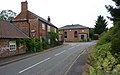
English: South Leverton is a village and civil parish in Bassetlaw, north Nottinghamshire, England, four miles from Retford. According to the 2001 census it has a population of 478.
village and civil parish in Nottinghamshire, UK  | |||||
| Upload media | |||||
| Instance of | |||||
|---|---|---|---|---|---|
| Location | Bassetlaw, Nottinghamshire, East Midlands, England | ||||
 | |||||
Subcategories
This category has only the following subcategory.
A
Media in category "South Leverton"
The following 200 files are in this category, out of 217 total.
(previous page) (next page)-

-
 Alongside Lee Beck - geograph.org.uk - 5198697.jpg 1,024 × 768; 375 KB
-
 Approaching Lee Beck - geograph.org.uk - 5198733.jpg 1,024 × 768; 320 KB
-
 Barn at Meeting House, South Leverton - geograph.org.uk - 4154696.jpg 1,280 × 960; 250 KB
-
 Bench mark, Westbrecks Farm - geograph.org.uk - 4152842.jpg 960 × 1,280; 412 KB
-
 Brecks Lane heading south - geograph.org.uk - 3512192.jpg 640 × 480; 78 KB
-
 Brickings Lane, South Leverton - geograph.org.uk - 2529423.jpg 1,024 × 768; 149 KB
-
 Broad Lane heading west - geograph.org.uk - 3512188.jpg 640 × 480; 73 KB
-
 Broad Lane junction with Meadow Dike Lane - geograph.org.uk - 4327289.jpg 3,964 × 2,180; 4.28 MB
-
 Buildings at Church Farm - geograph.org.uk - 4154265.jpg 1,280 × 913; 309 KB
-
 Buildings at White's Farm - geograph.org.uk - 4154260.jpg 1,280 × 936; 329 KB
-
 Buildings at White's Farm - geograph.org.uk - 4154262.jpg 1,280 × 908; 268 KB
-
 C.J. Bradley (Leverton) Ltd - geograph.org.uk - 2529436.jpg 1,024 × 768; 144 KB
-
 Can you see the path^ - geograph.org.uk - 4652479.jpg 800 × 600; 118 KB
-
 Cat and mouse - geograph.org.uk - 4154271.jpg 960 × 1,280; 190 KB
-
 Catchwater Drain - geograph.org.uk - 2578251.jpg 640 × 427; 89 KB
-
 Catchwater Drain - geograph.org.uk - 5244156.jpg 1,024 × 683; 223 KB
-
 Catchwater Drain near South Leverton - geograph.org.uk - 4327296.jpg 4,000 × 2,248; 6.33 MB
-
 Catchwater Drain near South Leverton - geograph.org.uk - 4327297.jpg 3,942 × 2,138; 5.22 MB
-
 Cattle near Lee Beck - geograph.org.uk - 1871960.jpg 1,024 × 776; 458 KB
-
 Church Farmhouse, Church Street - geograph.org.uk - 4154233.jpg 1,280 × 918; 361 KB
-
 Church Street, South Leverton - geograph.org.uk - 2688757.jpg 640 × 480; 105 KB
-
 Cottam Road - geograph.org.uk - 3512196.jpg 640 × 480; 61 KB
-
 Cottam Road - geograph.org.uk - 3512212.jpg 640 × 480; 75 KB
-
 Cottam Road heading east - geograph.org.uk - 2688770.jpg 640 × 480; 91 KB
-
 Cottam Road heading east from South Leverton - geograph.org.uk - 3415761.jpg 3,648 × 2,736; 4.08 MB
-

-
 Countryside north of Lee Beck - geograph.org.uk - 1967552.jpg 1,024 × 696; 429 KB
-
 Cowsland Farm - geograph.org.uk - 2688350.jpg 640 × 480; 67 KB
-
 Cowsland Farm - geograph.org.uk - 4652482.jpg 800 × 600; 89 KB
-
 Cowsland Road - geograph.org.uk - 5198703.jpg 1,024 × 768; 248 KB
-
 Cowsland Road - geograph.org.uk - 5198823.jpg 1,024 × 768; 246 KB
-
 Diamond House, Church Street - geograph.org.uk - 4154274.jpg 1,280 × 960; 265 KB
-
 Drain beside Broad Lane - geograph.org.uk - 3512184.jpg 640 × 480; 95 KB
-
 Drain, Cows and Railway track - geograph.org.uk - 4715880.jpg 1,600 × 1,037; 583 KB
-

-
 Farm track off Newings Lane - geograph.org.uk - 2528647.jpg 1,024 × 768; 166 KB
-
 Farmland near South Leverton - geograph.org.uk - 2688745.jpg 640 × 480; 76 KB
-
 Farmland near South Leverton - geograph.org.uk - 2688767.jpg 640 × 480; 68 KB
-
 Farmland north of Rampton - geograph.org.uk - 3512210.jpg 640 × 480; 103 KB
-
 Farmland off Broad Lane - geograph.org.uk - 3512183.jpg 640 × 480; 77 KB
-
 Farmland towards Westbrecks Farm - geograph.org.uk - 3512190.jpg 640 × 480; 78 KB
-
 Fat cat on a wall in South Leverton - geograph.org.uk - 4340491.jpg 4,996 × 3,682; 4.47 MB
-
 Field and hedges - geograph.org.uk - 1502752.jpg 640 × 427; 84 KB
-
 Field and view to Cottam power station - geograph.org.uk - 1967485.jpg 1,024 × 768; 404 KB
-
 Field by Lee Beck - geograph.org.uk - 1871985.jpg 1,024 × 691; 507 KB
-
 Field corner by Lee Beck - geograph.org.uk - 1871954.jpg 1,024 × 999; 827 KB
-
 Field of oil-seed rape - geograph.org.uk - 1872021.jpg 1,024 × 744; 455 KB
-
 Fields and footpath near Sheds Farm - geograph.org.uk - 1967543.jpg 1,024 × 768; 537 KB
-
 Fields by Lee Beck with power station beyond - geograph.org.uk - 1871932.jpg 1,024 × 768; 384 KB
-
 Fields in May - geograph.org.uk - 1871946.jpg 1,024 × 741; 513 KB
-
 Fingerpost, Church Street-Retford Road - geograph.org.uk - 4154236.jpg 960 × 1,280; 399 KB
-
 Footpath by a wheat field - geograph.org.uk - 1967528.jpg 1,024 × 727; 461 KB
-
 Footpath crossing ^ - geograph.org.uk - 2529271.jpg 1,024 × 768; 279 KB
-
 Footpath from Cottam Road to Torksey Ferry Road - geograph.org.uk - 3039975.jpg 1,024 × 768; 259 KB
-
 Footpath from Rampton Lane - geograph.org.uk - 2578244.jpg 640 × 427; 87 KB
-
 Footpath sign and ploughed fields - geograph.org.uk - 5198199.jpg 1,024 × 768; 277 KB
-
 Footpath to Treswell - geograph.org.uk - 1967135.jpg 1,024 × 768; 487 KB
-
 Frozen fields - geograph.org.uk - 1151555.jpg 640 × 427; 82 KB
-
 Glover Close, South Leverton - geograph.org.uk - 3048535.jpg 800 × 578; 113 KB
-
 Grove Road towards North Leverton - geograph.org.uk - 2688351.jpg 640 × 480; 63 KB
-
 Harvest at Westbrecks Farm - geograph.org.uk - 209243.jpg 640 × 427; 43 KB
-
 Hollowgate Road - geograph.org.uk - 2528439.jpg 1,024 × 768; 285 KB
-
 Hollowgate Road - geograph.org.uk - 4299542.jpg 1,024 × 768; 219 KB
-
 Horserider on Meadow Dike Lane - geograph.org.uk - 2529261.jpg 1,024 × 768; 293 KB
-
 Humber Meadow Lane - geograph.org.uk - 2528070.jpg 1,024 × 768; 217 KB
-
 Ice on the road - geograph.org.uk - 1151590.jpg 640 × 427; 77 KB
-
 Junction of Meetinghouse Lane and Retford Road - geograph.org.uk - 4715983.jpg 4,688 × 2,876; 5.69 MB
-
 Junction of Meetinghouse Lane and Treswell Road - geograph.org.uk - 4715992.jpg 4,928 × 3,264; 3.84 MB
-

-
 Meadow Dike Lane - geograph.org.uk - 2528658.jpg 1,024 × 768; 264 KB
-
 Meadow Dike Lane - geograph.org.uk - 4154168.jpg 1,280 × 960; 377 KB
-
 Meadow Dike Lane - geograph.org.uk - 4715871.jpg 4,817 × 3,191; 5.9 MB
-

-
 Meadow Dyke Lane - geograph.org.uk - 2284726.jpg 640 × 403; 66 KB
-
 Meadow off Rampton Lane - geograph.org.uk - 2578243.jpg 640 × 427; 123 KB
-
 Meetinghouse Lane - geograph.org.uk - 4299546.jpg 1,024 × 768; 155 KB
-
 Meetinghouse Lane - geograph.org.uk - 4326546.jpg 800 × 533; 114 KB
-
 Meetinghouse Lane approaching South Leverton - geograph.org.uk - 4326571.jpg 3,954 × 2,164; 5.06 MB
-

-
 Mill Lane junction with Rampton Lane - geograph.org.uk - 4715885.jpg 3,696 × 2,448; 2.27 MB
-
 Millfield Road - A track - geograph.org.uk - 4715988.jpg 4,928 × 3,264; 6.52 MB
-
 Millfield Road - geograph.org.uk - 5198750.jpg 1,024 × 768; 254 KB
-

-
 Millfield Road, now a track - geograph.org.uk - 1967534.jpg 1,024 × 768; 508 KB
-
 Millfield Road, South Leverton - geograph.org.uk - 4326812.jpg 4,000 × 2,248; 6.12 MB
-
 Near Cowsland Farm - geograph.org.uk - 4340401.jpg 4,893 × 3,576; 4.82 MB
-
 New Farm House - geograph.org.uk - 4154204.jpg 1,280 × 960; 360 KB
-
 New plantation off Millfield Road - geograph.org.uk - 5198746.jpg 1,024 × 768; 283 KB
-
 Newings Lane - geograph.org.uk - 2528050.jpg 1,024 × 768; 176 KB
-
 No tea this afternoon - geograph.org.uk - 4154239.jpg 1,280 × 960; 385 KB
-

-

-

-
 North Lverton Windmill, aerial 2017 - geograph.org.uk - 5543197.jpg 640 × 240; 22 KB
-
 Oilseed rape and West Burton power stations - geograph.org.uk - 5198743.jpg 1,024 × 768; 195 KB
-

-
 Old Manor House, Church Street, South Leverton - geograph.org.uk - 4326348.jpg 3,992 × 2,234; 5.33 MB
-
 Old Quaker Meeting House, Meetinghouse Lane - geograph.org.uk - 4326396.jpg 3,980 × 2,212; 5.44 MB
-
 Ordnance Survey Cut Mark - geograph.org.uk - 4967972.jpg 640 × 496; 118 KB
-
 Parkland at South Leverton - geograph.org.uk - 2529525.jpg 1,024 × 768; 201 KB
-
 Plough Inn, South Leverton - geograph.org.uk - 4154666.jpg 1,280 × 960; 242 KB
-
 Ploughed field off Wood Lane - geograph.org.uk - 5198726.jpg 1,024 × 768; 241 KB
-
 Ploughed fields and Woodhouse Farm - geograph.org.uk - 5198688.jpg 1,024 × 768; 225 KB
-
 Pond by Hollowgate Road - geograph.org.uk - 4652485.jpg 800 × 600; 135 KB
-
 Pond west of Hollowgate Road - geograph.org.uk - 4340425.jpg 3,888 × 5,184; 6.5 MB
-
 Power generation ancient and modern - geograph.org.uk - 4152581.jpg 1,280 × 810; 207 KB
-
 Powerful sky - geograph.org.uk - 4327271.jpg 3,950 × 2,156; 4 MB
-
 Railway bridge over Catchwater Drain - geograph.org.uk - 4327888.jpg 800 × 542; 145 KB
-
 Railway towards Cottam Power Station - geograph.org.uk - 3512186.jpg 640 × 480; 88 KB
-
 Rampton Lane - geograph.org.uk - 2528075.jpg 1,024 × 768; 197 KB
-
 Rampton Lane - geograph.org.uk - 2578245.jpg 640 × 427; 79 KB
-
 Rampton Lane - geograph.org.uk - 2578255.jpg 640 × 427; 86 KB
-
 Rampton Lane off Green Lane - geograph.org.uk - 3048646.jpg 800 × 600; 170 KB
-
 Retford road - geograph.org.uk - 2065793.jpg 640 × 427; 54 KB
-
 Retford Road - geograph.org.uk - 4326872.jpg 3,974 × 1,865; 4.06 MB
-
 Retford Road heading south - geograph.org.uk - 2688749.jpg 640 × 480; 57 KB
-
 Road signs on Retford Road - geograph.org.uk - 2060285.jpg 640 × 427; 53 KB
-
 Road to Cottam - geograph.org.uk - 4714974.jpg 4,776 × 3,152; 6.38 MB
-
 Shed with Red Doors - geograph.org.uk - 4340441.jpg 4,966 × 3,311; 4.89 MB
-
 Sheep on Meadow Dike Lane, South Leverton (geograph 6621596).jpg 1,024 × 683; 287 KB
-

-
 Slow down ^ Take care ^ - geograph.org.uk - 2528654.jpg 1,024 × 791; 186 KB
-
 Snow in the gateway - geograph.org.uk - 1151563.jpg 640 × 427; 65 KB
-
 Snow in the layby - geograph.org.uk - 2806129.jpg 640 × 428; 105 KB
-
 South Leverton Manor House - geograph.org.uk - 2529480.jpg 768 × 1,024; 225 KB
-
 South Leverton Memorial Institute - geograph.org.uk - 2529468.jpg 1,024 × 768; 177 KB
-
 South Leverton Memorial Institute - geograph.org.uk - 4154281.jpg 1,280 × 914; 290 KB
-
 South Leverton Memorial Institute - geograph.org.uk - 4327308.jpg 3,970 × 2,194; 5.31 MB
-

-
 South Leverton Millennium Monument (detail) - geograph.org.uk - 4154248.jpg 1,280 × 960; 332 KB
-
 South Leverton Millennium Monument (detail) - geograph.org.uk - 4154252.jpg 1,280 × 960; 275 KB
-
 South Leverton Millennium Monument - geograph.org.uk - 2528110.jpg 1,024 × 768; 273 KB
-
 South Leverton Millennium Monument - geograph.org.uk - 4154241.jpg 1,280 × 960; 359 KB
-
 South Leverton Millennium Monument - geograph.org.uk - 4154245.jpg 1,280 × 960; 417 KB
-
 South Leverton postbox ref DN22 60 - geograph.org.uk - 4154668.jpg 960 × 1,280; 313 KB
-
 South Leverton village entrance sign - geograph.org.uk - 4154704.jpg 1,280 × 960; 371 KB
-
 Sowing in the afternoon sun - geograph.org.uk - 1011005.jpg 640 × 399; 73 KB
-
 Spring wheat - geograph.org.uk - 450571.jpg 640 × 480; 94 KB
-
 Station Road towards South Leverton - geograph.org.uk - 1967109.jpg 1,024 × 824; 532 KB
-
 Stubble on Cowsland Hill - geograph.org.uk - 4652478.jpg 800 × 600; 92 KB
-
 Sunshine and showers - geograph.org.uk - 2284722.jpg 640 × 406; 92 KB
-
 The Barn at Meeting House, South Leverton - geograph.org.uk - 4340456.jpg 5,142 × 3,752; 4.98 MB
-
 The Dovecote, Retford Road - geograph.org.uk - 4154266.jpg 1,280 × 960; 311 KB
-
 The former Railway Inn - geograph.org.uk - 3048528.jpg 600 × 800; 92 KB
-
 The Granary, White's Farm - geograph.org.uk - 4154257.jpg 1,280 × 932; 356 KB
-
 The hot seat is elsewhere - geograph.org.uk - 4299549.jpg 1,024 × 768; 226 KB
-
 The junction of Grove Road and Retford Road - geograph.org.uk - 4152572.jpg 1,280 × 944; 292 KB
-
 The junction of Wood Lane and Cowsland Road - geograph.org.uk - 5198699.jpg 1,024 × 768; 214 KB
-
 The line to Cottam - geograph.org.uk - 1726873.jpg 640 × 426; 84 KB
-
 The line to Cottam Power Station - geograph.org.uk - 4152850.jpg 1,280 × 960; 386 KB
-
 The Manor House, Church Street - geograph.org.uk - 4154278.jpg 1,280 × 960; 308 KB
-
 The Meeting House, South Leverton - geograph.org.uk - 4154687.jpg 1,280 × 960; 313 KB
-
 The Meeting House, South Leverton - geograph.org.uk - 4154703.jpg 1,280 × 960; 325 KB
-
 The Old Shop (formerly Green Cottage) - geograph.org.uk - 4154205.jpg 1,280 × 957; 372 KB
-
 The Plough - geograph.org.uk - 1151574.jpg 640 × 427; 63 KB
-
 The Plough - geograph.org.uk - 4327892.jpg 800 × 625; 98 KB
-
 The Plough Inn - geograph.org.uk - 2529452.jpg 1,024 × 768; 173 KB
-
 The Plough, South Leverton - geograph.org.uk - 2688763.jpg 640 × 480; 64 KB
-
 The Railway Inn - gone ^ - geograph.org.uk - 715068.jpg 640 × 427; 55 KB
-
 The railway to Cottam Power Station - geograph.org.uk - 4327884.jpg 800 × 533; 187 KB
-
 The Rectory, South Leverton - geograph.org.uk - 2529500.jpg 1,024 × 768; 229 KB
-
 The site of the former Railway Inn - geograph.org.uk - 3048527.jpg 800 × 600; 146 KB
-
 The Wesleyan Chapel and School Room, South Leverton - geograph.org.uk - 3415746.jpg 3,648 × 2,736; 4.02 MB
-
-
 Track corner and junction - geograph.org.uk - 1871975.jpg 1,024 × 768; 486 KB
-
 Track heading south - geograph.org.uk - 1872012.jpg 1,024 × 796; 617 KB
-
 Trailer on the vergeside - geograph.org.uk - 1011021.jpg 640 × 427; 84 KB
-
 Tree-lined drive to Sheds Farm - geograph.org.uk - 4652483.jpg 800 × 600; 95 KB
-
 Trees along Lee Beck - geograph.org.uk - 5198719.jpg 1,024 × 768; 251 KB
-
 Trent Valley view - geograph.org.uk - 5244161.jpg 1,024 × 683; 238 KB
-
 Treswell Road heading south - geograph.org.uk - 2688778.jpg 640 × 480; 62 KB
-
 Unnamed railway crossing - geograph.org.uk - 4154177.jpg 1,280 × 945; 273 KB
-
 View to Sheds Farm - geograph.org.uk - 1871967.jpg 1,024 × 768; 537 KB
-
 View to Sheds Farm and Cottam Power Station - geograph.org.uk - 4340410.jpg 5,011 × 3,722; 4.91 MB
-
 View towards Cottam Power Station - geograph.org.uk - 4299545.jpg 1,024 × 768; 205 KB
-

-

-
 Wesleyan Chapel and School Room - geograph.org.uk - 4326544.jpg 800 × 533; 113 KB
-
 Wesleyan Chapel, South Leverton - geograph.org.uk - 2688761.jpg 640 × 480; 77 KB
-
 Westbrecks crossing - geograph.org.uk - 1726867.jpg 426 × 640; 79 KB
-
 Westbrecks crossing - geograph.org.uk - 1726877.jpg 640 × 426; 111 KB
-
 Westbrecks Crossing - geograph.org.uk - 3415881.jpg 3,648 × 2,736; 3.88 MB
-
 Westbrecks Crossing - geograph.org.uk - 3512185.jpg 640 × 480; 54 KB
-
 Westbrecks Crossing - geograph.org.uk - 4152848.jpg 1,280 × 961; 365 KB
-
 Westbrecks Crossing - geograph.org.uk - 4327277.jpg 3,926 × 2,108; 4.05 MB
-
 Westbrecks Crossing - geograph.org.uk - 4327880.jpg 800 × 553; 99 KB
-
 Westbrecks Farm - geograph.org.uk - 4152840.jpg 1,280 × 944; 273 KB
-
 Westbrecks Lane - geograph.org.uk - 4152846.jpg 1,280 × 960; 351 KB
-
 Westbrecks Lane - geograph.org.uk - 4714999.jpg 4,752 × 3,128; 6.19 MB
-
 Westbrecks Lane and Cottam Power Station - geograph.org.uk - 2528062.jpg 1,024 × 768; 157 KB
-
 Westbrecks Level Crossing - geograph.org.uk - 4715010.jpg 3,696 × 2,448; 2.61 MB
-
 Willow Cottages - geograph.org.uk - 2056433.jpg 640 × 426; 78 KB
-
 Willow Cottages on Grove Road - geograph.org.uk - 4340371.jpg 3,700 × 5,036; 5.44 MB
-
 Wood Lane - geograph.org.uk - 4652487.jpg 800 × 600; 165 KB
-
 Wood Lane - geograph.org.uk - 5198683.jpg 1,024 × 768; 283 KB
-
 Wood Lane - geograph.org.uk - 5198729.jpg 1,024 × 768; 212 KB
-
 Wood Lane crossing Lee Beck - geograph.org.uk - 5198693.jpg 1,024 × 768; 385 KB
-
 Bridleway in South Leverton - geograph.org.uk - 459002.jpg 640 × 480; 142 KB
-
 Cowsland Road - geograph.org.uk - 484902.jpg 640 × 427; 104 KB
_-_geograph.org.uk_-_5473439.jpg)


_Ltd_-_geograph.org.uk_-_2529436.jpg)


_-_geograph.org.uk_-_5543202.jpg)


.jpg)


_-_geograph.org.uk_-_4154248.jpg)
_-_geograph.org.uk_-_4154252.jpg)


_-_geograph.org.uk_-_4154205.jpg)


