Category:South Killingholme photographs taken on 2008-06-28
Jump to navigation
Jump to search
Media in category "South Killingholme photographs taken on 2008-06-28"
The following 24 files are in this category, out of 24 total.
-
 ConocoPhilips Smoking Area - geograph.org.uk - 867590.jpg 640 × 390; 236 KB
-
 Conoco-Philips Power Station - geograph.org.uk - 864698.jpg 640 × 396; 207 KB
-
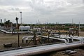
 ConocoPhilips Pipelines - geograph.org.uk - 865298.jpg 425 × 640; 85 KB
-
 Gas Storage Facility - geograph.org.uk - 865359.jpg 640 × 426; 298 KB
-
 Humber Bank Oil and Gas Facilities - geograph.org.uk - 863644.jpg 640 × 426; 277 KB
-
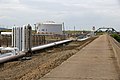 Humber Bank Public Footpath - geograph.org.uk - 863597.jpg 640 × 426; 296 KB
-
 Immingham Gas Terminal Jetty - geograph.org.uk - 863609.jpg 640 × 426; 276 KB
-
 Looking NW from Marsh Lane - geograph.org.uk - 864667.jpg 640 × 426; 272 KB
-
 Looking SE from Marsh Lane - geograph.org.uk - 877547.jpg 640 × 425; 91 KB
-

-
 Marsh Lane - geograph.org.uk - 864674.jpg 640 × 426; 348 KB
-
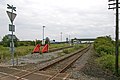
 Marsh Lane Level Crossing - geograph.org.uk - 863690.jpg 640 × 593; 336 KB
-
 Notice at the end of the Public Footpath - geograph.org.uk - 865334.jpg 640 × 586; 476 KB
-
 Notice on Marsh Lane - geograph.org.uk - 864531.jpg 480 × 640; 367 KB
-
 Pipework - geograph.org.uk - 867612.jpg 557 × 640; 134 KB
-
 Public Footpath to the Humber Bank - geograph.org.uk - 864542.jpg 640 × 426; 294 KB
-
 Remains of Old Jetty - geograph.org.uk - 865342.jpg 640 × 426; 274 KB
-
-
 Safety Measures - geograph.org.uk - 867602.jpg 640 × 426; 279 KB
-
 South Killingholme Haven - LPG Jetty - geograph.org.uk - 877497.jpg 640 × 412; 68 KB
-
 Storage Tank KS-1 - geograph.org.uk - 863586.jpg 640 × 426; 252 KB
-
 Storage Tank KS-1 - geograph.org.uk - 863625.jpg 640 × 426; 288 KB
-
 The End of the Public Footpath - geograph.org.uk - 865322.jpg 640 × 426; 258 KB
-
 The Public Footpath to Marsh Lane - geograph.org.uk - 865283.jpg 425 × 640; 87 KB


