Category:South Kelsey
Jump to navigation
Jump to search
English: South Kelsey is a village and civil parish in the West Lindsey district of Lincolnshire, England. According to the 2001 census it had a population of 571. It is on the B1205 between the A15 and Caistor.
village and civil parish in Lincolnshire, United Kingdom  | |||||
| Upload media | |||||
| Instance of | |||||
|---|---|---|---|---|---|
| Location | West Lindsey, Lincolnshire, East Midlands, England | ||||
| Population |
| ||||
 | |||||
Subcategories
This category has the following 5 subcategories, out of 5 total.
Media in category "South Kelsey"
The following 200 files are in this category, out of 242 total.
(previous page) (next page)-

-
 A disused canal at South Kelsey - geograph.org.uk - 2348686.jpg 800 × 600; 297 KB
-
 A farm track at South Kelsey Carrs - geograph.org.uk - 2352620.jpg 800 × 600; 239 KB
-

-
 A minor road to North Kelsey Moor - geograph.org.uk - 2352767.jpg 800 × 600; 292 KB
-
 A minor road towards North Kelsey - geograph.org.uk - 2352775.jpg 800 × 600; 259 KB
-
 A old Methodist Chapel at South Kelsey - geograph.org.uk - 2348695.jpg 800 × 600; 244 KB
-
 A Straight Lane - geograph.org.uk - 3374369.jpg 2,256 × 1,504; 4.03 MB
-
 Access road to Grove Farm - geograph.org.uk - 1727090.jpg 3,153 × 2,028; 4.35 MB
-
 Alone in the field - geograph.org.uk - 3010894.jpg 1,024 × 768; 185 KB
-
 Alongside Long Wood - geograph.org.uk - 2911408.jpg 1,024 × 768; 208 KB
-
 Auxiliary Hide - geograph.org.uk - 1729306.jpg 2,992 × 2,303; 6.29 MB
-
 B1205 Caistor Road - geograph.org.uk - 3342768.jpg 1,024 × 768; 85 KB
-
 B1205 heading to Moortown - geograph.org.uk - 4208154.jpg 1,024 × 768; 87 KB
-
 B1205 near College Farm - geograph.org.uk - 4152266.jpg 1,024 × 768; 74 KB
-
 B1205 road to Caistor - geograph.org.uk - 4152377.jpg 1,024 × 768; 94 KB
-
 B1434 Ellmore Lane - geograph.org.uk - 4645853.jpg 1,024 × 768; 169 KB
-
 B1434 heading south - geograph.org.uk - 3502912.jpg 640 × 480; 82 KB
-
 Back of the old Moortown Station - geograph.org.uk - 1959209.jpg 640 × 480; 66 KB
-
 Balderson Motors - geograph.org.uk - 3501952.jpg 640 × 427; 71 KB
-

-
 Being cleaned up - geograph.org.uk - 1729422.jpg 2,017 × 1,832; 3.54 MB
-
 Bend in B1205 Waddingham Road - geograph.org.uk - 5103282.jpg 3,696 × 2,448; 2.28 MB
-

-
 Brigg Road from Station Road, Moortown - geograph.org.uk - 5774927.jpg 1,600 × 1,094; 732 KB
-
 Brigg Road, South Kelsey - geograph.org.uk - 3501191.jpg 640 × 480; 85 KB
-
 Brook on North Kelsey Moor - geograph.org.uk - 327457.jpg 640 × 480; 86 KB
-
 Bungalow Farm - geograph.org.uk - 3490601.jpg 640 × 427; 67 KB
-
-
 Caistor Canal - geograph.org.uk - 1177808.jpg 640 × 406; 87 KB
-
 Caistor Canal - geograph.org.uk - 138873.jpg 640 × 480; 126 KB
-
 Caistor Canal - geograph.org.uk - 3820143.jpg 3,088 × 2,056; 2.98 MB
-

-

-
 Caistor Canal, South Kelsey - geograph.org.uk - 1134802.jpg 640 × 334; 61 KB
-
 Caistor Road (B1205) - geograph.org.uk - 3501185.jpg 640 × 480; 73 KB
-
 Caistor Road - geograph.org.uk - 4164124.jpg 3,088 × 2,056; 2.86 MB
-

-
 Cemetery on Brigg Road South Kelsey - geograph.org.uk - 5774964.jpg 1,600 × 1,065; 850 KB
-
 Clay Lane - geograph.org.uk - 1140887.jpg 640 × 435; 133 KB
-
 Clay Lane - geograph.org.uk - 5208652.jpg 1,024 × 768; 233 KB
-
 Clay Lane - geograph.org.uk - 5208656.jpg 1,024 × 768; 208 KB
-
 Clay Lane - geograph.org.uk - 5208663.jpg 1,024 × 768; 282 KB
-
 Clay Lane, South Kelsey - geograph.org.uk - 4407868.jpg 640 × 427; 74 KB
-
 College Farm - geograph.org.uk - 5208638.jpg 1,024 × 768; 154 KB
-

-

-
 Crop field near Newlands - geograph.org.uk - 3928323.jpg 640 × 480; 73 KB
-
 Crop field off Ellmore Lane - geograph.org.uk - 3502269.jpg 640 × 480; 53 KB
-
 Crop field, Moortown - geograph.org.uk - 3502918.jpg 640 × 487; 83 KB
-

-
 Disused bridge, South Kelsey - geograph.org.uk - 1134868.jpg 640 × 367; 121 KB
-
 Disused Lock on Caistor Canal - geograph.org.uk - 5650479.jpg 1,600 × 1,064; 763 KB
-

-
 Drain by Smithfield Road - geograph.org.uk - 3965189.jpg 640 × 427; 85 KB
-
 Drain towards the Railway, near Caistor - geograph.org.uk - 3374422.jpg 2,256 × 1,504; 1.93 MB
-
 Drain, North Kelsey Moor - geograph.org.uk - 3928333.jpg 640 × 480; 86 KB
-
 Dry drainage ditch off Caistor Road - geograph.org.uk - 3501179.jpg 640 × 480; 74 KB
-
 Ellmore Lane (B1434), heading south - geograph.org.uk - 3502273.jpg 640 × 480; 74 KB
-
 Ellmore Lane - geograph.org.uk - 4164133.jpg 3,088 × 2,056; 3.97 MB
-
 Entering Moortown, Lincolnshire - geograph.org.uk - 2352706.jpg 800 × 600; 325 KB
-
 Entering South Kelsey - geograph.org.uk - 3820157.jpg 3,088 × 2,056; 3.57 MB
-

-
 Entrance to Footpath - geograph.org.uk - 3820150.jpg 3,088 × 2,056; 3.97 MB
-
 Entrance to Hall Park Farm - geograph.org.uk - 4152286.jpg 1,024 × 768; 172 KB
-
 Entrance to Watermill Farm (Café and Bar) - geograph.org.uk - 4152389.jpg 1,024 × 768; 159 KB
-

-
 Farm track off Ellmore Lane - geograph.org.uk - 3502271.jpg 640 × 480; 90 KB
-

-
 Farmland near Moortown - geograph.org.uk - 4645854.jpg 1,024 × 768; 165 KB
-
 Farmland near South Kelsey - geograph.org.uk - 3501155.jpg 640 × 480; 67 KB
-
 Farmland near South Kelsey - geograph.org.uk - 3501194.jpg 640 × 480; 72 KB
-
 Farmland off Caistor Road - geograph.org.uk - 3501181.jpg 640 × 480; 63 KB
-
 Farmland off Gipsy Lane - geograph.org.uk - 3501173.jpg 640 × 480; 90 KB
-
 Farmland, South Kelsey Carrs - geograph.org.uk - 3501205.jpg 640 × 480; 55 KB
-
 Field at sunset, near Highfield Farm - geograph.org.uk - 1134737.jpg 640 × 447; 89 KB
-

-
 Field near College Farm - geograph.org.uk - 5209071.jpg 1,024 × 768; 187 KB
-
 Field off North End Lane, South Kelsey - geograph.org.uk - 3010889.jpg 1,024 × 768; 239 KB
-
 Filled-in canal - geograph.org.uk - 1726930.jpg 2,992 × 1,861; 4.05 MB
-

-
 Footbridge over the Caistor Canal - geograph.org.uk - 5653494.jpg 1,600 × 1,064; 698 KB
-
 Footbridge over the remains of the Caistor Canal - geograph.org.uk - 2799008.jpg 1,024 × 768; 313 KB
-

-
 Footpath to Moortown Park - geograph.org.uk - 3010891.jpg 1,024 × 768; 210 KB
-
 Former Caistor Navigation Canal - geograph.org.uk - 1726900.jpg 3,474 × 2,182; 6.03 MB
-
 Former Methodist church at South Kelsey - geograph.org.uk - 3009883.jpg 1,024 × 768; 200 KB
-
 Former Station House at Moortown - geograph.org.uk - 5774884.jpg 1,600 × 1,065; 718 KB
-
 Frozen pond - geograph.org.uk - 1722961.jpg 2,805 × 1,961; 4.51 MB
-

-
 Gipsy Lane - geograph.org.uk - 3501177.jpg 640 × 480; 81 KB
-
 Gipsy Lane off Caistor Road - geograph.org.uk - 5774968.jpg 1,600 × 1,101; 900 KB
-
 Grange Lane - geograph.org.uk - 323806.jpg 640 × 427; 66 KB
-
 Green lane - geograph.org.uk - 1134668.jpg 533 × 640; 133 KB
-
 Green lane - geograph.org.uk - 1134689.jpg 328 × 640; 107 KB
-
 Hall Farm - geograph.org.uk - 1156030.jpg 640 × 453; 117 KB
-
 Hall Farm, South Kelsey - geograph.org.uk - 1124383.jpg 640 × 480; 149 KB
-
 Hall Farm, South Kelsey - geograph.org.uk - 1124826.jpg 640 × 389; 73 KB
-
 Holding with sheep on Moortown Road - geograph.org.uk - 3490604.jpg 640 × 427; 70 KB
-
 Holme Hill Farm - geograph.org.uk - 1105017.jpg 640 × 480; 50 KB
-
 Holme Hill Farm - geograph.org.uk - 1161856.jpg 640 × 374; 64 KB
-
 Holton Road (B1434), heading south - geograph.org.uk - 3502921.jpg 640 × 480; 71 KB
-
 Kelsey Road, Moortown, Lincolnshire - geograph.org.uk - 2352715.jpg 800 × 600; 198 KB
-
 Land off the B1205 near South Kelsey - geograph.org.uk - 5103296.jpg 4,784 × 3,108; 6.9 MB
-
 Lane to Hall Farm Cottages. South Kelsey - geograph.org.uk - 5209065.jpg 1,024 × 768; 165 KB
-

-
 Leaving South Kelsey on Brigg Road - geograph.org.uk - 4645828.jpg 1,024 × 768; 114 KB
-
 Lincolnshire farmland alongside the B1205 - geograph.org.uk - 4152275.jpg 1,024 × 647; 49 KB
-
 Manor Farm Yard - geograph.org.uk - 1156007.jpg 640 × 420; 66 KB
-
 Mill Farm House - geograph.org.uk - 1151971.jpg 640 × 432; 95 KB
-
 Minor road heading south - geograph.org.uk - 3928329.jpg 640 × 480; 70 KB
-
 Minor Road Towards Moortown House Farm - geograph.org.uk - 5228217.jpg 4,608 × 3,456; 6.89 MB
-
 Moortown cross roads - geograph.org.uk - 4152386.jpg 1,024 × 514; 98 KB
-
 Moortown Junction ahead - geograph.org.uk - 4152383.jpg 1,024 × 768; 84 KB
-
 Moortown level crossing - geograph.org.uk - 3342775.jpg 1,024 × 701; 151 KB
-
 Moortown level crossing - geograph.org.uk - 3490613.jpg 640 × 427; 69 KB
-
 Moortown Road, Moortown - geograph.org.uk - 5774889.jpg 1,600 × 1,102; 611 KB
-
 Moortown Station - geograph.org.uk - 2124828.jpg 640 × 427; 87 KB
-
 Moortown Station - geograph.org.uk - 2124900.jpg 640 × 427; 66 KB
-
 Near Highfield Farm - geograph.org.uk - 1134772.jpg 640 × 248; 59 KB
-
 Near Winghale Priory - geograph.org.uk - 1152379.jpg 528 × 640; 159 KB
-
 Nettleton Beck (2) - geograph.org.uk - 2826240.jpg 1,024 × 768; 286 KB
-
 Nettleton Beck - geograph.org.uk - 2826233.jpg 1,024 × 768; 310 KB
-
 Nettleton Beck in Moortown - geograph.org.uk - 3964589.jpg 640 × 427; 108 KB
-
 New and old bridges. - geograph.org.uk - 1723048.jpg 2,865 × 1,955; 3.63 MB
-

-
 New Bridge - geograph.org.uk - 1134829.jpg 585 × 640; 135 KB
-
 New fence alongside Raspberry Plantation - geograph.org.uk - 3490609.jpg 640 × 427; 102 KB
-

-
 North along railway from Moortown - geograph.org.uk - 1959211.jpg 640 × 480; 96 KB
-
 North End Lane, South Kelsey (2) - geograph.org.uk - 3010875.jpg 1,024 × 768; 215 KB
-
 North End Lane, South Kelsey (3) - geograph.org.uk - 3010878.jpg 1,024 × 768; 183 KB
-
 North End Lane, South Kelsey - geograph.org.uk - 3009446.jpg 1,024 × 768; 253 KB
-
 North End Lane, South Kelsey - geograph.org.uk - 4407739.jpg 640 × 427; 48 KB
-
 North End Lane, South Kelsey - the end - geograph.org.uk - 3010884.jpg 1,024 × 768; 303 KB
-
 Northbound - geograph.org.uk - 2124831.jpg 640 × 427; 124 KB
-
 Now that's what I call a bridge... - geograph.org.uk - 3964407.jpg 533 × 800; 145 KB
-

-

-
 Old Forge and Methodist Chapel - geograph.org.uk - 1140865.jpg 640 × 355; 55 KB
-
 Orchard, Mill Farm - geograph.org.uk - 1498700.jpg 640 × 516; 222 KB
-
 Over the fields. - geograph.org.uk - 1722922.jpg 2,517 × 1,673; 2.35 MB
-
-
-
 Power lines near Riverhead Farm Moortown - geograph.org.uk - 4208152.jpg 1,024 × 768; 103 KB
-

-

-
 Reinforced verge on Moortown Road - geograph.org.uk - 3490624.jpg 427 × 640; 101 KB
-

-

-
 Ridge and furrow, South Kelsey - geograph.org.uk - 1134526.jpg 640 × 263; 75 KB
-
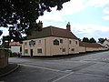
 Skipworth Arms - geograph.org.uk - 2124834.jpg 640 × 427; 85 KB
-
 Skipworth Arms Moortown - geograph.org.uk - 1959204.jpg 640 × 480; 76 KB
-

-
 Small roadside plantation near South Kelsey - geograph.org.uk - 3009886.jpg 1,024 × 768; 167 KB
-
 Smithfield Road from Ellmore Lane - geograph.org.uk - 5774944.jpg 1,600 × 1,065; 445 KB
-
 Smithfield Road leading to Moortown - geograph.org.uk - 3965167.jpg 640 × 427; 85 KB
-
 Snow over the wolds - geograph.org.uk - 1722984.jpg 3,407 × 2,229; 4.03 MB
-
 South Kelsey church of St mary - geograph.org.uk - 4152279.jpg 1,024 × 768; 97 KB
-
 South Kelsey Methodist Church - geograph.org.uk - 1413423.jpg 640 × 480; 75 KB
-
 South Kelsey, aerial 2018 (1) - geograph.org.uk - 5981140.jpg 427 × 640; 80 KB
-
 South Kelsey, aerial 2018 (2) - geograph.org.uk - 5981142.jpg 427 × 640; 85 KB
-

-
 South Pasture development - geograph.org.uk - 1157020.jpg 640 × 479; 88 KB
-
 South Wood - geograph.org.uk - 3501153.jpg 640 × 480; 86 KB
-
 Southbound - geograph.org.uk - 2124892.jpg 640 × 427; 127 KB
-
 Station Road, towards Moortown - geograph.org.uk - 4164147.jpg 3,088 × 2,056; 3.51 MB
-

-
 The B1434 at Moorhouse House Farm - geograph.org.uk - 2352758.jpg 800 × 600; 210 KB
-
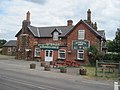
 The Bull Inn - geograph.org.uk - 1898912.jpg 640 × 426; 60 KB
-
 The Bull Inn, South Kelsey - geograph.org.uk - 1140851.jpg 640 × 370; 47 KB
-
 The Bull Inn, South Kelsey - geograph.org.uk - 1413496.jpg 640 × 480; 76 KB
-
 The Bull Inn, South Kelsey - geograph.org.uk - 2348705.jpg 800 × 600; 294 KB
-
 The Bull Inn, South Kelsey - geograph.org.uk - 3501187.jpg 640 × 480; 61 KB
-
 The collapsing wall of Moor Lock - geograph.org.uk - 3964411.jpg 427 × 640; 130 KB
-

-
 The former Moortown station - geograph.org.uk - 2474598.jpg 1,024 × 768; 193 KB
-
 The harvest is in - geograph.org.uk - 4152379.jpg 1,024 × 768; 151 KB
-
 The junction of the B1205 and Gipsy Lane - geograph.org.uk - 2352695.jpg 800 × 600; 300 KB
-
 The lane to Winghale Priory - geograph.org.uk - 2799384.jpg 1,024 × 768; 139 KB
-
 The Manor Farm - geograph.org.uk - 1140878.jpg 640 × 389; 87 KB
-
 The Old Post Office - geograph.org.uk - 1155946.jpg 640 × 406; 85 KB
-
 The old Sunday school - geograph.org.uk - 1155983.jpg 640 × 533; 119 KB
-
 The remains of Moor Lock - geograph.org.uk - 2799004.jpg 1,024 × 768; 302 KB
-
 The Road to Winghale Priory Farm - geograph.org.uk - 1413506.jpg 640 × 480; 64 KB
-
 The scourge of the wind turbines - geograph.org.uk - 3964552.jpg 1,024 × 683; 311 KB
-
 The Skipworth Arms - geograph.org.uk - 3376895.jpg 2,256 × 1,504; 1.53 MB
-
 The Station House, Moortown - geograph.org.uk - 4516866.jpg 1,024 × 768; 146 KB
-

-
 The way to Winghale Priory - geograph.org.uk - 2352625.jpg 800 × 600; 247 KB
-

-
 Thornton Road, South Kelsey - geograph.org.uk - 4407416.jpg 640 × 427; 57 KB
-
 Towards the old coach road - geograph.org.uk - 1729441.jpg 2,664 × 1,780; 3.51 MB
-
 Towards the Wolds - geograph.org.uk - 1143192.jpg 640 × 359; 80 KB
-
 Track into Holton Plantation - geograph.org.uk - 3964604.jpg 640 × 427; 101 KB
-

-
 Track off Kelsey Road - geograph.org.uk - 4164128.jpg 3,088 × 2,056; 3.69 MB
-
 Track off North End Lane, South Kelsey - geograph.org.uk - 3009455.jpg 1,024 × 768; 235 KB
-
 Track Through Coach Road Plantation - geograph.org.uk - 1413450.jpg 640 × 480; 134 KB
-
 Track to Daisy Hill Farm - geograph.org.uk - 3501175.jpg 640 × 480; 100 KB


_-_geograph.org.uk_-_5984187.jpg)
_-_geograph.org.uk_-_5984191.jpg)

_-_geograph.org.uk_-_3501185.jpg)


,_heading_south_-_geograph.org.uk_-_3502273.jpg)


_-_geograph.org.uk_-_4152389.jpg)


,_heading_south_-_geograph.org.uk_-_3502921.jpg)


_-_geograph.org.uk_-_2826240.jpg)


_-_geograph.org.uk_-_3010875.jpg)
_-_geograph.org.uk_-_3010878.jpg)


_-_geograph.org.uk_-_5981140.jpg)
_-_geograph.org.uk_-_5981142.jpg)


