Category:South Cerney
Jump to navigation
Jump to search
village in the United Kingdom | |||||
| Upload media | |||||
| Instance of | |||||
|---|---|---|---|---|---|
| Location | Cotswold, Gloucestershire, South West England, England | ||||
| Population |
| ||||
 | |||||
Subcategories
This category has the following 7 subcategories, out of 7 total.
Media in category "South Cerney"
The following 200 files are in this category, out of 574 total.
(previous page) (next page)-
 A circular walk around Cricklade (24) - geograph.org.uk - 6338138.jpg 4,320 × 3,240; 4.67 MB
-
 A grand entrance - geograph.org.uk - 2541238.jpg 640 × 480; 70 KB
-
 A lane called Bow Wow - geograph.org.uk - 1513923.jpg 640 × 414; 94 KB
-
 A Manor House South Cerney - geograph.org.uk - 128838.jpg 640 × 480; 94 KB
-
 A small island on Lake 12 - geograph.org.uk - 3281786.jpg 640 × 480; 64 KB
-
 A study in magnificence - geograph.org.uk - 4597512.jpg 480 × 640; 116 KB
-
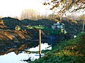
 A swollen River Churn near South Cerney - geograph.org.uk - 3790892.jpg 3,000 × 4,000; 5.27 MB
-
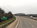
 A419 - northbound near Driffield - geograph.org.uk - 2089514.jpg 640 × 480; 48 KB
-
 A419, Wiltshire - geograph.org.uk - 3411245.jpg 640 × 480; 372 KB
-
 Across the dismantled railway - geograph.org.uk - 3117026.jpg 4,320 × 3,240; 4.67 MB
-
 Across the lake - geograph.org.uk - 5912118.jpg 4,320 × 3,240; 3.36 MB
-
 Across the road - geograph.org.uk - 5915567.jpg 3,240 × 4,320; 4.72 MB
-
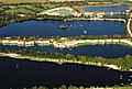 Aerial View of Spring Lake - geograph.org.uk - 2143957.jpg 640 × 432; 57 KB
-
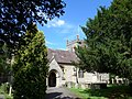
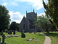
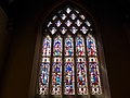
 All Hallows Church, South Cerney - geograph.org.uk - 5871490.jpg 6,000 × 4,000; 4.25 MB
-
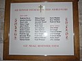
 All Hallows, South Cerney, banner - geograph.org.uk - 4097690.jpg 480 × 640; 50 KB
-

-
-
-
-

-

-

-

-
-
-
-
-

-

-

-
 All Hallows, South Cerney, font - geograph.org.uk - 4097716.jpg 480 × 640; 60 KB
-
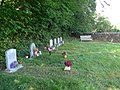
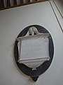
 All Hallows, South Cerney, memorial (i) - geograph.org.uk - 4097365.jpg 640 × 480; 113 KB
-
-

-
-
-

-

-

-

-

-

-

-

-

-
-

-

-

-
-
-
-
-
 All Hallows, South Cerney, organ - geograph.org.uk - 4097691.jpg 480 × 640; 58 KB
-
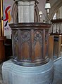 All Hallows, South Cerney, pulpit - geograph.org.uk - 4097687.jpg 468 × 640; 60 KB
-

-
-

-

-

-
-

-
 Alongside the river - geograph.org.uk - 4221632.jpg 4,320 × 3,240; 4.89 MB
-

-
-
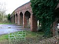
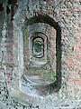 Arches in an old bridge near South Cerney - geograph.org.uk - 677497.jpg 480 × 640; 335 KB
-
 Are you leaving us so soon^ - geograph.org.uk - 4222033.jpg 4,320 × 3,240; 5.04 MB
-
 Armed Forces Day display parachuting.jpg 3,482 × 2,267; 4.93 MB
-
 Around the lake (1) - geograph.org.uk - 5915561.jpg 4,320 × 3,240; 2.75 MB
-
 Around the lake (2) - geograph.org.uk - 5915562.jpg 4,320 × 3,240; 3.71 MB
-
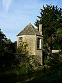
 Ash Moon House - geograph.org.uk - 5911038.jpg 4,320 × 3,240; 4.28 MB
-
 Atkyns Manor - geograph.org.uk - 4221515.jpg 4,320 × 3,240; 5.29 MB
-
-
 Bagged Gravel - geograph.org.uk - 5361290.jpg 3,264 × 2,448; 2.45 MB
-
 Bend in the road, Cerney Wick - geograph.org.uk - 4010802.jpg 4,000 × 3,000; 5.3 MB
-
 Beneath Wildmoorway Lane bridge - geograph.org.uk - 3790890.jpg 3,000 × 4,000; 3.44 MB
-
 Bordering on farcical (21) - geograph.org.uk - 4085885.jpg 640 × 480; 92 KB
-
 Bordering on farcical (22) - geograph.org.uk - 4085892.jpg 640 × 480; 80 KB
-
 Bow Wow Road South Cerney - geograph.org.uk - 6514039.jpg 640 × 480; 104 KB
-
 Bow Wow sign, South Cerney - geograph.org.uk - 1517968.jpg 640 × 480; 298 KB
-
 Bow Wow South Cerney - geograph.org.uk - 6514052.jpg 640 × 480; 110 KB
-

-
 Bow-Wow, South Cerney - geograph.org.uk - 4081465.jpg 4,000 × 3,000; 5.67 MB
-
 Bow-wow, South Cerney - geograph.org.uk - 5871571.jpg 6,000 × 4,000; 4.65 MB
-
 Boxwell Spring Lock, Thames and Severn Canal - geograph.org.uk - 4777585.jpg 3,264 × 2,448; 1.92 MB
-

-
 Bridge beside the Spine Road - geograph.org.uk - 3790868.jpg 4,000 × 3,000; 2.92 MB
-
 Bridge near South Cerney - geograph.org.uk - 6535820.jpg 1,024 × 768; 217 KB
-
 Bridge over a weir near South Cerney - geograph.org.uk - 6535846.jpg 1,024 × 768; 326 KB
-
-
 Bridge repairs - geograph.org.uk - 5324120.jpg 640 × 480; 181 KB
-
 Bridleway alongside road (1) - geograph.org.uk - 5912090.jpg 4,320 × 3,240; 4.27 MB
-
 Bridleway alongside road (2) - geograph.org.uk - 5912091.jpg 3,240 × 4,320; 3.24 MB
-
 Bridleway through the trees - geograph.org.uk - 4068452.jpg 1,280 × 800; 1.32 MB
-
 Bridleway to Cricklade (1) - geograph.org.uk - 5912105.jpg 4,320 × 3,240; 3.82 MB
-
 Bridleway to Cricklade (2) - geograph.org.uk - 5913324.jpg 4,320 × 3,240; 4.84 MB
-
 Bridleway to Cricklade (3) - geograph.org.uk - 5913329.jpg 3,240 × 4,320; 4.41 MB
-
 Bridleway to Cricklade (4) - geograph.org.uk - 5913332.jpg 3,240 × 4,320; 4.41 MB
-
 Bridleway to Cricklade, near Cerney Wick - geograph.org.uk - 2161962.jpg 1,440 × 1,080; 894 KB
-
 Bridleway to South Cerney - geograph.org.uk - 5876305.jpg 6,000 × 4,000; 5.89 MB
-
 Bridleway to the Spine Road (East), near Cerney Wick - geograph.org.uk - 2161973.jpg 1,440 × 1,080; 782 KB
-
 Bridleway towards South Cerney - geograph.org.uk - 5877460.jpg 6,000 × 4,000; 6.04 MB
-
 Broadway Lane, near South Cerney - geograph.org.uk - 6534316.jpg 1,024 × 768; 288 KB
-
 Broadway Lane, near South Cerney - geograph.org.uk - 6534479.jpg 1,024 × 768; 141 KB
-
 Broadway Lane, near South Cerney - geograph.org.uk - 6534485.jpg 1,024 × 768; 183 KB
-
 Broadway Lane, South Cerney - geograph.org.uk - 6534508.jpg 1,024 × 768; 213 KB
-
 Broadway Lane, South Cerney - geograph.org.uk - 6534568.jpg 1,024 × 768; 151 KB
-
 Buffed to perfection - geograph.org.uk - 4598893.jpg 640 × 480; 93 KB
-

-
 Byway near Cleveland Lakes - geograph.org.uk - 2390994.jpg 680 × 1,024; 323 KB
-
 Canal bridge near South Cerney - geograph.org.uk - 6535868.jpg 1,024 × 768; 240 KB
-
 Cattle in a field near South Cerney - geograph.org.uk - 4709052.jpg 800 × 531; 118 KB
-
 Cerney Lakes Tennis Club, South Cerney, Gloucestershire.jpg 2,587 × 1,940; 1.26 MB
-
 Cerney on the Water, South Cerney - geograph.org.uk - 6534513.jpg 1,024 × 768; 136 KB
-
 Cerney on the Water, South Cerney - geograph.org.uk - 6534528.jpg 1,024 × 768; 163 KB
-
 Cerney on the Water, South Cerney - geograph.org.uk - 6534549.jpg 1,024 × 768; 156 KB
-
 Cerney Wick - geograph.org.uk - 6541587.jpg 1,024 × 768; 127 KB
-
 Cerney Wick Farm (1) - geograph.org.uk - 5915564.jpg 4,320 × 3,240; 3.35 MB
-
 Cerney Wick Farm (2) - geograph.org.uk - 5915565.jpg 4,320 × 3,240; 3.1 MB
-
 Cerney Wick Lane - geograph.org.uk - 5324131.jpg 640 × 480; 131 KB
-
 Cerney Wick Lane - geograph.org.uk - 5873823.jpg 6,000 × 4,000; 4.28 MB
-
 Cerney Wick Road Bridge - geograph.org.uk - 3281801.jpg 640 × 480; 86 KB
-
 Cerney Wick road bridge - geograph.org.uk - 3790862.jpg 4,000 × 3,000; 4.79 MB
-
 Cerney Wick, village boundary - geograph.org.uk - 4097738.jpg 640 × 480; 118 KB
-
 Changing direction - geograph.org.uk - 5913361.jpg 4,320 × 3,240; 3.79 MB
-
 Children's playground, South Cerney, Gloucestershire.jpg 2,432 × 1,824; 1.07 MB
-
 Churn Pool - geograph.org.uk - 3281795.jpg 640 × 480; 86 KB
-
 Cirencester Road - geograph.org.uk - 6514093.jpg 640 × 480; 80 KB
-
 Cirencester Road at A419 Island - geograph.org.uk - 6514097.jpg 640 × 480; 50 KB
-
 Claeys Combine - geograph.org.uk - 2619881.jpg 3,648 × 2,736; 1.99 MB
-
 Completion of the parachute display - geograph.org.uk - 4103616.jpg 3,480 × 2,571; 2.25 MB
-
 Conveyor belt - geograph.org.uk - 5915558.jpg 4,320 × 3,240; 2.72 MB
-
 Conveyor belt near Cerney Wick - geograph.org.uk - 6541621.jpg 1,024 × 768; 191 KB
-
 Conveyor Bridge (1) - geograph.org.uk - 5913333.jpg 4,320 × 3,240; 3.8 MB
-
 Conveyor Bridge (2) - geograph.org.uk - 5913343.jpg 4,320 × 3,240; 3.34 MB
-
 Conveyor Bridge (3) - geograph.org.uk - 5913344.jpg 4,320 × 3,240; 4.13 MB
-
 Cotswold Camping, South Cerney - geograph.org.uk - 2213941.jpg 1,024 × 768; 180 KB
-
 Cotswold Outdoor shop, near South Cerney - geograph.org.uk - 6535764.jpg 1,024 × 768; 154 KB
-
 Cotswold Sailing Club entrance and lake - geograph.org.uk - 3276604.jpg 1,024 × 768; 485 KB
-
-
 Cotswold Water Park - geograph.org.uk - 5873045.jpg 6,000 × 4,000; 7.2 MB
-
 Cotswold Water Park, near South Cerney - geograph.org.uk - 6535050.jpg 1,024 × 768; 214 KB
-
 Cotswold Waterpark - geograph.org.uk - 2144137.jpg 640 × 480; 37 KB
-
 Country lane near Cerney Wick - geograph.org.uk - 6541595.jpg 1,024 × 768; 205 KB
-
 Crane Bridge, Thames and Severn Canal - geograph.org.uk - 4777592.jpg 3,264 × 2,448; 1.85 MB
-
 Crossroads east of Upper Cerney - geograph.org.uk - 1587434.jpg 640 × 480; 79 KB
-
 Crown Inn - geograph.org.uk - 6579094.jpg 1,200 × 810; 1.07 MB
-
 Culvert, Wildmoorway Upper Lock, Thames & Severn Canal - geograph.org.uk - 3244740.jpg 4,000 × 3,000; 2.93 MB
-
 Cycle path running parallel to Spine Road (East) - geograph.org.uk - 4082785.jpg 4,000 × 3,000; 6.43 MB
-
 Cycle path to South Cerney - geograph.org.uk - 5875423.jpg 6,000 × 4,000; 5.81 MB
-
 Cycle Track 45 meeting Spine Road (East) - geograph.org.uk - 5877471.jpg 6,000 × 4,000; 4.72 MB
-
 Cycle track to South Cerney - geograph.org.uk - 5877528.jpg 6,000 × 4,000; 6.13 MB
-
 Damselflies near Elmlea Farm - geograph.org.uk - 5431327.jpg 4,000 × 3,000; 4.75 MB
-
 De Havilland DH-104 Devon C2 AN2132731.jpg 1,024 × 683; 353 KB
-
-
 Disused lock, Thames and Severn Canal - geograph.org.uk - 4709058.jpg 800 × 531; 162 KB
-
 Disused South Cerney Airfield - geograph.org.uk - 6514098.jpg 640 × 480; 58 KB
-
 Disused Thames and Severn Canal - geograph.org.uk - 4709061.jpg 800 × 531; 181 KB
-
 Dormans Electric Yachts - geograph.org.uk - 4597545.jpg 640 × 480; 98 KB
-

-
 Drain near Cerney Wick - geograph.org.uk - 5875411.jpg 6,000 × 4,000; 4.65 MB
-
 Elmlea Meadow SSSI information board - geograph.org.uk - 2865072.jpg 640 × 480; 79 KB
-
 Elmlea Meadows - geograph.org.uk - 4010832.jpg 4,000 × 3,000; 6.29 MB
-
 Entering Wiltshire - geograph.org.uk - 3921267.jpg 3,480 × 2,486; 4.53 MB
-
 Entrance to Berite sawmills, Broadway Lane - geograph.org.uk - 4082588.jpg 4,000 × 3,000; 4.65 MB
-

-
 Entrance to South Cerney Sailing Club - geograph.org.uk - 5877520.jpg 5,730 × 3,817; 2.99 MB
-

-
 Entrance to The Landings, Station Road - geograph.org.uk - 4082762.jpg 4,000 × 3,000; 4.75 MB
-
 Entrance to Trenchard Gardens, South Cerney Army Station - geograph.org.uk - 1880988.jpg 1,600 × 1,200; 1.28 MB
-
 Evening sun on Wickwater Lane, near South Cerney - geograph.org.uk - 6541723.jpg 1,024 × 768; 275 KB
-
 Ex-emergency vehicle line-up - geograph.org.uk - 3583732.jpg 3,905 × 1,773; 2.65 MB
-
 Ex-emergency vehicles on display - geograph.org.uk - 3583742.jpg 4,000 × 3,000; 3.29 MB
-
 Farmland near Hailstone Farm, Cricklade - geograph.org.uk - 1820239.jpg 1,600 × 1,200; 904 KB
-
 Field edge path - geograph.org.uk - 4219797.jpg 4,320 × 3,240; 5.12 MB
-
 Fine tree - geograph.org.uk - 5913323.jpg 3,240 × 4,320; 2.44 MB
-
-
 Flood alleviation near Spine Road - geograph.org.uk - 3387691.jpg 1,024 × 768; 179 KB
-
 Flooded fields near Cerney Wick - geograph.org.uk - 3790818.jpg 4,000 × 3,000; 2.96 MB
-
 Footpath by the Thames and Severn Canal, near South Cerney - geograph.org.uk - 2162041.jpg 1,440 × 1,080; 1.04 MB
-
 Footpath by Wildmoorway Lane (1) - geograph.org.uk - 5911027.jpg 4,320 × 3,240; 4.75 MB
-
 Footpath by Wildmoorway Lane (2) - geograph.org.uk - 5911028.jpg 4,320 × 3,240; 4.48 MB
-
 Footpath by Wildmoorway Lane (3) - geograph.org.uk - 5911032.jpg 3,773 × 2,830; 2.21 MB
-
 Footpath near Cerney Wick - geograph.org.uk - 5876323.jpg 6,000 × 4,000; 5.8 MB
-
 Footpath near Cotswold Water Park - geograph.org.uk - 5873105.jpg 6,000 × 4,000; 5.5 MB
-
 Footpath near South Cerney - geograph.org.uk - 3790885.jpg 4,000 × 3,000; 4.86 MB
-
 Footpath near South Cerney - geograph.org.uk - 6539241.jpg 1,024 × 768; 339 KB
-
 Footpath off Wickwater Lane - geograph.org.uk - 3790863.jpg 4,000 × 3,000; 4.35 MB
-
 Footpath off Wickwater Lane - geograph.org.uk - 3790867.jpg 4,000 × 3,000; 3.49 MB
-

-
 Footpath to Cerney Wick - geograph.org.uk - 5876300.jpg 6,000 × 4,000; 4.28 MB
-
 Footpath to South Cerney - geograph.org.uk - 1049514.jpg 640 × 480; 101 KB
-
 Footpaths at Wildmoorway Lower Lock - geograph.org.uk - 3387695.jpg 1,024 × 768; 160 KB
-
 Fork handles - handles for forks^ - geograph.org.uk - 4597539.jpg 640 × 480; 119 KB
-
 Former Boxwell Springs Lock - geograph.org.uk - 5871874.jpg 5,793 × 3,860; 4.39 MB
-
 Former lockkeeper's house - geograph.org.uk - 4709055.jpg 800 × 531; 151 KB
-
 Former MSWJ Railway line - geograph.org.uk - 3790870.jpg 4,000 × 3,000; 5.94 MB
-
 Former road bridge (1) - geograph.org.uk - 5912124.jpg 4,320 × 3,240; 3.46 MB
-
 Former road bridge (2) - geograph.org.uk - 5912125.jpg 3,051 × 4,067; 2.29 MB
-
 Former road bridge (3) - geograph.org.uk - 5913321.jpg 4,320 × 3,240; 3 MB
_-_geograph.org.uk_-_6338138.jpg)


_-_geograph.org.uk_-_4096899.jpg)
_-_geograph.org.uk_-_4097341.jpg)
_-_geograph.org.uk_-_4097343.jpg)
_-_geograph.org.uk_-_4097344.jpg)
_-_geograph.org.uk_-_4097347.jpg)
_-_geograph.org.uk_-_4097349.jpg)
_-_geograph.org.uk_-_4097351.jpg)
_-_geograph.org.uk_-_4097352.jpg)
_-_geograph.org.uk_-_4097354.jpg)
_-_geograph.org.uk_-_4097355.jpg)
_-_geograph.org.uk_-_4097357.jpg)
_-_geograph.org.uk_-_4097359.jpg)
_-_geograph.org.uk_-_4097361.jpg)
_-_geograph.org.uk_-_4097362.jpg)

_-_geograph.org.uk_-_4097365.jpg)
_-_geograph.org.uk_-_4097367.jpg)
_-_geograph.org.uk_-_4097369.jpg)
_-_geograph.org.uk_-_4097377.jpg)
_-_geograph.org.uk_-_4097387.jpg)
_-_geograph.org.uk_-_4097379.jpg)
_-_geograph.org.uk_-_4097380.jpg)
_-_geograph.org.uk_-_4097382.jpg)
_-_geograph.org.uk_-_4097385.jpg)
_-_geograph.org.uk_-_4097388.jpg)
_-_geograph.org.uk_-_4097389.jpg)
_-_geograph.org.uk_-_4097391.jpg)
_-_geograph.org.uk_-_4097394.jpg)
_-_geograph.org.uk_-_4097403.jpg)
_-_geograph.org.uk_-_4097395.jpg)
_-_geograph.org.uk_-_4097396.jpg)
_-_geograph.org.uk_-_4097398.jpg)
_-_geograph.org.uk_-_4097400.jpg)
_-_geograph.org.uk_-_4097404.jpg)
_-_geograph.org.uk_-_4097405.jpg)
_-_geograph.org.uk_-_4097682.jpg)
_-_geograph.org.uk_-_4097721.jpg)


_-_geograph.org.uk_-_4097697.jpg)
_-_geograph.org.uk_-_4097702.jpg)
_-_geograph.org.uk_-_4097711.jpg)
_-_geograph.org.uk_-_4097713.jpg)
_-_geograph.org.uk_-_4097723.jpg)
_-_geograph.org.uk_-_4097726.jpg)
_-_geograph.org.uk_-_4097727.jpg)


_-_geograph.org.uk_-_5915561.jpg)
_-_geograph.org.uk_-_5915562.jpg)


_-_geograph.org.uk_-_4085885.jpg)
_-_geograph.org.uk_-_4085892.jpg)


_-_geograph.org.uk_-_5912090.jpg)
_-_geograph.org.uk_-_5912091.jpg)

_-_geograph.org.uk_-_5912105.jpg)
_-_geograph.org.uk_-_5913324.jpg)
_-_geograph.org.uk_-_5913329.jpg)
_-_geograph.org.uk_-_5913332.jpg)


,_near_Cerney_Wick_-_geograph.org.uk_-_2161973.jpg)


_-_geograph.org.uk_-_5915564.jpg)
_-_geograph.org.uk_-_5915565.jpg)


_-_geograph.org.uk_-_5913333.jpg)
_-_geograph.org.uk_-_5913343.jpg)
_-_geograph.org.uk_-_5913344.jpg)


_-_geograph.org.uk_-_4082785.jpg)

_-_geograph.org.uk_-_5877471.jpg)


_-_geograph.org.uk_-_5911027.jpg)
_-_geograph.org.uk_-_5911028.jpg)
_-_geograph.org.uk_-_5911032.jpg)


_-_geograph.org.uk_-_5912124.jpg)
_-_geograph.org.uk_-_5912125.jpg)
_-_geograph.org.uk_-_5913321.jpg)