Category:South Bedburn
Jump to navigation
Jump to search
civil parish in County Durham, England  | |||||
| Upload media | |||||
| Instance of | |||||
|---|---|---|---|---|---|
| Location | County Durham, North East England, England | ||||
| Population |
| ||||
 | |||||
Subcategories
This category has the following 2 subcategories, out of 2 total.
B
H
- Hamsterley Forest (80 F)
Media in category "South Bedburn"
The following 200 files are in this category, out of 282 total.
(previous page) (next page)-
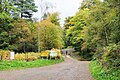
 A roadside clearing in Hamsterley Forest - geograph.org.uk - 5825060.jpg 640 × 480; 360 KB
-
 A view with a smell - geograph.org.uk - 5328841.jpg 640 × 480; 80 KB
-
 Aborted track in Hamsterley Forest - geograph.org.uk - 6664152.jpg 5,472 × 3,648; 7.21 MB
-
 About to descend from Neighbour Moor - geograph.org.uk - 3748070.jpg 4,000 × 3,000; 4.78 MB
-
 Access road for Carrwood Hill Farm - geograph.org.uk - 2393955.jpg 640 × 480; 108 KB
-
 Along the Top Wall - geograph.org.uk - 1892172.jpg 1,525 × 1,593; 939 KB
-
 Approach to Stanhope Lane - geograph.org.uk - 6462422.jpg 2,000 × 1,062; 1.98 MB
-
 Approaching Fivelane Ends - geograph.org.uk - 5472292.jpg 640 × 480; 114 KB
-

-
 Autumnal larches beside forest road - geograph.org.uk - 6316954.jpg 2,000 × 1,481; 3.64 MB
-
 Ayhope Beck - geograph.org.uk - 1911145.jpg 3,849 × 2,535; 2.52 MB
-
 Barn and trees at Mayland Lea - geograph.org.uk - 2387670.jpg 1,500 × 899; 1.3 MB
-
 Barn off Emms Hill Lane - geograph.org.uk - 3926208.jpg 640 × 480; 164 KB
-
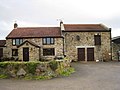
 Barn, Dryderdale Farm - geograph.org.uk - 5907635.jpg 640 × 480; 68 KB
-
 Bedburn Beck - geograph.org.uk - 5095743.jpg 640 × 480; 143 KB
-
 Birch Plantation - geograph.org.uk - 2232322.jpg 3,888 × 2,592; 2.44 MB
-
 Birch trees above a forest road - geograph.org.uk - 6737435.jpg 1,335 × 2,000; 3.37 MB
-
 Black Midding - geograph.org.uk - 2232326.jpg 3,865 × 2,559; 2.32 MB
-
 Blink and miss it^ - geograph.org.uk - 3659655.jpg 1,541 × 1,169; 903 KB
-
 Blocks of rock blocking access - geograph.org.uk - 5624838.jpg 1,500 × 1,125; 2.16 MB
-
 Boarded-up cottage at Paddy's Plantation - geograph.org.uk - 2345540.jpg 640 × 480; 100 KB
-
 Bracken Hill Farm - geograph.org.uk - 1311175.jpg 640 × 480; 120 KB
-

-
 Bridge over Bedburn Beck - geograph.org.uk - 5095728.jpg 640 × 480; 139 KB
-
 Bridge over Bedburn Beck at Hamsterley Forest - geograph.org.uk - 4811084.jpg 1,500 × 1,000; 1.83 MB
-
 Bridge over Spurlswood Beck - geograph.org.uk - 5928863.jpg 1,999 × 1,330; 3.29 MB
-
 Bridleway about the least suitable bike route - geograph.org.uk - 3748220.jpg 3,000 × 4,000; 1.84 MB
-
 Buggy racing in Hamsterley Forest - geograph.org.uk - 6664142.jpg 3,648 × 5,472; 7.41 MB
-
 Bypassing road in Hamsterley Forest - geograph.org.uk - 6316125.jpg 1,600 × 1,090; 1.14 MB
-
 Caravan site at Newhall Farm - geograph.org.uk - 2082299.jpg 640 × 359; 73 KB
-
 Carrwood Hill - geograph.org.uk - 2082535.jpg 2,000 × 1,500; 3.49 MB
-

-
 Cattle grid on farm road towards Edge Knoll Farm - geograph.org.uk - 3342065.jpg 3,648 × 2,736; 2.9 MB
-
 Cattle near Windy Bank Road - geograph.org.uk - 5909646.jpg 640 × 480; 54 KB
-
 Christmas tree sales at Hamsterley Forest - geograph.org.uk - 5221306.jpg 1,500 × 1,001; 1.5 MB
-
 Clear fell area, Hamsterley Forest - geograph.org.uk - 5443399.jpg 640 × 480; 83 KB
-
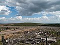
 Clear felled forest at Sharnberry Flat - geograph.org.uk - 2345395.jpg 640 × 480; 115 KB
-
 Clear-fell area, Sharnberry Flat - geograph.org.uk - 5492838.jpg 640 × 480; 85 KB
-
 Clear-felled area of Windy Bank Wood - geograph.org.uk - 2068233.jpg 2,000 × 1,500; 3.65 MB
-
 Cleared forest and forestry road - geograph.org.uk - 2401419.jpg 640 × 480; 99 KB
-
 Conservation Area with Pennington Cottage - geograph.org.uk - 2014105.jpg 1,500 × 1,125; 2.13 MB
-
 Cottage at Shipley Moss - geograph.org.uk - 1730150.jpg 2,048 × 1,536; 1.6 MB
-
 Curving forest road in Pennington Plantation - geograph.org.uk - 5928902.jpg 2,000 × 1,500; 3.16 MB
-
 Cycleway and path junction in Low Redford Wood - geograph.org.uk - 2066998.jpg 2,000 × 1,500; 4.41 MB
-
 Descent into the valley of Linburn Beck - geograph.org.uk - 5825042.jpg 640 × 480; 269 KB
-
 Drive to Low Burn Lea Farm off Howlea Lane - geograph.org.uk - 3356803.jpg 3,648 × 2,736; 3.17 MB
-
 Drive to Snape Gate Farm off Howlea Lane - geograph.org.uk - 3356829.jpg 3,648 × 2,736; 2.13 MB
-
 Dryderdale Farm - geograph.org.uk - 4004894.jpg 4,000 × 3,000; 2.91 MB
-
 Dryderdale Lodge - geograph.org.uk - 4004887.jpg 4,000 × 3,000; 4.24 MB
-
 Edge of the forest, Sharnberry Flat - geograph.org.uk - 5819802.jpg 640 × 480; 62 KB
-
 Emms Hill Lane - geograph.org.uk - 5909697.jpg 640 × 480; 82 KB
-
 Entrance drive to High Kays Lea Farm - geograph.org.uk - 1997280.jpg 2,048 × 1,536; 1.03 MB
-
 Entrance gate and drive to Low Shipley Farm from Howlea Lane - geograph.org.uk - 3340054.jpg 3,648 × 2,736; 2.24 MB
-
 Entrance to Carrwood Hill Farm from Howlea Lane - geograph.org.uk - 3041394.jpg 3,648 × 2,736; 3.28 MB
-
 Entrance to drive to High Shipley Farm from Howlea Lane - geograph.org.uk - 3041480.jpg 3,648 × 2,736; 2.2 MB
-
 Entrance to New Hall Caravan Park from Howlea Lane - geograph.org.uk - 3041338.jpg 3,648 × 2,736; 3.1 MB
-
 Euden Beck - geograph.org.uk - 2345493.jpg 640 × 480; 159 KB
-
 Euden Beck through the trees - geograph.org.uk - 5492809.jpg 640 × 480; 120 KB
-
 Eudenbeck - geograph.org.uk - 5095739.jpg 640 × 480; 78 KB
-
 Fallen Beech branch in Tinker Hills Plantation - geograph.org.uk - 6664134.jpg 5,472 × 3,648; 7.57 MB
-
 Fallen tree in West Moor Plantation - geograph.org.uk - 4811370.jpg 1,500 × 1,000; 1.92 MB
-
 Farm access road for High Kays Lea - geograph.org.uk - 2848666.jpg 1,500 × 843; 1.02 MB
-
 Farm at Bracken Hill - geograph.org.uk - 1730151.jpg 2,048 × 1,536; 2.03 MB
-
 Farm road east from Park House - geograph.org.uk - 2082348.jpg 2,000 × 1,500; 2.49 MB
-
 Farm track carrying a public footpath - geograph.org.uk - 3356722.jpg 3,648 × 2,736; 2.26 MB
-
 Farm track east from minor road - geograph.org.uk - 5234111.jpg 1,500 × 1,125; 2.17 MB
-
 Farm track off Howlea Lane - geograph.org.uk - 5907603.jpg 640 × 480; 81 KB
-
 Felled - geograph.org.uk - 1892117.jpg 2,048 × 1,536; 990 KB
-
 Field adjacent to River Wear - geograph.org.uk - 2082417.jpg 2,000 × 1,123; 2.21 MB
-
 Field and wall near East Rackwood Hill - geograph.org.uk - 3926975.jpg 640 × 480; 141 KB
-
 Field descending to Black Hill Top Plantation - geograph.org.uk - 2068243.jpg 2,000 × 1,123; 2.3 MB
-
 Field entrance off Shull Bank - geograph.org.uk - 5907639.jpg 640 × 480; 124 KB
-
 Field gate on line of Bedburn Public Footpath No 22 - geograph.org.uk - 3356816.jpg 3,648 × 2,736; 3.77 MB
-
 Field near High Shipley - geograph.org.uk - 3275509.jpg 1,500 × 830; 1.03 MB
-
 Field to the north of Crane Row Lane - geograph.org.uk - 3926203.jpg 640 × 480; 128 KB
-
 Field with barley remnant - geograph.org.uk - 2082236.jpg 2,000 × 1,500; 3.18 MB
-
 Field with trees on north side - geograph.org.uk - 5248289.jpg 1,500 × 1,125; 1.78 MB
-
 Field with West Knotty Hill - geograph.org.uk - 2751942.jpg 1,500 × 843; 1.1 MB
-
 Fields around Linburn Hall Farm - geograph.org.uk - 5825018.jpg 640 × 480; 292 KB
-
 Fields off Emms Hill Lane - geograph.org.uk - 5909696.jpg 640 × 480; 73 KB
-
 Footbridge across the River Wear - geograph.org.uk - 1311221.jpg 640 × 480; 111 KB
-
 Footbridge over Harthope Beck - geograph.org.uk - 3356805.jpg 3,648 × 2,736; 3.65 MB
-

-
 Footpath heading west from Bedburn beside Bedburn Beck - geograph.org.uk - 4004879.jpg 4,000 × 3,000; 4.8 MB
-

-
 Footpath through The Forest to Bedburn Beck and beyond - geograph.org.uk - 3340247.jpg 3,648 × 2,736; 2.43 MB
-
 Footpath to Snape Gate from Howlea Bridge - geograph.org.uk - 3340239.jpg 3,648 × 2,736; 3.69 MB
-
 Footpath with owl sculpture - geograph.org.uk - 6316940.jpg 1,600 × 1,124; 1.09 MB
-
 Ford and footbridge - geograph.org.uk - 5095701.jpg 640 × 480; 117 KB
-
 Ford and footbridge on the Linburn Beck - geograph.org.uk - 3926953.jpg 640 × 480; 191 KB
-
 Ford at Hamsterley - geograph.org.uk - 3896455.jpg 3,872 × 2,592; 4.94 MB
-
 Ford at Hamsterley - geograph.org.uk - 3896506.jpg 3,872 × 2,592; 4.89 MB
-
 Ford at Hamsterley - geograph.org.uk - 4389389.jpg 3,872 × 2,592; 4.91 MB
-
 Ford at Hamsterley - geograph.org.uk - 4389400.jpg 3,872 × 2,592; 4.84 MB
-
 Ford in Hamsterley Forest - geograph.org.uk - 4389453.jpg 3,872 × 2,592; 4.86 MB
-
 Ford in Hamsterley Forest - geograph.org.uk - 4389463.jpg 3,872 × 2,592; 4.65 MB
-
 Ford in Hamsterley Forest - geograph.org.uk - 4389471.jpg 3,872 × 2,592; 4.84 MB
-
 Ford in Hamsterley Forest - geograph.org.uk - 4389480.jpg 3,872 × 2,592; 4.81 MB
-
 Ford near Hamsterley - geograph.org.uk - 71456.jpg 480 × 360; 29 KB
-
 Forest junction - geograph.org.uk - 3748354.jpg 1,920 × 1,080; 278 KB
-
 Forest path, Pennington Plantation - geograph.org.uk - 924683.jpg 640 × 480; 96 KB
-
 Forest road - geograph.org.uk - 4846930.jpg 640 × 480; 82 KB
-
 Forest road descending through Mill Plantation - geograph.org.uk - 4811365.jpg 1,500 × 1,000; 1.29 MB
-
 Forest road heading towards Euden Beck Cottage - geograph.org.uk - 5249209.jpg 1,500 × 827; 1.64 MB
-
 Forest road in Hamsterley Forest - geograph.org.uk - 5707479.jpg 1,500 × 1,125; 1.61 MB
-
 Forest road on slope of Black Hill - geograph.org.uk - 5250253.jpg 1,499 × 922; 1.32 MB
-
 Forest road with junction - geograph.org.uk - 5249206.jpg 1,500 × 980; 2.11 MB
-
 Forest track - geograph.org.uk - 1276880.jpg 640 × 480; 108 KB
-
 Forest track, Nest Plantation - geograph.org.uk - 5492799.jpg 640 × 480; 112 KB
-
 Forest track,Pennington Plantation - geograph.org.uk - 3536485.jpg 640 × 480; 108 KB
-
 Forestry road near Middle Redford - geograph.org.uk - 2207618.jpg 2,000 × 1,500; 2.97 MB
-
 Forestry Road With Beehives - geograph.org.uk - 2015774.jpg 1,500 × 1,125; 1.96 MB
-
 Forestry road, Hamsterley Forest - geograph.org.uk - 5492816.jpg 640 × 480; 103 KB
-
 Forestry track,Hamsterley Forest - geograph.org.uk - 5488229.jpg 640 × 480; 66 KB
-
 Forestry track,West Moor Plantation - geograph.org.uk - 5484336.jpg 640 × 480; 97 KB
-
 Frank Lockwood Memorial Seat - geograph.org.uk - 1819323.jpg 640 × 480; 626 KB
-

-
 Grassland towards Newhall Farm - geograph.org.uk - 5907188.jpg 640 × 480; 54 KB
-
 Grassland, Mayland - geograph.org.uk - 5909621.jpg 640 × 480; 62 KB
-
 Grazing and trees near Howlea Bridge - geograph.org.uk - 5907600.jpg 640 × 480; 113 KB
-
 Grazing and woodland, Shipley - geograph.org.uk - 5907610.jpg 640 × 480; 51 KB
-
 Grazing Dryderdale Farm - geograph.org.uk - 5907634.jpg 640 × 480; 50 KB
-
 Grazing near West Hoppyland - geograph.org.uk - 5907644.jpg 640 × 480; 71 KB
-
 Grazing off Howlea Lane - geograph.org.uk - 5907606.jpg 640 × 480; 54 KB
-
 Grazing, East Rackwood Hill - geograph.org.uk - 5907647.jpg 640 × 480; 46 KB
-
 Grazing, Rackwood Hill - geograph.org.uk - 5907652.jpg 640 × 480; 43 KB
-
 Hamsterley Forest - geograph.org.uk - 5443400.jpg 640 × 480; 112 KB
-
 Hamsterley Forest - geograph.org.uk - 5466387.jpg 640 × 480; 82 KB
-
 Hamsterley Forest - geograph.org.uk - 5488230.jpg 640 × 480; 72 KB
-
 Hamsterley Forest track crossing Acton Beck - geograph.org.uk - 6664197.jpg 5,472 × 3,078; 7.6 MB
-
 Hatcase - geograph.org.uk - 2216696.jpg 2,535 × 1,459; 1.07 MB
-
 Haymeadow near Howlea Bridge - geograph.org.uk - 1338771.jpg 640 × 480; 125 KB
-
 High Burnlea - geograph.org.uk - 2232308.jpg 3,782 × 2,434; 1.19 MB
-
 High Burnlea Farm - geograph.org.uk - 3265487.jpg 1,824 × 1,216; 1.26 MB
-
 Hillside at Oak Bank - geograph.org.uk - 2345524.jpg 640 × 480; 148 KB
-
 Hoppyland Lodge, South Bedburn - geograph.org.uk - 3356870.jpg 3,648 × 2,736; 2.42 MB
-
 House at Bedburn - geograph.org.uk - 4811071.jpg 1,500 × 1,000; 2.1 MB
-
 House at Shipley Moss - geograph.org.uk - 1730721.jpg 2,048 × 1,536; 1.25 MB
-
 Howlea Lane - geograph.org.uk - 5907601.jpg 640 × 480; 113 KB
-
 Howlea Lane - geograph.org.uk - 5907604.jpg 640 × 480; 121 KB
-
 Howlea Lane - geograph.org.uk - 5907611.jpg 640 × 480; 56 KB
-
 Ice on forest road in Knitsley Plantation - geograph.org.uk - 6738023.jpg 2,000 × 1,335; 3.04 MB
-
 Into the Forest - geograph.org.uk - 1892201.jpg 1,536 × 2,048; 1.22 MB
-
 Junction of forest roads in Hamsterley Forest - geograph.org.uk - 5707499.jpg 1,500 × 951; 1.3 MB
-
 Junction of paths in Low Redford Wood - geograph.org.uk - 6638775.jpg 2,000 × 1,335; 3.57 MB
-
 Knitsley Cottage - geograph.org.uk - 3357433.jpg 2,396 × 1,774; 1.54 MB
-
 Knitsley Cottage - geograph.org.uk - 6429826.jpg 1,500 × 843; 1.77 MB
-
 Knitsley Plantation - geograph.org.uk - 3392231.jpg 1,500 × 934; 1.32 MB
-
 Lambs reunited - geograph.org.uk - 3926940.jpg 640 × 480; 178 KB
-
 Larches above Cloudlam Beck - geograph.org.uk - 6664166.jpg 5,472 × 3,648; 7.44 MB
-
 Leaving The Grove - geograph.org.uk - 5492791.jpg 640 × 480; 112 KB
-
 Lichen trees at Knitsley - geograph.org.uk - 1178232.jpg 640 × 483; 218 KB
-
 Linburn Beck - geograph.org.uk - 1997241.jpg 2,048 × 1,536; 1.22 MB
-
 Llamas in field at Shull - geograph.org.uk - 5634713.jpg 1,500 × 755; 1.29 MB
-
 Log piles on Sharnberry Flat - geograph.org.uk - 4846939.jpg 640 × 480; 71 KB
-
 Looking along Stanhope Lane - geograph.org.uk - 2881784.jpg 4,608 × 3,456; 5.26 MB
-
 Looking East from the Hamsterley road - geograph.org.uk - 2881742.jpg 4,608 × 3,456; 5.12 MB
-
 Looking north west on Howlea Lane - geograph.org.uk - 5907609.jpg 640 × 480; 61 KB
-
 Looking up the Bedburn valley - geograph.org.uk - 1338770.jpg 640 × 480; 96 KB
-
 Low Redford Allotments - geograph.org.uk - 2232316.jpg 3,783 × 2,437; 2.22 MB
-
 Lynburn Hall entrance - geograph.org.uk - 1998903.jpg 2,048 × 1,536; 1.25 MB
-
 Marginal farmland below Mayland Hall - geograph.org.uk - 2848683.jpg 1,500 × 843; 1.21 MB
-
 Mature Scots pine, Hamsterley Forest - geograph.org.uk - 5492830.jpg 640 × 480; 85 KB
-
 Mayland Lea Farm - geograph.org.uk - 5909644.jpg 640 × 367; 33 KB
-
 Meadow near Mayland Hall Farm - geograph.org.uk - 5825058.jpg 640 × 480; 270 KB
-
 Minor Forestry track on Pennington Rake - geograph.org.uk - 6664208.jpg 5,472 × 3,648; 7.44 MB
-
 Minor road crossing valley of Linburn Beck - geograph.org.uk - 2198403.jpg 2,000 × 1,069; 1.49 MB
-
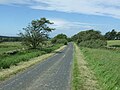
 Minor road towards Bedburn - geograph.org.uk - 5907646.jpg 640 × 480; 96 KB
-
 Minor road towards Woodland - geograph.org.uk - 5909657.jpg 640 × 480; 65 KB
-
 Monkfield - geograph.org.uk - 1311181.jpg 640 × 480; 119 KB
-
 Mossy woodland road in Dryderdale Plantation - geograph.org.uk - 6432136.jpg 2,000 × 3,000; 6.5 MB
-
 Mud and serious erosion on forest road - geograph.org.uk - 6316231.jpg 1,600 × 1,086; 990 KB
-
 Muddy track in the forest - geograph.org.uk - 5095685.jpg 640 × 480; 112 KB
-
 Multi-way Junction of Forest Roads - geograph.org.uk - 1819337.jpg 640 × 480; 359 KB
-
 Near Pennington Plantation - geograph.org.uk - 923308.jpg 640 × 480; 126 KB
-
 Neighbour Moor - geograph.org.uk - 1911192.jpg 3,888 × 2,419; 1.74 MB
-
 Nest Plantation - geograph.org.uk - 2232320.jpg 3,751 × 2,391; 2.32 MB
-
 Newhall Farm - geograph.org.uk - 2232313.jpg 3,869 × 2,253; 1.42 MB
-
 North Plantation - geograph.org.uk - 1911134.jpg 2,592 × 3,888; 2.06 MB
-
 Old buildings adjacent to Emms Hill Lane - geograph.org.uk - 3926206.jpg 640 × 480; 132 KB
-

-
 Old firebreak in the forest - geograph.org.uk - 923346.jpg 640 × 480; 120 KB
-
 One of Ewer Pools - geograph.org.uk - 1819348.jpg 639 × 359; 312 KB
-
 Ordnance Survey Flush Bracket 2249 - geograph.org.uk - 4007640.jpg 4,000 × 3,000; 4.24 MB
-
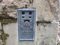 Ordnance Survey Flush Bracket 2250 - geograph.org.uk - 5405233.jpg 4,000 × 3,000; 4.46 MB
-
 Ordnance Survey Flush Bracket 2251 - geograph.org.uk - 4007666.jpg 4,000 × 3,000; 3.62 MB
-
 Paddy's Plantation - geograph.org.uk - 1911130.jpg 3,888 × 2,592; 2.03 MB
-
 Pennington Plantation - geograph.org.uk - 2232654.jpg 3,888 × 2,356; 1.64 MB
-
 Pennington Rigg - geograph.org.uk - 2232344.jpg 3,888 × 2,405; 1.9 MB
-
 Ploughing a field adjacent to Emms Hill Lane - geograph.org.uk - 3612122.jpg 1,500 × 963; 1.61 MB
-
 Pool at five-way road meeting - geograph.org.uk - 4768851.jpg 1,500 × 1,087; 1.46 MB
-
 Private bridge over Bedburn Beck - geograph.org.uk - 3342044.jpg 3,648 × 2,736; 4.73 MB
-
 Public footpath in old lane at High Shipley - geograph.org.uk - 3356797.jpg 3,648 × 2,736; 2.34 MB
-
 Quad and trailer at New Row Farm - geograph.org.uk - 3926967.jpg 640 × 480; 159 KB
-
 Quiet track above Cloudlam Beck - geograph.org.uk - 6664181.jpg 5,472 × 3,648; 7.59 MB
-
 Recent clearcut on Pennington Rake - geograph.org.uk - 6664222.jpg 5,472 × 3,648; 6.67 MB
-
 Remains of Metcalfe's House - geograph.org.uk - 5250301.jpg 1,500 × 996; 2.05 MB
-
 Ribwort Plantain - geograph.org.uk - 3536490.jpg 640 × 480; 54 KB
-
 River Wear below Low Harperley - geograph.org.uk - 2313569.jpg 1,500 × 1,125; 1.49 MB
-
 River Wear upstream from footbridge - geograph.org.uk - 6472501.jpg 2,000 × 1,097; 2.39 MB


